Sharp Edge is a knife-edge ridge with precipitous drops on either side. Hiking along the ridge is the best way to walk up Blencathra, but this Grade 1 scramble is not for everyone. This guide helps you gauge whether walking Blencathra via Sharp Edge is for you.
By: Mark Barnes | Last Updated:
The mountain of Blencathra is 2,848 ft (868m) high and is only the 14th highest in the Lake District, but what makes it special are the sensational routes to the summit.
The most challenging route is via Sharp Edge.
Alfred Wainwright, the famous writer of the Lakeland Fells, described Sharp Edge as “a rising crest of naked rock, of sensational and spectacular appearance, a breaking wave carved in stone.”
The knife-edge ridge is exceptionally narrow, making this the most exposed Grade 1 scramble in the Lake District. It is not for the faint of heart, but the rewards are an immense sense of satisfaction and far-reaching views from the summit.
You can turn the hike into an excellent circular walk by taking the easy route via Scaley Fell or the more challenging route via Halls Fell Ridge.
Here’s all you need to know to hike Blencathra via Sharp Edge, including maps, instructions, and tips on whether the walk is for you.

What Is Sharp Edge Like?
Sharp Edge is the most challenging route up Blencathra and is classified as a Grade 1 scramble.
The term ‘scrambling’ falls between hillwalking and rock climbing. It involves the use of hands and feet to ascend steep, rough terrain.
Grade 1 scrambles are the easiest classification of scrambles. Hikers, rather than mountain climbers, can usually complete them and do not require equipment like rope and helmets.
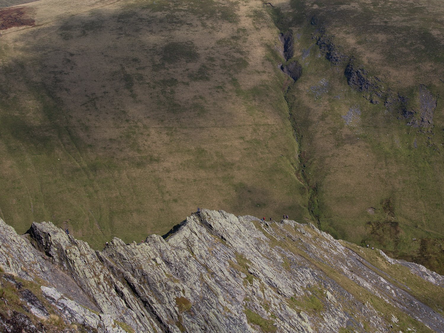
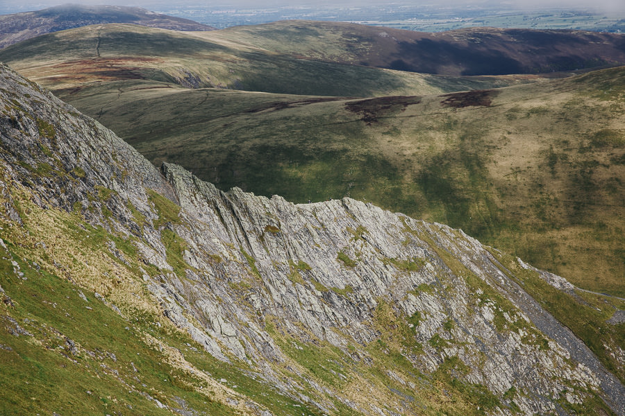
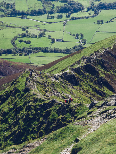
While Sharp Edge is ‘only’ a Grade 1 scramble is the most exposed in the Lake District. The top of the ridge is barely a metre wide and it drops up to 200m on either side.
The knife-edge ridge is only 300m long, but traversing it can feel like a lifetime. Around two-thirds of the way, there is a “bad” step that requires shuffling on your backside along a sloping slab of rock and down onto a narrow edge.
On busy days, this “bad” step can create a bit of a queue, and if you have not got a good head for heights, hanging around on the ridge is not fun.
Fortunately, after the step, the worst is over, and it’s a steep but short climb up to the summit.
To attempt Sharp Edge, ensure you have a good head for heights, an excellent grip on your boots, and some experience scrambling.
We suggest hiking Helvellyn via Striding Edge beforehand. This (much easier) Grade 1 scramble is a great place to gauge whether the more challenging Sharp Edge is for you.
Check out our favourite Grade 1 scrambles in the Lake District for other suggestions.

Should You Ascend or Descend via Sharp Edge?
We highly recommend using Sharp Edge to ascend Blencathra and not descend, for several reasons.
Firstly, it is easier to walk up the narrow ridge than down it.
Secondly, almost everyone else will be ascending, so you do not have to pass other hikers on the top of the ridge.
Thirdly, resting on the summit is much more fun when the nerve-wracking bit is out of the way.
What Conditions Should You Have for Sharp Edge?
Apart from having a head for heights and some scrambling experience, the weather is the most significant factor when tackling Sharp Edge.
Do not attempt Sharp Edge on a windy day, and be aware that wind on the edge can be much stronger than down at the bottom.
Also, do not attempt in wet or icy conditions; the ridge is challenging enough on a dry day, never mind if the rock is slippery.
You can check the weather on Blencathra using Mountain Forecast, which shows the wind conditions and temperatures at the base and at the summit. Use the button on the left to toggle between elevations.


Blencathra via Sharp Edge Practical Information
Hike Overview
The route up Blencathra via Sharp Edge begins at Scales. The walk to the summit is only 2.3 miles long and takes between 2 hours and 2 hours 30 minutes.
The easiest and quickest route back down is via Scales Fell. This is the walk that we detail below – but there are other ways down that we cover later in the post.
HIKE STATS
- Start & End – Scales Farm
- Distance – 4.35 miles (7 km)
- Time – 3 to 4 hours
- Ascent & Descent – 2,195 feet (670m)
- Difficulty – Challenging Grade 1 scramble
Blencathra Hike Map
Below is a map of the route.
The ascent up Blencathra via Sharp Edge is marked in red.
The descent via Scales Fell is marked in orange. An alternative descent via Halls Fell Ridge is marked in purple.
For more details, including contours of the land and ascent and descent profile, use our Blencathra OS Map.
Click on the top right corner to open our map in your Google Maps app. Click the star next to the title to save it to your Google account.
How to Get to the Trailhead
The walk up Blencathra via Sharp Edge begins in the village of Scales, which is on the A66 between Keswick and Penrith.
Scales by Car
If you have a car, a small free car park is next to the White Horse Inn in Scales. There are a few spots on the lane in the village and more in a lay-by on the main road.
Scales by Bus
There is no bus stop at Scales, but the X4 and X5 running between Keswick and Penrith stop at the Horse and Farrier pub in Threlkeld. Buses run about hourly until the early evening.
From Threlkeld, it is a 2-mile walk to Scales, which adds about 1 hour to the ascent. It is much quicker to descend via Halls Fell Ridge (which ends near Threlkeld) than Scales Fell (which ends at Scales).
Instructions for Ascent via Sharp Edge
From the car park in Scales by the White Horse Inn, walk past the pub and turn right, taking a path that looks like it goes through someone’s back garden.
Cross over the wall at the back of the property and turn right. Now, with the wall on your right, follow the path as it contours around Scales Fell on your left.
As the path leaves the wall, turn left and then quickly right to continue contouring around the fell. The path keeps bending left, and the River Glenderamackin appears below you.
After just under 1 hour and just before reaching Scales Beck, the path splits. Take the left fork, then cross over the Beck and turn left to walk towards Scales Tarn.
Just before the tarn, turn right and climb up to Sharp Edge. Once you are on Sharp Edge you have no navigation choices, just carefully head across the narrow ridge.
At the end of the ridge, there is a short scramble to the top of Foule Crag. Turn left and follow the grassy slopes to the summit of Blencathra.

Blencathra Summit
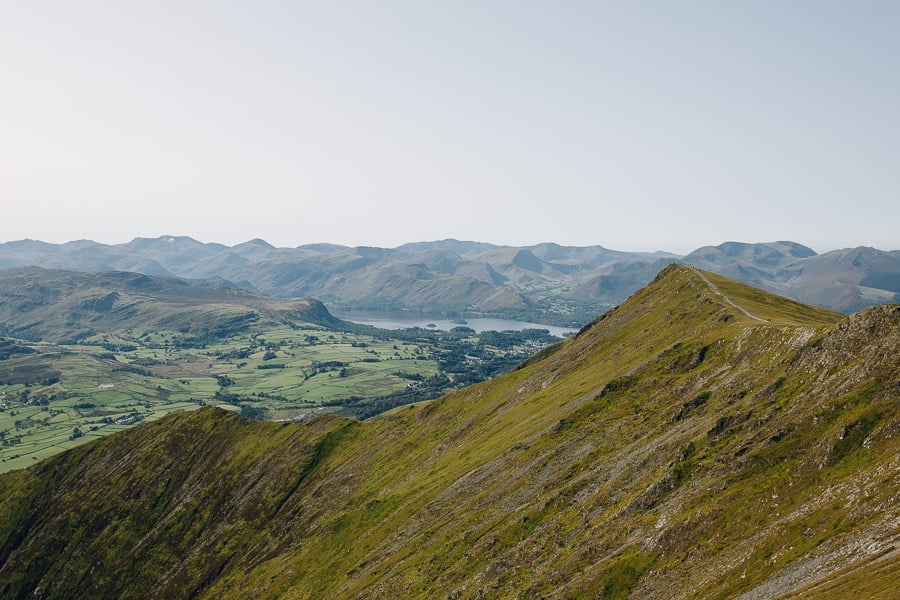
Although ascending Blencathra feels like an adventure in the rugged mountains, the summit is surprisingly flat. It makes a great spot for a picnic as the never-ending rolling green hills of the Pennines stretch before you.
Please take some time to explore the summit before descending. There is an easy flat walk westwards to Knowe Crags & Blease Fell, from where you get great views over Keswick, Derwent Water, and the western Fells.
Descending via Scales Fell
The easiest descent from Blencathra is via Scales Fell. The route heads east from the summit, and after a few slightly steep zig-zags, the path gradually descends as it follows the top of the ridge line.
Once over the top of Scales Fell, the path descends more steeply. Before long, it meets the path you ascended on. Turn right and retrace your footsteps to Scales.

Alternative Descent via Hall’s Fell Ridge
An alternative and more thrilling descent is via Hall’s Fell Ridge.
The route heads south from the summit and descends along the top of an excellent ridge. The ridge consists of a series of low crags that can be easily clambered over.
It is wider (2 to 3m) and much less exposed than Sharp Edge. You may need your hands in places, but confident hikers can walk across the top. It’s an exciting (but not too thrilling) way to descend a mountain.
After about 30 minutes, the rocky ridge becomes a grassy shoulder as it descends towards Threlkeld. If you came by bus, then it’s only a short walk to the bus stop in Threlkeld. But if you came by car, it’s 1.5 miles and 45 minutes back to Scales.


Tips for Scrambling on Sharp Edge
01. Be aware that unlike most hill walking, scrambling comes with a bit of risk. Take your time, be careful and don’t attempt these walks if you’re unsure.
02. To hike Sharp Edge, you do not need any special equipment, but make sure you wear walking boots or shoes with a good grip.
03. Sharp Edge is exposed; if you do not have a head for heights, then do not attempt the hike.
04. Build up your experience by attempting easier scrambles first. Helvellyn via Striding Edge is an excellent place to start.
05. If you are not particularly experienced, do not attempt rocky exposed scrambles in wet or windy conditions. Clouds also carry considerable moisture, so aim for sunny clear day.
06. Take a good map and a guidebook. Sharp Edge is covered in Brian Evans’ book: Scrambles in the Lake District: Northern edition.


Where to Stay to Hike Blencathra
The area around Keswick is an excellent base for hiking Blencathra. We have some specific recommendations below, but read Where to Stay in the Lake District for a more comprehensive list.
Bungalow’s Guest House (£) – Just a few miles out of Keswick in Threlkeld, The Bungalows Guesthouse is an excellent budget option in the area. The location at the foot of Blencathra is superb.
Keswick Country House Hotel (££) – Set in the centre of Keswick, Lakeside House is contemporary luxury accommodation with all the modern amenities you could ask for. Breakfast is served in front of a stunning view.
Lakeside House (£££) – Set in the centre of Keswick, Lakeside House is contemporary luxury accommodation with all the modern amenities you could ask for. Breakfast is served in front of a stunning view.
More Lake District Guides
- Find your perfect area with our guide to the best places to stay in the Lake District.
- Use our detailed guide to see the Lake District without a car.
- Tackle one of our favourite hikes in the Lake District.
- Attempt one of the many routes up Scafell Pike.
- Or choose the best option and hike the Corridor Route.
- For the best Grade 1 scramble, hike Helvellyn via Striding Edge.
- Try one of these amazing wild swimming locations in the Lake District.
- There’s more than hiking; find more great things to do in the Lake District.
- Check out our easy-to-reach best views in the Lake District.
- Find all the great things to do in Keswick.
- Discover all the best attractions in Ambleside and the nearby area.

reader-supported
When you buy through links on our site, we may earn a small affiliate commission at no extra cost to you.
Thanks for your support // Paul & Mark