The canyons and sculpted rocks provide some breathtaking hiking in Cappadocia. But the trailheads and paths are tricky and obscure. So, read on for all the tips and tricks we think you’ll need.
By: Mark Barnes | Last Updated:
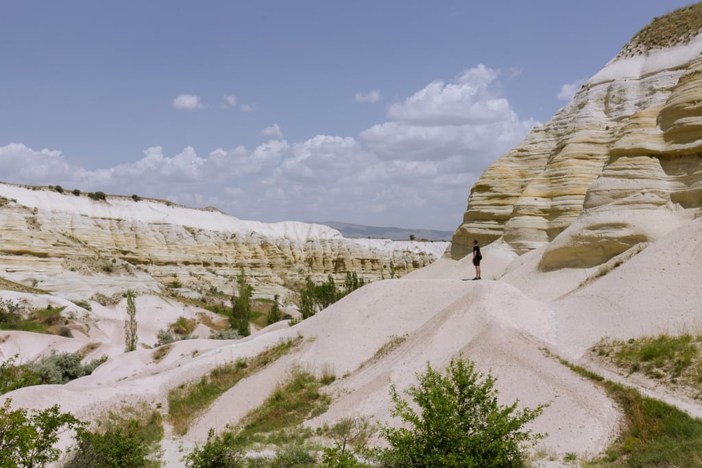
Over millennia, wind and rain have sculpted the valleys, creating a surreal natural landscape.
Domed white rocks, rippling rose canyons, and phallic rock formations provide a magnificent backdrop to some stunning hiking in Cappadocia.
However, for all the tourists who come to this fairy-tale landscape, the information on hiking in Cappadocia is decidedly poor.
We searched high and low for good walking maps or even average walking maps. None we found marked the trailheads, and most barely had the paths covered at all.
While there is more information about hiking in Cappadocia online now, we still think these are the 3 best walks in the area, given all the other wonderful things to do in Cappadocia.
We’ve also included detailed instructions along with maps you can download and take with you so you can see some amazing corners of Cappadocia without worrying about getting lost.


Hike 1: Pigeon Valley, Uçhisar Castle & Love Valley
Distance: 11 kilometres | Time: 3 hours, 20 minutes to 5 hours
The canyon walls of Pigeon Valley are topped with teeth-shaped rocks; the castle at Uçhisar offers wide panoramic views, and Love Valley has the iconic mushroom-topped columns heavily photographed in Cappadocia.
This excellent circular walk begins in Göreme, heads up Pigeon Valley, and ascends to the castle at Uçhisar before returning via Love Valley to Göreme.
It takes around 4 hours, during which it visits some of Cappadocia’s most iconic scenery.
Pigeon Valley to Love Valley Hike Instructions
The Pigeon Valley (Guvercinlik Vadisi) path starts at Trail Marker G3 on Uzun Dore Road in southeast Göreme.
Follow signs pointing up the valley, walking through a cafe and up some steps as the valley bottom rises and opens out.
Follow the path bending right, and squeeze through the tightest part of the canyon. Have tea at Calgary Tea Garden overlooking the view.
To Uçhisar Castle
Continue up the path as it rises out of Pigeon Valley and onto the Göreme-Uçhisar road. Turn left and head up to Uçhisar Castle. The entrance to the castle is on the south side.


Love Valley Section
Head back to the Love Valley (Baglidere Vadisi) trailhead, which is 100 metres past where you exited Pigeon Valley on the main road towards Göreme.
Follow the path to the left of the Ozler Centre. Take the right fork at marker B6 and follow the sign pointing to Love Valley.
Turn left at marker sign B5 and head steeply down into the valley before turning right and making your way along the valley floor.
The canyon walls keep you hemmed in, so you can’t go far wrong, but you may need to backtrack once or twice, making your way around a local farm and following a dried-up river bed.
Return to Göreme
Arrive at the iconic Phallic rocks of Love Valley and stop for tea at Keres Cafe before following the path, bending right as the valley widens and meets the main road. Turn right and follow the road back into Göreme.

Pigeon & Love Valley Hike Map
HIKING ALONG PIGEON VALLEY (BLUE)
1.5 kilometres | 30 minutes to 1 hour
HIKING UP TO UÇHISAR CASTLE (PURPLE)
1.5 kilometres | 30 minutes to 1 hour
LOVE VALLEY SECTION (BROWN)
5 kilometres | 1 hour, 40 minutes to 2 hours, 20 minutes
BACK TO GÖREME
2.5 kilometres | 20 minutes
Hike 2: Red Valley, Meskendir Valley & Rose Valley
Distance: 11 kilometres | Time: 3 hours, 50 minutes – 5 hours, 30 minutes (easily shortened)
When hiking in Cappadocia, all the scenery is impressive, but the views on this hike – covering 3 different valleys northeast of Göreme, home to some of the best hotels in Cappadocia – are simply staggering.
Meskendir Valley is a narrow canyon that heads arrow-like into the more coloured canyons.
Rose Valley is a mass of pointed pink and white rocks whose interiors have been carved into churches.
Red Valley contains sinuous fins of rock, and its viewpoints had us perched above rippling oceans of stone.
Finding the paths in the Red and Rose Valleys can be tricky, mostly due to the immense profusion of signs. Unclear trail markers point in dubious directions, red scribbles on walls sometimes point both left and right, and many signs lay broken, buried or crossed out.
We highly recommend you download our map to help make this spectacular walk a little easier to navigate.

Red Valley to Rose Valley Hike Instructions
Park in a layby east of Kale campground on the Göreme to Ürgüp road. There is a Rose Valley sign painted in red, which is the beginning of your trail.
After a couple of hundred meters, take the right turn and descend into Meskendir Valley.
Hiking Down Meskendir Valley
Follow the valley north and then northwest. After about 2 kilometres, you will pass Kucuk Church.
Shortly, you come to a makeshift hut marked as Bufe on Google Maps, with the G201 trail marker next to it.
This is the trail marker for the Rose Valley, which consists of two valleys, Gulludere I and Gulludere II. The marker signs for these valleys begin G1, G2 or G12.
Turn right at this marker and follow the path into the valley.


Rose Valley Loop
After about 500 metres, you pass Anna Joachim Church. 100 metres further, you come across trail marker G203 telling you to head left.
Ignore this and continue straight on. Following the path, you will arrive at the remarkable Kolonlu (Direkli) church. After going inside, continue on the path.
You soon find yourself at trail marker G1202, and you take the smaller path leading past the left-hand side of the marker. The path quickly rises before bending right for some fine viewpoints over Red Valley and then heads left.
At trail markers, G1205 and G1206, follow signs for Gulludere I-II Cikisi, and you will shortly reach Panorama Point, where you can get a drink and refreshments.
Red Valley Loop
Make your way back down Red Valley (Kizilcukur Vadisi) following trail marker K11.
Keep left at trail marker K10, and you will soon pass Uzumlu church and a café.
The main Red Valley path continues down the valley, but in our opinion, it is better to stay on the high ground and keep the good views.
So, in spite of the sign suggesting you go left, turn right at K7C, come off the main path and take the smaller path across the valley and up the other side.
Then, bend left to a great viewpoint marked by Demir Merdiven on Google Maps.


Enjoy the views before continuing on a path that slowly arcs right, and you find yourself back at the G1202 marker.
You can now re-join your Rose Valley Loop (and Google Maps) by heading up to Hacli Church. Look at the frescoes at Hacli church before gaining the ridge and following the path northwest.
Back to Meskendir Valley
The path comes to a sign that tries to take you down a rather precipitous slope with a bit of rope that had recently snapped (unlucky for someone).
It’s very steep, so avoid this and head left and follow the contours of the ridge, which slowly drops you back into Meskendir Valley.
Re-join Meskendir Valley, turn left and walk the 3 kilometres back to the car.


Alternative Options for the Red Valley, Meskendir Valley and Rose Valley Hike
This is a fairly long hike and involves parking near Kale Campground, which requires a car. However, here are a number of ways you can shorten this walk and do it without a car.
Option 1 – Skip the Red Valley
You can skip the Red Valley Loop by staying on the Rose Valley Loop when you first come to trail marker G1202. This will reduce the walk by about an hour.
Option 2 – Skip Meskendir Valley
If you don’t have a car and are staying in Göreme town, you can skip the Meskendir valley and take a shortcut to the Rose Valley Trailhead.
This shortcut (shown in grey on the map) takes about 35 minutes. So, you could walk from Göreme, complete the Rose Valley Loop and the Red Valley Loop and return to Göreme in around 4h – 4h 30 mins.
Option 3 – Start at Panorama Point
If you have a car and want to shorten the walk, you can drive up to Panorama Point and start the walk there.
Hiking the Red Valley Loop will take you just over an hour, or hiking both the Red Valley and Rose Valley Loops will take about 3 hours.
Make sure you finish back at Panorama Point for a drink and a sit-down! It’s a great scene at sunset, so sit back with a beer and survey all the paths you have covered in Cappadocia.

Red & Rose Valley Hike Map
HIKING DOWN MESKENDIR VALLEY (PURPLE)
2.5 kilometres | 50 minutes to 1 hour, 10 minutes
HIKING THE ROSE VALLEY LOOP (YELLOW)
3 kilometres | 1 hour, 10 minutes to 1 hour, 40 minutes
RED VALLEY LOOP (RED)
2.5 kilometres | 50 minutes to 1 hour, 10 minutes
BACK TO MESKENDIR VALLEY
3 kilometres | 1 hour to 1 hour, 20 minutes
Hike 3: Ihlara Valley
Distance: 8km | Time 3 hours – 4 hours
The Ihlara Valley is a beautiful narrow canyon of sandstone-coloured walls, with a river drifting along the verdant valley floor.
The river not only supports a plethora of plants and flowers but also numerous chirping birds and belching frogs.
Churches carved deep into the canyon walls can be explored and offer excellent views over this idyllic scene.
The Ihlara Valley hike is a very straightforward, tranquil stroll along the prettiest part of the valley and is well worth the 1 hour, 15 minutes drive from Göreme.
The only major challenge is finding the heavily disguised ticket office at the entrance to the valley in Ihlara Village.
This hike starts in Ihlara Village, heads to Belisirma Village and back again.
The total distance is 8 kilometres, and it took us about 4 hours, including time to stop for tea and check out the churches.

Ihlara Valley Hike Instructions
Park in Ihlara Village, outside the Star Café. There is a red sign that says ‘Valley’ on the Star Café’s wall pointing left. Follow the sign and stay on the road.
As the road rises and bends right, follow the canyon wall, keeping the valley on your right. After about 400 metres you will see a small building through the trees with red writing saying Ticket Office.
Valley Floor
Leave the ticket office, drop down into the valley and walk along the valley floor.
There is no chance of getting lost on this walk as it is a narrow valley, and you are hemmed in on both sides by the canyon wall. Head up to the nicely frescoed Konar Church.
Pop into Algacati Church, meeting the tour groups walking down the steps from their buses. Have tea at Diker Aile Çay Bahçesi by the river (or do so on the way back).
St George Church
Climb the steps up to S. George Church to see the frescoes, but more importantly, it offers fine views over the valley.
Exit the valley at the Belisirma ticket office (don’t worry, your ticket will get you back in).
Take the road that curls up to the left and visit Direkli and Bahattin Samanligi churches, which are worth the short walk.
Leave the two churches and retrace your footsteps back to the car in Ihlara Village.

Tips for Hiking in Cappadocia
01 – It can be hot, and there is often little protection. Wear sun protection and take a hat.
02 – Be very careful during and after rain. The smooth rocks can quickly funnel water and be slippery.
03 – Some cafes on these walks were open, but not all of them. Make sure you take snacks to re-energise and plenty of water, either in a water filter bottle or a hydration bag like this one.
04 – Most of the walking was simple, but there is the odd steep section. For the Red Valley Loop, ensure you have decent grip on your shoes/boots (we use something like these).
05 – Use Google Maps App with downloaded maps of the local area. To download maps, go to the app menu and select Offline Maps. Then select Custom Maps, choose the area you want to download and then hit download. Make sure you do this while you still have Wi-Fi or mobile reception.


06 – Don’t worry too much about being on the wrong path. While it may sometimes feel as though you are in a massive area, the valleys are actually quite small, and you can’t go too far wrong, especially with Google Maps. Getting lost and found again is part and parcel of hiking in Cappadocia.
07 – You can combine the Rose and Red Valley loops with watching the balloons fly overhead, but you’ll have to be on the paths as the sun rises.
08 – Download our Cappadocia hiking maps onto your phones. Click on the icon to the left of the title on the map. To save this map, click on the star the right of the title – this will download to: YOUR PLACES -> MAPS in Google. Then you can easily follow our recommended paths and instructions while hiking in Cappadocia.

More Turkey Guides
- More great things to do can be found in our guide to visiting Istanbul.
- Travelling around? Read our guide to the best places to visit in Turkey.
- Try these incredible hikes in Cappadocia (maps included).
- Here are the best things to do in Antalya.
- Take the ultimate scenic voyage in a Cappadocia Hot Air Balloon ride.
- Plan your trip with our Turkey Itinerary.
- Here are the best things to do in Cappadocia.
- Relive history in the best ancient ruins in Turkey.
- Plan the ultimate 4-days in Cappadocia with our detailed itinerary.

reader-supported
When you buy through links on our site, we may earn a small affiliate commission at no extra cost to you.
Thanks for your support // Paul & Mark
Hiking is one of our favourite activities and do it in a place like Cappadocia looks so cool. The view form there is majestic. Thanks for the alternative options 🙂
Cappadocia is a great place for hiking, so many interesting trails. You need to stay alert though, they haven’t exactly marked the paths very well !
Wow, thanks you for all of these hiking tips. I recently went on a hike near my home that didn’t have very clear maps or trail markers, and it was a huge pain to deal with. Your information is so helpful!
Thanks, Michelle – glad you found it useful. It was pretty frustrating trying to find their obscure markers but the walking was amazing nonetheless.
Oh my, I love this place. It’s so high on my bucket list 🙂 I hope to visit it soon. Thanks for your tips
Awesome. I hope you do too. It’s really amazing.
Cappadocia is stunning. I saw already some amazing photos about Cappadocia and make me feel it is worth to visit. I didn’t know it was even worth to hike there, and this is a good plus point to this place. Your photos look nice.
Thanks. Yes the hiking is great. Its a really good place to settle down for a few days and go explore.
Kia ora Mark and Paul,
Very helpful information, I did the Rose Valley and Red Valley Loops today walking from Goreme. Weather here is perfect for hiking mid 20’s during the middle of the day – cooler before hand. Your route on the return leg of the Red valley loop was spot on and I wouldn’t have attempted it without your information – thanks so much.
Yesterday I walked up to Uçhisar from Göreme following back roads and tracks along ridges over from and above Pigeon Valley. I walked Pigeon Valley from the trail head outside Uçhisar. You have to walk up towards Uçhisar at just over 2 km as there is an impassable cliff, the track comes out near the Calvery Tea garden.
Agree with the comment about footwear, I was wearing some trail runners with decent tread which worked well.
There were very few people on the trails, but a lot of people at points where tourist buses could get to.
Nga mihi
Fraser
These are great routes! I loved Cappadocia and saw a number of these sites during our time but did shorter hikes. I’d definitely go back and do these again!
Thats great. Hopefully you’ll get lost less than we did!
This is a fantastically detailed blog – thanks for the wealth of information! I will be traveling to Cappadocia in June and this has been most helpful.
Hope you have a great time. Let us know how it goes.
My husband and I just got back from Cappadocia. What a stunning place! Thank you for your detailed hiking paths. We did hike 2, red valley, rose valley and meskendir valley and your instructions helped us a lot!
Many thanks
Hi Anjli, It is an amazing place isn’t it. I am so glad the instructions helped. It can be a bit of a maze out there. It took us a while just get them all written down. Thanks Mark
Your maps look really helpful but I’m struggling to download them to my offline maps. Could you guide me with that please?
Hi Kapil –
To save the map: click on the star next to the title of the map (if you hover on a computer it will come up with a message saying “Save this map to view in Google Maps” the little star should go yellow.
Then in the Google Maps App on your device click on the 3 horizontal lines beside the box where you enter an address to bring up your options, then click “Your places” then “Maps”. The map should be there for you.
To download to off-line maps: Once you have the map on screen – go back into settings (by clicking on the 3 horizontal lines again), select “Offline maps” then “custom maps” and it should have selected the last map you viewed which will be the one you saved. Click downlaod.
Hope this makes sense, let me know if you have any other questions.
The maps are not downloadable. Can you please look into it?
Hi AP – you need to open the map in the Google Maps app by hitting the box in the top right-hand corner (or saving it to “Your Places” by hitting the star if you are logged in to google). Once you have the map visible in the Google Maps app, navigate to: Offline Maps – Custom Map. This will bring up the area you last searched for (in this case the map on this post) for you to Download.
This is great information!
Question: can one swim in the river along the Ihlara hike?
Hi Deb – Not 100% sure I’m sorry. I don’t think there would be anything stopping you from going for a swim, but we didn’t see anyone doing it while we were there.
Awesome! Exactly what I needed to help me plan my trip later this month. Thank you!!
You’re welcome. Hope the trip goes well.
Thanks a lot for your detailed information, we enjoyed your trails a lot and were very grateful for the maps and directions!!!!
Always great to hear. Glad you found it useful, we’ve love to go back to Cappadocia someday, such a great destination.
Thanks men, your maps gave me the confidence to go on hikes on my own. I really appreciate the effort you have put in to provide such detailed information to your fellow travellers.
I cannot reemphasise enough: even if you veer off the plan (rose/red valley), it doesn’t matter. There are many paths criss-crossing each other and somehow you get to you destination. But the path is the goal anyway.
Love valley and Meskendir valley in particular were so beautiful I almost wanted to cry. Hiking in Cappadocia is a must-do once in your lifetime (and I have been quite a bit around the world, so I am not easily impressed).
You are more than welcome. It was fun getting lost and finding the way!
These maps are amazing. I did hike 2 today and it was stunning. I walked for long stretches without seeing anyone. So much better than being sheep in a tour group. Many thanks for putting this together!!!!
We love hearing this. Thanks for letting us know, Nathan. It took us a while of getting lost to pull them together but it was so great to finally have a walk people can do independently. Enjoy the rest of your time in Turkey.
Awesome blog
I love the pictures you have taken
Thanks a lot. Glad you like it!
Thanks a lot for this awesome blog post. We are heading to Cappadocia tomorrow night and plan to use Goreme as a base and spend a week doing day hikes in the region. It seems the options are endless. We’ll be following some of your recommendations.
Keep up the good work! ?
Glad to hear it guys, enjoy Cappadocia – it’s amazing.