Tre Cime di Lavaredo loop is an excellent day hike in the Dolomites with stunning views of jagged limestone peaks, top-quality rifugios and awesome photo opportunities. Here’s everything you need to know.
By: Paul Healy | Last Updated: | Jump to Comments
In the southeast corner of the Alps, the Dolomites are a spectacular landscape with jagged peaks, vertiginous slopes, and high alpine meadows.
Tre Cime di Lavaredo is a day hike that circles 3 impressive peaks; in our opinion, it’s the best of the best. Although it’s busy, we believe this hike is unbeatable in the area.
The scenery is mesmerising, and the hike is achievable, but it is still a challenge.
The path is easy to follow, so it’s a great hike for inexperienced hikers who want spectacular views.
As of the 2025 summer season, you need to book parking online in advance to visit Tre Cime. We have updated this guide with all the necessary information below.

SUMMARY
DISTANCE
10.3-kilometre round trip
TIME
3 hours, 20 minutes
ELEVATION
400 metres (+/-)
DIFFICULTY
Easy to Medium
TRE CIME OVERVIEW
WHAT IS THE TRE CIME DI LAVAREDO HIKE?
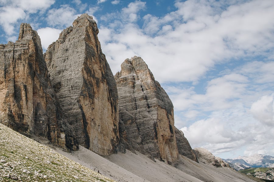
The Tre Cime di Lavaredo hike is a trail in the Italian Dolomites that circles three iconic peaks: Cima Piccola, Cima Grande, and Cima Ovest, collectively known as Tre Cime di Lavaredo or Three Peaks of Lavaredo.
It’s one of the most popular hikes in the Dolomites and typically takes around 3.5 hours to complete.
Throughout the hike, you are rewarded with panoramic views of dramatic cliffs, rugged valleys, and serene alpine lakes.

WHAT’S IT LIKE?
From the beginning of the trail, a series of jagged peaks loom over the horizon, resembling a crumbling forest of rocky skyscrapers.
The play of light on the immense sandstone monoliths of Tre Cime di Lavaredo fills the scene with an enchanting glow.
The trail gently dropped below the Croda Passaporto and Monte Paterno summits to Rifugio Locatelli (Dreizinnenhütte), strategically positioned in front of the three towers.
After passing Rifugio Locatelli, the trail descends briefly, then ascends again, guiding you along a narrow rocky ledge.
On one side, a steep drop reveals sweeping panoramic views of the surrounding landscape, while on the other side, the path clings closely to the base of the three towers.
The trail eventually rises to Forcella Col di Mezzo Ridge where a verdant meadow transforms the hike into an idyllic alpine scene.


TRAIL CONDITIONS AT TRE CIME
From the Rifugio Auronzo car park, the trail can be completed in either direction, but we recommend walking anti-clockwise, keeping Tre Cime di Lavaredo on your left. The views are better.
The path around Tre Cime is straightforward, although rocky in places, and easy to follow.
Several different trails traverse the area, so pay attention to the signs to ensure you stay on the correct path. Our detailed route description is below.
The Tre Cime towers should always be on your left-hand side so it will quickly become clear if you go wrong.
The 10.3-kilometre loop has 400 metres of ascent/descent and a nice mix of up and downhill sections. There are no particularly tricky places, and no special equipment is needed.
The most challenging section is the drop from Rifugio Locatelli down the valley and back up the other side. But it is not too difficult, and anyone with a reasonable fitness level should have no problem.
If you need a rest, there are many great rifugios in which to recharge.


TRE CIME DI LAVAREDO TRAIL ROUTE
The trail begins at the car park at Rifugio Auronzo.
Follow the wide gravel track (path 101) that starts from the car park and heads east past the rifugio. Keep the three towers on the left.
The path gently descends to a wayside chapel and then to Rifugio Lavaredo.
A number of paths meet here, but turn left and remain on path 101 to ascend to the Forcella Lavaredo ridge for a great view. Keep following the wide track (101) as it drops down the other side, passing under the peaks of Croda Passaporto and Monte Paterno.
Then, continue on the short climb up to Rifugio Locatelli (Dreizinnenhütte).
Leaving Rifugio Locatelli – via the church tucked behind it – take path 102 which makes a small clockwise loop before zigzagging down the rocky valley. This is the steepest and hardest part of the walk, but it’s not too difficult.
Upon reaching a junction of trails, take path 105, heading southwest, rising up the other side of the valley, past Malaga Langalm and up to Forcella Col di Mezzo ridge.
Follow path 105 as it bends around Tre Cime and drops gently back to the car park.
The paths are well-signposted and clearly shown on Google Maps.
HIKE DISTANCES
RIFUGIO AURONZO TO RIFUGIOO LAVAREDO
30 minutes | 1.7km
RIFUGIOO LAVAREDO TO FORCELLA LAVAREDO
15 minutes | 0.6km
FORCELLA LAVAREDO TO RIFUGIO LOCATELLI
45 minutes | 2.2km
RIFUGIO LOCATELLI TO MALGA LANGALM
1 hour | 3.2km
MALGA LANGALM TO RIFUGIOO AURONZO
1 hour | 3.2km


HIKE MAP
Although the paths are well marked and clear, it’s a long walk, and the clouds can come in quickly, so take a map.
A handy book to take with you is Shorter Walks in the Dolomites, which has good maps and details of Tre Cime and other great walks in the area.
USING OUR MAPS. Click on the top right corner to open in the Google Maps app. Click on the star to save to your Google account.
WHEN TO HIKE TRE CIME DI LAVAREDO?
The best time to hike the Tre Cime loop is late July or early September.
Any snow will have gone, the crowds will be a bit lower, and the cable cars and rifugios in the region will still be running.
Generally, the hiking season in the Dolomites roughly runs from late May to early October, depending on the weather conditions and the height of the walks you want to undertake.
The best weather is in the summer months, but August is also the busiest time,e and this is a popular walk.
Many cable cars and rifugios in the Dolomites only open from mid-June to the end of September, with only a few remaining open until early October.
The views at Tre Cime are great at all times of the day, but make sure you leave early enough so you don’t have to rush, and in peak season, it will help you beat the crowds.


GETTING TO THE TRAIL HEAD AT RIFUGIO AURONZO
The Tre Cime di Lavaredo hike begins from Rifugio Auronzo (2320 metres), which is 23 kilometres from Cortina d’Ampezzo (40 minutes drive) and 23 kilometres from Dobbiaco (35 minutes drive).
RIFUGIO AURONZO PARKING
Access to the car park at Rifugio Auronzo is via the 7-kilometre (very scenic) paved toll road that leaves the SP49 near Misurina, northeast of Cortina.
The toll gate is just past Lago d’Antorno.
There have been some changes to parking at Rifugio Auronzo and you now need to book and pay for your parking online in advance. Here is the key information:
- Parking is €40 per car, per day (€26 for motorcycles; €60 campervans).
- You need to book online here and register an account.
- You can cancel with no cost up to 5 days before your selected date.
- You need to provide a car registration, which you can update 1 day before you arrive. (Please note: you can only change the car registration once).
- The permit is for 12 hours.
- The permit is for a single entry only.

RIFUGIO AURONZO BY BUS
Cortina to Rifugio Auronzo — To get to the car park at Rifugio Auronzo from Cortina, you have a choice of taking the 445 and changing onto the 444 or the 030 and changing onto the 031. Both routes take about 90 minutes.
Dobbiaco to Rifugio Auronzo — Alternatively, if you are coming from Dobbiaco, there is a shuttle bus (444) which runs regularly from June to mid-October. It takes 45 minutes.
Booking Bus Tickets — Bus trips must be booked in advance if you are visiting between 10 July and 10 September. All other times, tickets can be purchased on the bus.

WHERE TO STAY
The best place to stay to do the Tre Cime di Lavaredo hike is Cortina, which is 23 kilometres from Rifugio Auronzo. It’s a charming town with a good range of facilities and public transport connections.
The other option is to stay in Dobbiaco which has a little less going on than Cortina, but it does have a more direct shuttle bus to the trailhead at Rifugio Auronzo.
- Al Larin Hotel (Cortina) – A Simple but clean budget hotel just one mile north of Cortina.
- Hotel de Len (Cortina) – Rural contemporary hotel with a minimalist design and strong sustainability credentials. There’s a wellness centre and excellent restaurants.
- Hotel Rosengarten (Dobbiaco) – Family-run property in the centre of Dobbiaco with a traditional restaurant and excellent views.

GETTING TO THE DOLOMITES
The Dolomites is a large mountain range in northeastern Italy. As a popular location for both skiing and summer hiking, there are plenty of good options for getting to the Dolomites.
BY AIR
Several international airports serve the Dolomites. Venice and Innsbruck are closest to Cortina.
BY TRAIN
Unless you are already in Italy, getting to the Dolomites via train is unlikely to be a good option. However, if you are arriving from within Italy, the train station at Calalzo di Cadore is 35 kilometres to the south of Cortina.
Read our complete guide to visiting the Italian Dolomites for further information about getting to and around the area.

WHAT TO TAKE ON THE HIKE
01 – The Tre Cime di Lavaredo loop is a medium-length walk and the path is sometimes rocky, so decent hiking boots are best. We use something like these. Hiking poles can also help to bypass some of the strain from your legs to your arms.
02 – The hike is well-marked and straightforward, but if you’re anything like us, a physical map is nice to have. The one you need for Tre Cime is the Cortina Tobacco Map.
03 – There are plenty of refreshments on the route in the well-placed rifugios which all sell food and drink, but we recommend lunch at Rifugio Locatelli.
04 – Weather conditions on the walk can change dramatically. Always take a waterproof and some warm clothes. Every 1,000m you rise the temperature drops about 5 degrees and if the clouds come over and the wind picks up it can get cold quickly. Similarly, clouds can clear quickly. Even if it looks overcast before you set off, the sun could be shining in no time. So pack a hat and/or sunscreen.
05 – If you want to up your photography game, we highly recommend investing in good-quality ND Filters, they’ll really make your images pop. To use the filters, you’ll need a decent tripod, the Ultralight SIrui is the best we’ve come across.

MORE DOLOMITES GUIDES
- Here are all our favourite places to visit in the Dolomites.
- Put your trip together with our Dolomites road trip itinerary.
- Hike to the beautiful Lago di Sorapis.
- Try one of our favourite hikes in the Dolomites.
- The Sassolungo Circuit is one of our favourite walks in the world.
- Take on one of the most popular hikes in the Dolomites – Tre Cime di Lavaredo.
- Visit the beautiful Lago di Braies.

READER-SUPPORTED
When you buy through links on our site, we may earn a small affiliate commission at no extra cost to you.
Thanks for your support. Paul & Mark


Hi Paul!
This is one of the best article for all travelers, who really like this amazing article. These photographs are very beautiful and charming. Thanks for sharing this article with all of us
Hi!
Thank you for the details article! Would this be doable with an active/sporty 3.5 year old? Since it’s a bit rocky, I assume the pram is a no-go. But are there any dangerous areas along the trail for the little one?
Hi Sasha,
It’s a little difficult for us to gauge as we don’t have kids. There are no particularly tricky sections, but the whole circuit is quite long, 10 kilometres which took us around 3.5 hours. There’s one section of the path that is a bit narrow but otherwise it’s not technically difficult. You definitely wouldn’t be able to take the pram.
Hope this helps.
Paul.
I already started planning the trip to Dolomites – the views are breathtaking!
Absolutely, it’s a beautiful place. Enjoy your trip.
This was very helpful to me- thank you!
Very glad to hear it, such a wonderful walk.
Hi! I have a few follow up questions for you…
I am wondering if you have stayed in either the Locatelli/Dreizinnenhutte or Lavaredo hut and, if so, which you would recommend. Both have availability for the date we will need lodging and I am trying to determine your route based on which lodging we go with.
I am also wondering if any part of this hike is scary in terms of exposed drops, etc. My family is pretty good with this kind of thing, but I am not and want to mentally prepare!
Thank you so very much,
Susan
Hi Susan – We didn’t stay in either of the huts so I’m not quite sure which would be best. The only thing I can tell you is that Dreizinnenhütte has the best views and the most paths leading from it. There are no particularly scary sections on the walk, just miles of beautiful scenery. You’ll love it.
Hi..so not recommended to go to tre chime in early october?
Better to stay in cordina then san candido if plan to visit tre chime?
Only visit dolomites for 3 days ..but want to visit tre chime, lago di braise and st maddalena chrch…is it possible? What best city to be a basecamp?
Thank you
Hi Santi, Yes it very possible to see St Maddalena, Lago di Braies, and Tre Cime in three days if you have a car. Without a car it’s a bit trickier but can still be done. The best base is Toblach (Dobbiaco). Last time I looked there were direct buses to Lago di Braies and Tre Cime. Val di Funes is harder to reach and might involve a couple of bus changes but should be doable as a long day trip. Early October is right on the boundary of when snow usually comes to the region. You will probably be ok walking Tre Cime then, but you may get unlucky with early snowfall. Hope that helps. Mark
Hi,
I love your articles -very clear and very helpful.
Could you tell me what the driving conditions are like from Orteisei to Cortina? My husband does the driving and loves it but I am a nervous navigator.
Also, would you recommend doing both regions in 7-8 days or should we stay in one region and enjoy the stay there?
Is the Val Gardena area really convenient by local transport – as good as having your own car?
Hi Lalita,
The driving directions from Ortisei to Cortina are pretty straightforward. Head over the Sella Pass, then as you drop down the other side you meet the hairpins of Passo Pordoi. Go left heading uphill and follow the hairpins. They are well paved and easy to drive BUT watch out for buses coming in the other direction and give them priority on the bends. From the top of the pass (Sass Pordoi) make sure you take the cable car to the summit for amazing views. Then continue on to Cortina on the SR48. Google will stop you going wrong!
Personally, I would split your time. 3 or 4 days in Ortisei and 3 or 4 days in Cortina. That way you can see most of the Dolomites without driving too far each day.
If you were just staying for 3 to 5 days I would recommend basing yourself in Val Gardena, in which case you might not need a car. However, in 8 days I’d get a car and try and see the best of the entire area. It makes life easier for getting from the airport, travelling between Ortisei and Cortina as well as journeying to Val di Funes, Lago di Carezza, Lago di Braies and Vajolet Towers.
Hope that helps.
Mark
Hi Paul! I’m planning to do both Tre Cime di Lavaredo and Cadini di Misurina in one day. I’m trying to reserve a parking ticket, but what time would you suggest me to start the hike? How about something like 8am – 1pm hike, then eat & rest (possibly it’ll rain), then do the Cadini di Misurina near sunset?
Hi Shirley,
Parking at around 8 am would be fine for what you want to do. However, the Cadini di Misurina viewpoint is only about 30 minutes from Rifugio Auronzo car park (where the Tre Cime walk starts and finishes), so you’d have to wait quite a while if you wanted to be there for sunset.
Hope this helps.
Paul.