There’s a version of the Lake District you’ve probably seen: Grasmere, the queues on Helvellyn, the Instagram crowds at Rydal Water. It’s beautiful, of course — but it’s not the whole story.
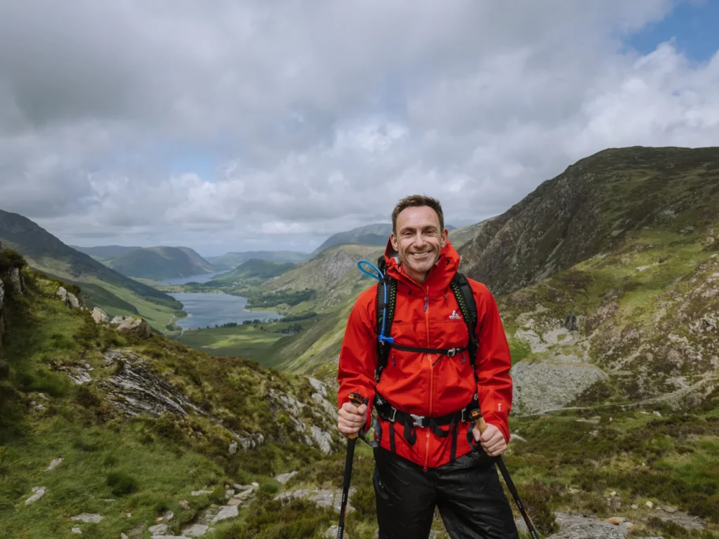
By: Mark Barnes | Last Updated:
The real Lakes reveal themselves slowly, on foot, over days.
They hide in the valley that requires two mountain passes to reach, in the pub that’s been serving wet walkers for 75 years, in the tarn where a man once asked for his ashes to be scattered because nowhere on earth felt more like home.
This is a 5-day circular hike through the most remote, dramatic, and unspoiled corners of the Lake District.
From Keswick to Buttermere, over Haystacks, down into wild Wasdale, across to Great Langdale, and home through the hidden valley of Borrowdale.
Each day ends at a historic pub; each morning offers a choice of high or low routes depending on the weather (and your legs); and the whole thing forms a loop you can complete in 3, 4, or 5 days.

Multi-Day Hike Overview
This hike has been designed to stick to the most rugged and remote valleys in the Lake District. It covers about 8 miles a day, visiting many of the National Park’s most scenic and photogenic sights.
If you want to see the best of the area and escape the crowds, this is the itinerary for you.
Day 1 – Keswick to Buttermere
Day 2 – Buttermere to Wasdale Head
Day 3 – Wasdale Head to Great Langdale
Day 4 – Great Langdale to Borrowdale
Day 5 – Borrowdale to Keswick
Highlights Along the Hike
- Summit Catbells with its grand views over Derwent Water and Keswick
- See the single best view in the Lake District from the shores of Buttermere.
- Climb up Haystacks, Wainwright’s favourite mountain.
- Stay in remote, rugged and wonderful Wasdale.
- Take in the views of Great Langdale from the Langdale Pikes.
- Walk a beautiful section of the Cumbrian Way through Langstrath and Borrowdale.
- End each day in a country inn and share a drink with fellow hikers


High Route or Low Route
Each day, you can pick a High Route or a Low Route to reach your destination. Both routes are approximately the same length, but they differ in elevation and the level of effort required.
The High Route heads over one or more summits ranging from 2,300 to 3,500 feet of ascent and descent.
The Low Route sticks to the valleys and passes. It is still a challenge, but it requires, on average, 1,000 feet less ascent and descent each day.
If you are fit and energetic and the skies are clear, the High Routes are a fantastic way to see the Lake District. If you want to take it (a bit) easier, or rain is forecast, and the tops are covered, then you have the option of doing the Low Routes.
We mixed them up depending on the weather in the morning. If it’s particularly bad weather, we wouldn’t recommend taking the high routes.
Here are the total distances and elevation for each of the routes:
High Route Details
Duration: 5 days
Distance: 40.2 miles
Elevation: 14,400 ft ascent and descent
Daily Average: 8 miles with 2,880 ft ascent and descent per day
Low Route Details
Duration: 5 days
Distance: 37.7 miles
Elevation: 8,700 ft ascent and descent
Daily Average: 7.5 miles per day with 1,750 ascent and descent per day

Getting There & Back
This multiday hike starts and finishes in Keswick. To get here, catch the train to Penrith, then the X5 or X4 bus to Keswick (40 minutes).
Penrith is on the fast west coast train line, and it’s particularly convenient from London Euston (3 hours and 15 minutes) and Glasgow (1 hour and 40 minutes).
We have more details about getting around in our guide to seeing the Lake District by public transport.
3-Day or 4-Day Hike
This hike can be easily modified to a 3-day or 4-day trip.
For a 3-day hike, follow the first 3 days, then catch Bus 516 from Old Dungeon Ghyll to Ambleside to make your way home.
For a 4-day hike, follow the first 4, then get Bus 78 or 77 from Borrowdale to Keswick to make your way home.
Where to Stay?
We spent each night in a remote valley, where we had a choice of a campsite or a hotel/pub.
All of the hotels we stayed at offered packed lunches for the following day (except in Keswick, where there are plenty of shops anyway). The cost is approximately £10 and includes a sandwich, a packet of crisps, a piece of fruit, and a chocolate bar.
Order your packed lunch when you check in or at the bar while having dinner.
To help with booking, follow these links:
Staying in B&Bs, Pubs and Inns
- Day 0 – Highfield Hotel (Keswick)
- Day 1 – Buttermere Court Hotel (Buttermere)
- Day 2 – Wasdale Head Inn (Wasdale Head)
- Day 3 – New Dungeon Ghyll Hotel (Great Langdale)
- Day 4 – Stonethwaite Country Inn (Borrowdale)
- Day 5 – Highfield Hotel (Keswick)
Staying in Campsites
- Day 0 – Keswick Camping and Caravanning Club (Keswick)
- Day 1 – Syke Farm Campsite (Buttermere)
- Day 2 – National Trust Wasdale Campsite (Wasdale Head)
- Day 3 – National Trust Great Langdale Campsite (Great Langdale)
- Day 4 – Chapel House Farm Campsite (Borrowdale)
- Day 5 – Keswick Camping and Caravanning Club (Keswick)
While campsites often have late and walk-in availability, we suggest booking hotels well in advance, especially if you plan to do this hike over the summer holiday or on weekends.
If your dates are flexible, then booking from Sunday to Thursday or Monday to Friday will make finding a hotel much easier.


Day-By-Day Breakdown
Below is a day-by-day outline of the hike. We have included the start point, end point, walking distance, and elevation change.
It also has an expected walking time, but be sure to add another 60 to 90 minutes for lunch, rest, and enjoying the views.
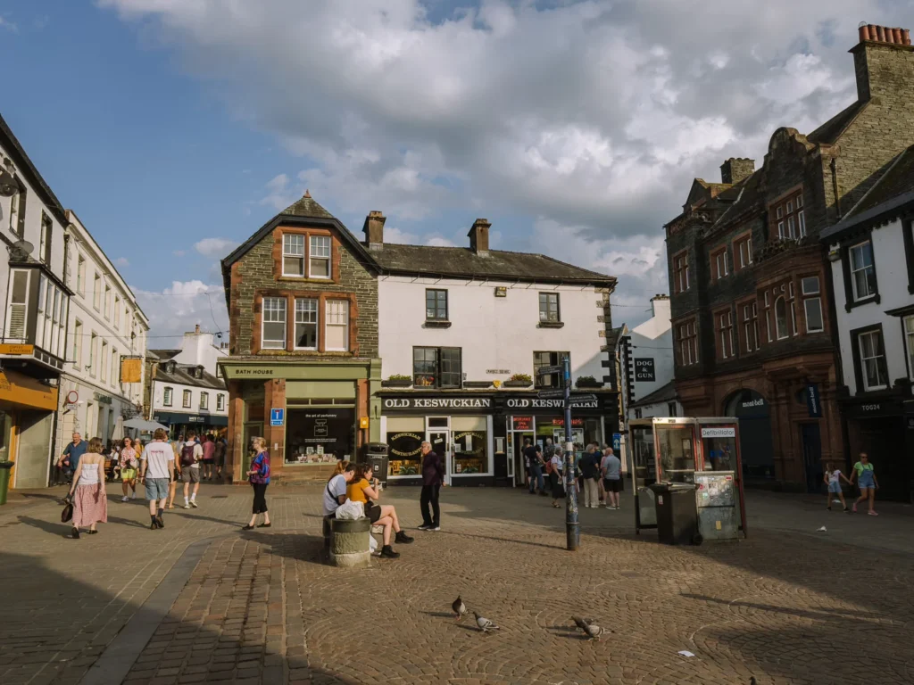
We arrived mid-afternoon and spent the night in Keswick before starting the hike. The Highfield Hotel, where we stayed, offers an award-winning breakfast that is perfect for fuelling the first day. It also has excellent views of Catbells.
They do not offer packed lunches, but there are plenty of supermarkets, cafes and pie shops in Keswick to get your packed lunch for Day 1.
Day 1: Keswick to Buttermere
- Start: Keswick
- End: Buttermere
- Distance: 7.4 miles
- Elevation: 3,400 ft ascent and descent
- Time: 5 hours walking time
- Stay: Buttermere Court Hotel
- High Route Map: OS Day 1 High Route Map
For the first day, we hiked from Keswick to Buttermere over Catbells and Robinson.
To start the hike, catch the ferry from Keswick to Hawes End Jetty. There is a 9:45 am “Walker’s Special” departure that goes directly to Hawes End (rather than the 50-minute circular loop)—book tickets at Keswick Launch.
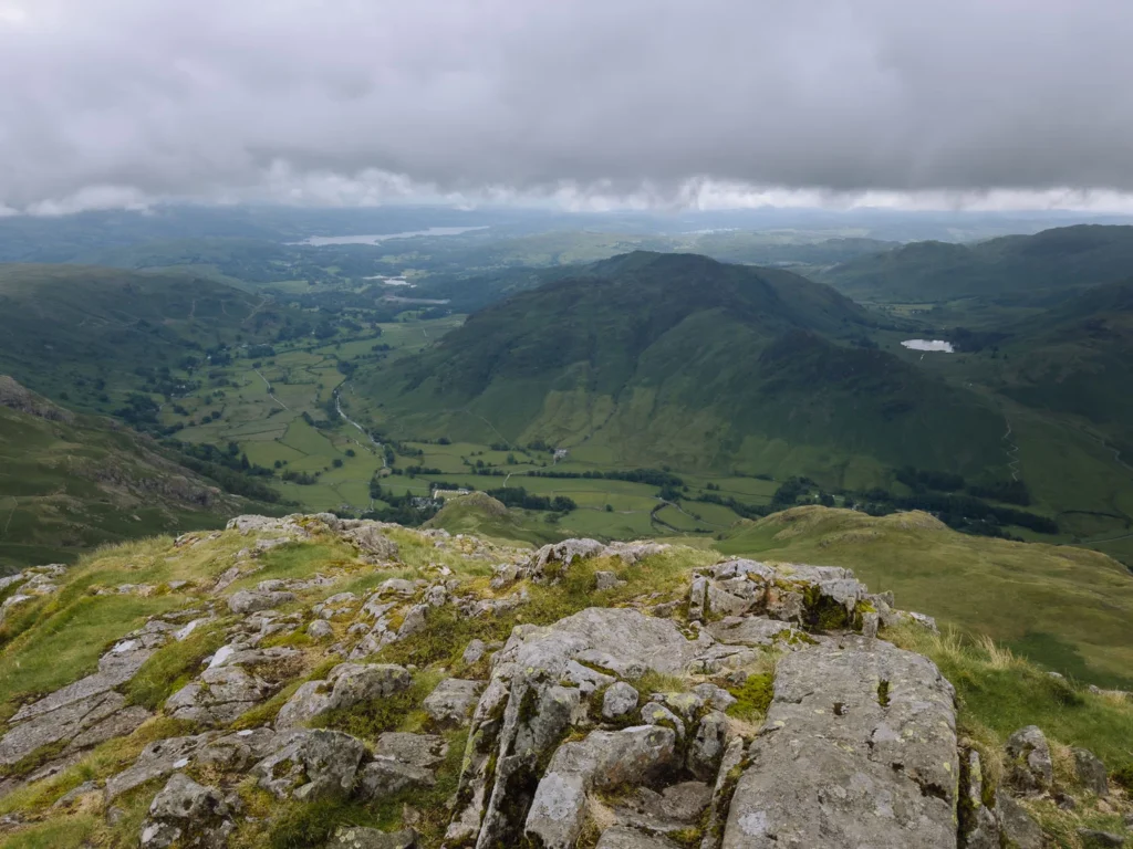
The hike up Catbells is one of our favourites in the Lake District, offering impressive 360-degree views from the summit. The path is easy to follow, zigzagging up the crest.
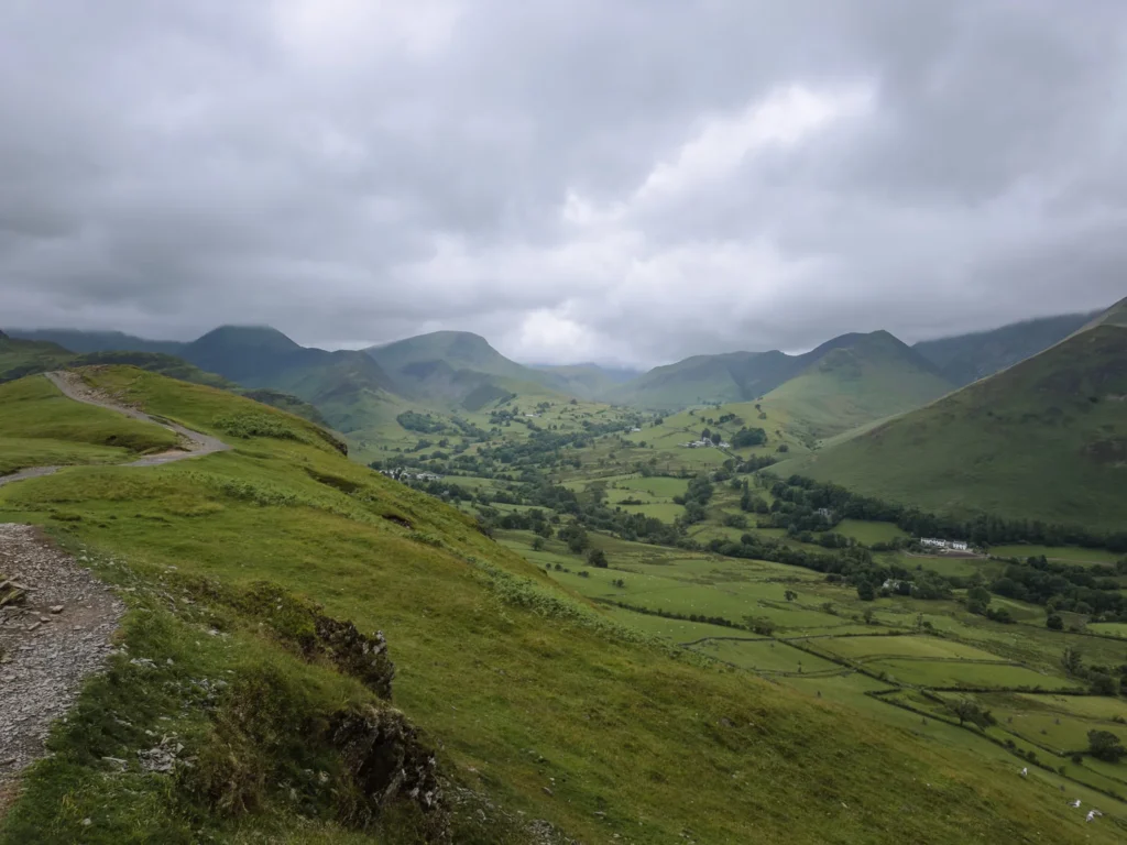
From Catbells, we continued over Robinson, which has fantastic views – on a clear day. Unfortunately, we had terrible weather and couldn’t see a thing. The summit is a broad plateau with wonderful views over Buttermere and the Western Fells.
There is a steep grassy descent into the village of Buttermere, which requires a bit of care in wet weather (which we had plenty of). The views, however, were some of our favourites on the walk.


Low Route
The low route bypasses the summits of Catbells and Robinson, following a path just above the bottom of Newlands Valley.
It is a quarter of a mile longer, but with only 1,700 ft of elevation, it has just half the ascent and descent. You could also go over the summit of Catbells, but skip Robinson.
Low Route Map: OS Day 1 Low Route Map.
Stay
We stayed at the Buttermere Court Hotel — an extremely friendly pub with a lively bar/restaurant. They also had a drying room, which was invaluable to us. Don’t forget to order your packed lunch for tomorrow. If it is fully booked, try the Bridge Hotel next door.
For campers, Syke Farm Campsite in Buttermere has pitches with some of the best views in the Lakes.

Day 2: Buttermere to Wasdale Head
- Start: Buttermere
- End: Wasdale Head
- Distance: 9.15 miles
- Elevation: 3,000 ft ascent and descent
- Time: 5 hours 30 minutes walking time
- Stay: Wasdale Head Inn
- Map: OS Day 2 High Route Map
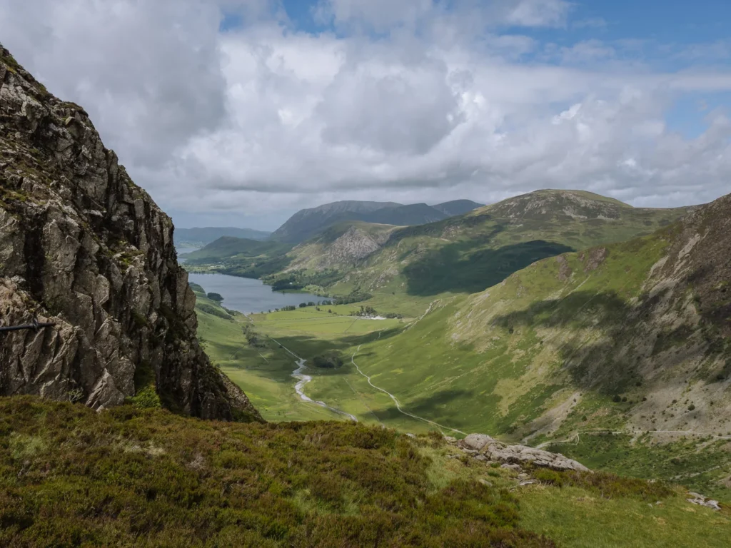
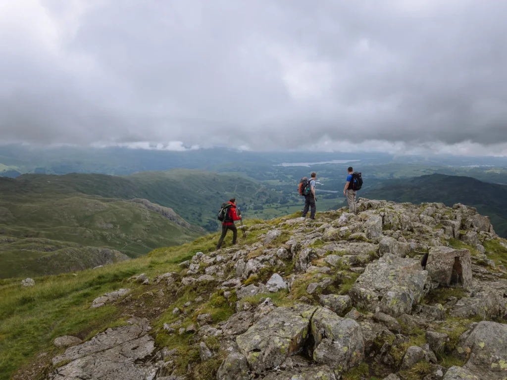
For Day 2 we hiked from Buttermere to Wasdale Head via the summit of Haystacks and Black Sail Pass.
We started the day with a beautiful, easy walk along the banks of Buttermere. There was almost no wind, and the views of the dramatic cliff face of Haystacks could be seen reflected in the water.
Leaving the lake, we ascended Warnscale Bottom, a scenic and steep path with stunning views over Buttermere behind us.
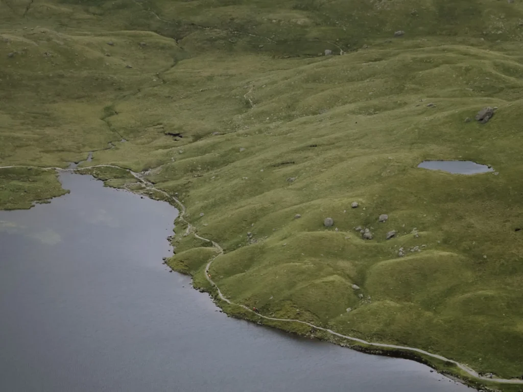
The trail flattened, and we crossed to the summit of Haystacks. Haystacks is a distinctive mountain in the Lake District. Featuring nobbles, tiny canyons, and rocky outcrops, it’s easy to see why it was one of Wainwright’s favourites. His ashes were scattered on Innominate Tarn, which you pass on the way to the summit.
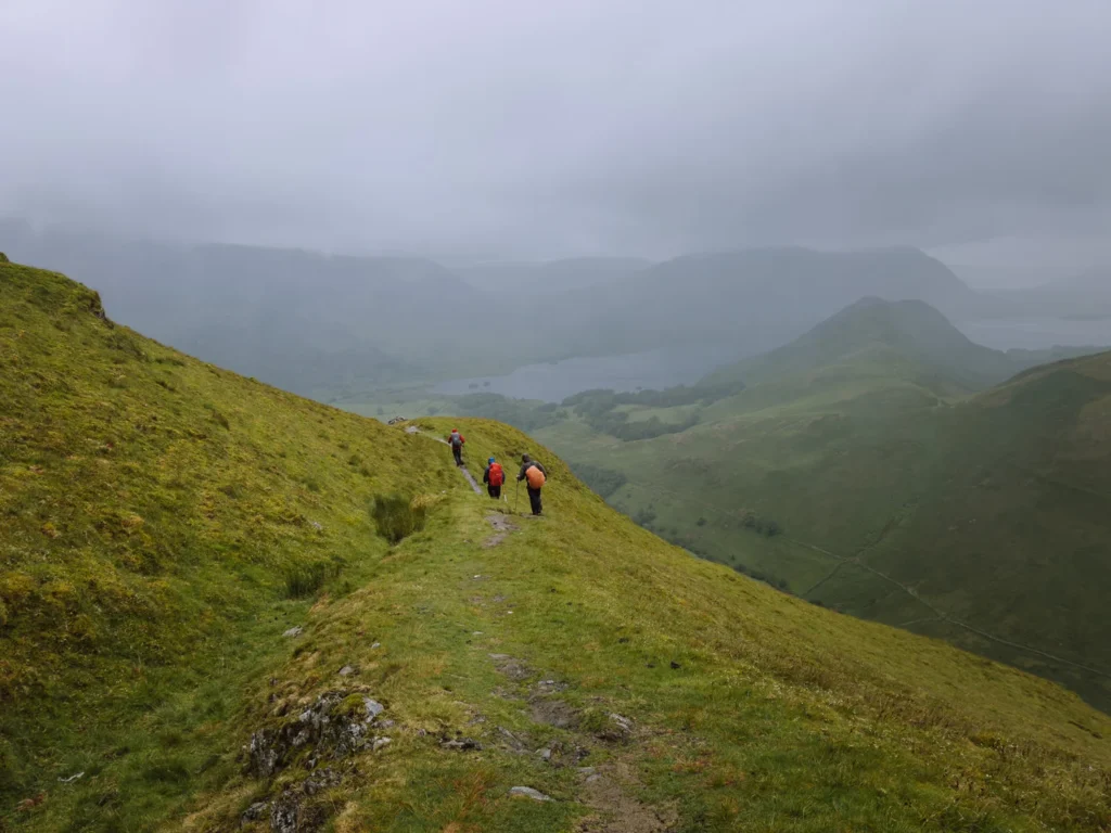
From the summit, we had some easy scrambling down to Scarth Gap Pass, where we turned left and headed across the top of Ennerdale. From the old stone Youth Hostel, we climbed up to Black Sail Pass and then dropped into dramatic Wasdale.
We were fortunate to have some great weather and had stunning views of Great Gable, Pillar, Scafell, Scafell Pike, and Wastwater.
Low Route
The low route bypasses the summit of Haystacks and ascends via Scarth Gap Pass instead of Warnscale Bottom.
It is nearly 2 miles shorter with roughly 700 ft less ascent and descent. However, it is a less interesting route and misses some stunning views. We only suggest doing the low route if you have particularly bad weather.
Low Route Map: OS Day 2 Low Route Map
Stay
We stayed at Wasdale Head Inn, an old hiker’s pub at the northern end of magnificent Wasdale. It is bursting with historic charm, and it’s most lively in the late afternoon when walkers descend from the slopes.
This is the only hotel in Wasdale, so book in advance.
For campers, there are two campsites. The Wasdale Head Campsite is conveniently right next to the pub. The National Trust Wasdale Campsite is 1 mile down the road. It has better facilities, including a shop, and can be booked in advance, but it’s a bit of a walk back to get a pint.
Day 3: Wasdale Head to Great Langdale
- Start: Wasdale Head
- End: Great Langdale
- Distance: 9 miles
- Elevation: 3,134 feet ascent and descent
- Time: 5 hours 30 minutes walking time
- Stay: New Dungeon Ghyll Hotel
- Map: OS Day 3 High Route Map
For Day 3, we hiked from Wasdale Head to Great Langdale via Esk Hause and the summit of Bowfell. (You do have the option of going over Scafell Pike, but in our opinion, this is the more interesting route with better views.)
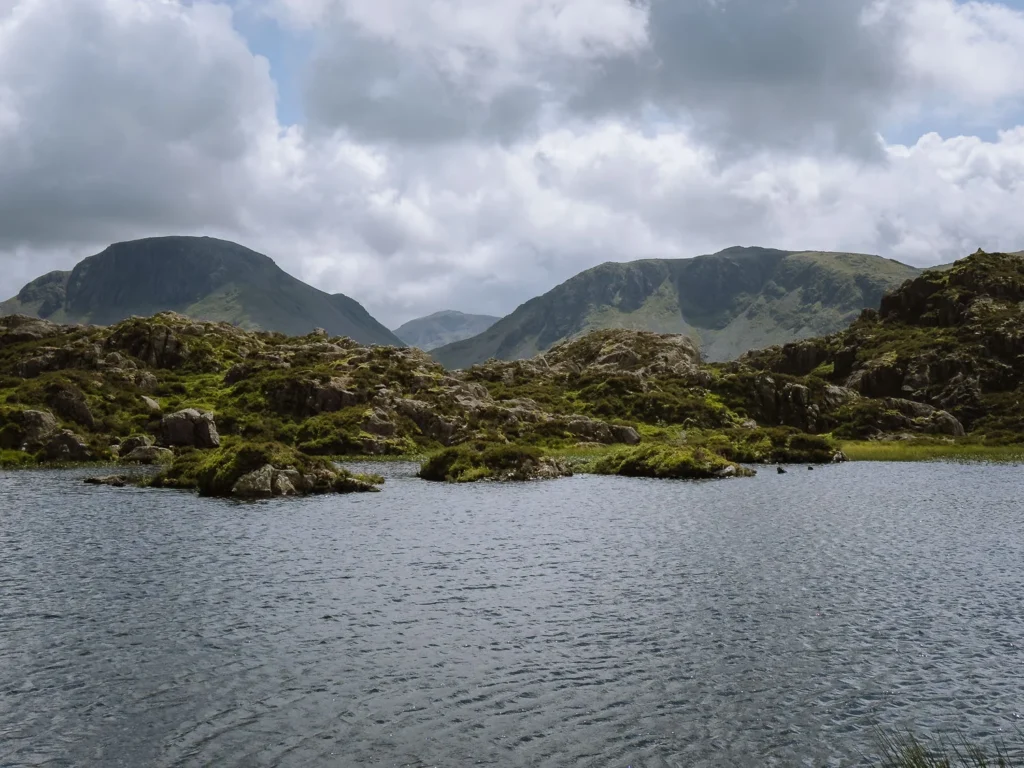
From Wasdale Head, we took Moses Trod (path) and gradually climbed to reach a saddle with views over Styhead Tarn. The well-marked path is easy to follow, but it can get boggy in wet conditions.
A little further, we passed the chilly water of Sprinkling Tarn before reaching Esk Hause. This gap in the high mountains has great views of some of the highest peaks in the Lakes.
From Esk Hause, we continued over Esk Pike to the summit of Bowfell, one of the most distinctive mountains in the Lake District with sweeping views of the Scafells, Langdale Pikes and (if you’re lucky) the Irish Sea.
From Bowfell, there is a long ridge descent into Great Langdale via The Band, but we prefer the route via Hell Gill and the attractive Whorneyside Waterfall, whose pool is great for a cooling dip.
This had been a long, tough day, but a wonderful one. We finished it at the Old Dungeon Ghyll. This historic hikers’ pub has been welcoming walkers with tired limbs for over 75 years, and us for the last 30.

Low Route
The low route bypasses the summits of Esk Pike and Bowfell and descends via Rossett Gill rather than Whorneyside. It is only a quarter of a mile shorter (8.75 miles) and saves approximately 500 feet of ascent and descent.
You don’t need to decide which route to take until you reach Esk Hause. Both routes are splendid, but if you’ve got the energy and the skies are clear, the views from Bowfell are worth the effort.
Low Route Map: OS Day 3 Low Route Map
Stay
We stayed at one of the stalwarts in the lakes, The New Dungeon Ghyll Hotel. The service can be patchy, and the rooms could do with a facelift, but the food in the bar is very good and the lounge a great spot to relax. If it is fully booked, try the Old Dungeon Ghyll Hotel.
For campers, the National Trust Great Langdale Campsite has over 120 pitches, a drying room, and a small shop selling essentials. It accepts online bookings, but only for a 2-night minimum. Fortunately, it almost always offers space for walk-ins arriving on foot.

Day 4: Great Langdale to Borrowdale
- Start: Great Langdale
- End: Stonethwaite
- Distance: 7.4 miles
- Elevation: 2,560 ft ascent and descent
- Time: 4 hours and 30 minutes walking time
- Stay: Stonethwaite Country Inn
- Map: OS Day 4 High Route Map
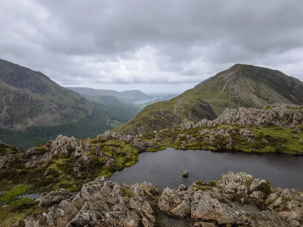
For Day 4, we hiked from Great Langdale to Borrowdale via the summit of three of the Langdale Pikes.
We began by climbing steeply up the shoulder of Pike Howe, taking a short detour to the summit, which has great views over Great Langdale. It was a tough start, and we were puffing and panting within a few minutes of setting off.
From Pike Howe, we continued to climb a grassy bank. The trail goes above the steep-sided ravine of Dungeon Ghyll, and at one point, it is quite narrow. But not for long, and soon we reached a saddle between Loft Crag and Harrison Stickle — two of the five Langdale Pikes.
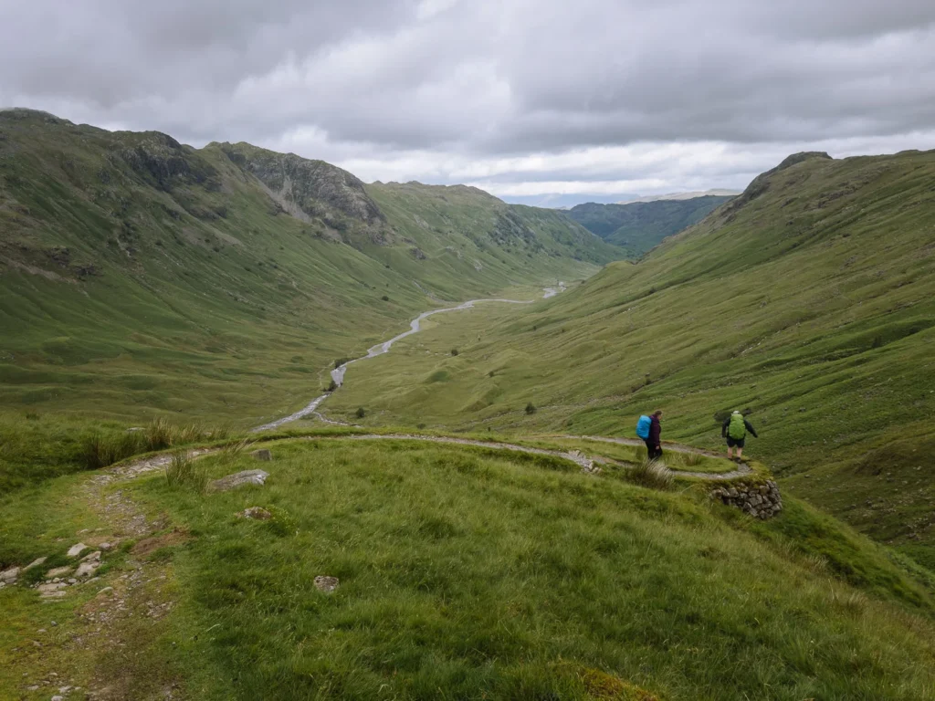
We took a detour up to the summit of Harrison Stickle for great views over Stickle Tarn and Pavey Ark, the largest cliff face in the Lake District. Then we headed over Loft Crag and Pike Howe and down to Stake Pass.
We had lunch at the top of the pass, with great views down the Langstrath Valley. After a break, we descended steeply down the zigzags and then along the valley bottom to Stonethwaite.
There is an excellent wild swimming spot at Black Moss Pot (about 45 minutes before you reach the Stonethwaite Inn). A 25-metre-long narrow channel is wedged between two rocky walls. On a sunny, warm day, it’s a great place to chill out and cool down.
The inn at Stonethwaite has a small collection of wooden picnic tables nestled under a tree. It’s one of our favourite spots for an after-walk pint.
Low Route
The low route avoids the Langdale Pike summits and instead follows the Cumbria Way over Stake Pass into the Langstrath Valley.
It is a quarter of a mile longer but saves 1,000 feet of ascent and descent. The views from Stake Pass into Langstrath are wonderful and partially make up for missing the views from the tops.
Low Route Map: OS Day 4 Low Route Map
Stay
We stayed at Stonethwaite Country Inn, an excellent inn at the bottom of the Langstrath Valley. They serve hearty meals in a cosy atmosphere with outside tables nestled under the canopy of a grand old tree.
If fully booked, you’ll need to walk a little further and stay in Seatoller at the Glaramara or in Rosthwaite at the Royal Oak.
For campers, the Chapel House Farm Campsite has lovely pitches along Stonethwaite Beck just before you reach the Inn. It has basic toilets, 50p showers and can be booked by email or phone. The Seatoller Farm Campsite is set in a grassy field half a mile past the Inn. It has wood-fired pizza evenings in peak season.


Day 5: Borrowdale to Keswick
- Start: Borrowdale
- End Keswick
- Distance: 7.1 miles
- Elevation: 2,300 ft ascent and descent
- Time: 4 hours 15 minutes walking time
- Map: OS Day 5 High Route Map
On the final day, we headed back to Keswick via the eastern side of the Dale Head Round.
We began the day following the pretty River Derwent as it babbled past Rosthwaite Village.
The trail quickly steepened as it headed up Tongue Gill and through the Rigghead Quarries. It’s a wild, rocky ascent, and to be quite frank, not the prettiest. But as we climbed, the views over Borrowdale opened up.
At the top of the ridge, we turned right to reach the summit of High Spy. From there, it is a glorious ridge walk over Maiden Moor and then Catbells before descending back to Hawes End, where it all began five days ago.
You can now either take the ferry back to Keswick Launch or walk the additional 2.5 miles (roughly 1 hour) from Hawes End to Keswick.


Low Route
The low route bypasses the summits of High Spy, Maiden Moor, and Catbells and follows the Cumbrian Way through charming Borrowdale and along the edge of Derwent Water.
It’s 1 mile shorter, and staying along the valley floor has only 400 feet of ascent and descent. It is an easy final day that allows you to finish early and get home.
Low Route Map: OS Day 5 Low Route Map
Stay
We spent the final night again at the Highfield Hotel in Keswick. They have complimentary tea and cakes in the afternoon.
For campers, Keswick Camping and Caravanning Site is on the northern edge of Derwent Water, just a short walk from the town centre.


More Lake District Guides
- Find your perfect area with our guide to the best places to stay in the Lake District.
- Use our detailed guide to see the Lake District without a car.
- Tackle one of our favourite hikes in the Lake District.
- Attempt one of the many routes up Scafell Pike.
- Or choose the best option and hike the Corridor Route.
- For the best Grade 1 scramble, hike Helvellyn via Striding Edge.
- Try one of these amazing wild swimming locations in the Lake District.
- There’s more than hiking; find more great things to do in the Lake District.
- Check out our easy-to-reach best views in the Lake District.
- Find all the great things to do in Keswick.
- Discover all the best attractions in Ambleside and the nearby area.

reader-supported
When you buy through links on our site, we may earn a small affiliate commission at no extra cost to you.
Thanks for your support // Paul & Mark
anywhere specific that we’re able to park the car for the duration of the walk?
Hi Stefanie, I’ve only ever done the walk using the train to Penrith. However, I think there are a few options. Firstly, I think you can buy a 1-month permit for Keswick Lakeside Car Park. Secondly, I think there are some residential roads in Keswick (just off Penrith Road) where you may be able to park. Finally, you can try parking in the residential streets in Threlkeld and get the bus to Keswick. Obviously, if you park on a residential road, try to be courteous to the residents. Let me know if you find anywhere better. Kind regards, Mark
Did you use a luggage transfer service?
Hi Jo,
No we didn’t. We carried all out stuff with us.
Paul.