This excellent hike to Rifugio Fratelli Fonda Savio takes you to the heart of the soaring pinnacles and scree fields of the Cadini di Misurina. This post includes maps and comprehensive instructions.
By: Mark Barnes | Last Updated:
The Cadini di Misurina are a group of spiky mountains in the Sesto Dolomites. The most iconic image of them is from the Cadini di Misurina viewpoint, a short walk from Rifugio Auronzo.
With near-vertical rocky facades, the peaks are almost only accessible to climbers or via ferrata enthusiasts.
But the hike to Rifugio Fratelli Fonda Savio is easy (but strenuous) and allows you to witness this dramatic and inhospitable landscape without the climbing gear.
From the rifugio, you are rewarded with a wonderful view of the spiky peaks of the Sesto Dolomites.
If you’re spending time in the Eastern Dolomites, this hike will give you a different vantage point to the popular Cadini di Misurina viewpoint or the Tre Cime circular hike.
Rifugio Fratelli Fonda Savio Hike Overview
- Start / Finish – Lago d’Antorno
- Distance – 8 km / 5 miles
- Duration – 2 hours 20 minutes (3 hours for the circuit)
- Elevation gain – 550 metres
- Difficulty – Medium
For a shortish walk, the Rifugio Fratelli Fonda Savio hike is an excellent adventure.
It begins near Lago d’Antorno and steadily ascends using Path 115 to reach the basin of Ciadin dei Tocci. From here it curves round the basin and ascends a short scree slope to reach Rifugio Fratelli Fonda Savio, beautifully set amongst the peaks.
As a there-and-back hike, spend some time enjoying the views and lunch at the rifugio, before making your way back the way you came.
Circular Hike Option
There is an option to make this a circular hike; however, due to bad weather, we didn’t get to do it. We did a lot of research, so we have explained below how to do it if this is something you’d like to do.
The circuit hike heads over Passo dei Tocci and follows Path 117 as it descends steeply down a rocky gully to Forcella dei Rinbianco. From there, it bears left and gently descends on Path 119 back to Lago d’Antorno.
There is a short, steep section with cable support just after Passo dei Tocci. The circuit takes about 3 hours.
Rifugio Fratelli Fonda Savio Hike Map
Below is a map of the Rifugio Fratelli Fonda Savio hike. The there-and-back hike is marked in red, and the more challenging circuit return is marked in orange.
The car parks, bus stops, and restaurant (at the beginning of the hike) are marked in blue.
For a physical map, get Kompass 617 – Cortina d’Ampezzo.
For digital, download the Belluno region on Maps.me. It has all the trails, and you can track yourself online. Or use our map below.
Click on the top right corner to open our map in your Google Maps app. Click the star next to the title to save it to your Google account.
Getting to the Trailhead
The Rifugio Fratelli Fonda Savio hike begins near Lago d’Antorno, just north of Misurina.
By Car
The best place to park is the Rifugio Fonda Savio car park. It is situated on the right-hand side of the road as you drive from Lago Misurina to Lago d’Antorno.
The car park is free and has quite a few spaces, but it can get busy during peak season, so try to arrive early or late in the afternoon.
If it is full, there is car parking at Lago d’Antorno. The parking on the right-hand side (next to the lake) is limited to 2 hours, but there are a few spaces on the left-hand side (just past Chalet Lago d’Antorno) where parking is free and unlimited.
By Bus
The 445 bus runs from Dobbiaco (Toblach in German) to the Misurina Genzianella bus stop, taking 30 minutes. From the bus stop, it is a 10-minute walk up the road to the trailhead.
The 051 bus runs from Cortina d’Ampezzo to the Misurina Genzianella bus stop, also taking 30 minutes.
There is also a bus stop at Lago d’Antorno, which is connected to Misurina Genzianella by the 050-shuttle bus. It’s not worth taking if you plan on completing the there-and-back hike, but it reduces the circuit walk by about 20 minutes.
Hiking Instructions
Lago D’antorno to Rifugio Fratelli Fonda Savio (1 Hour 20 Minutes)
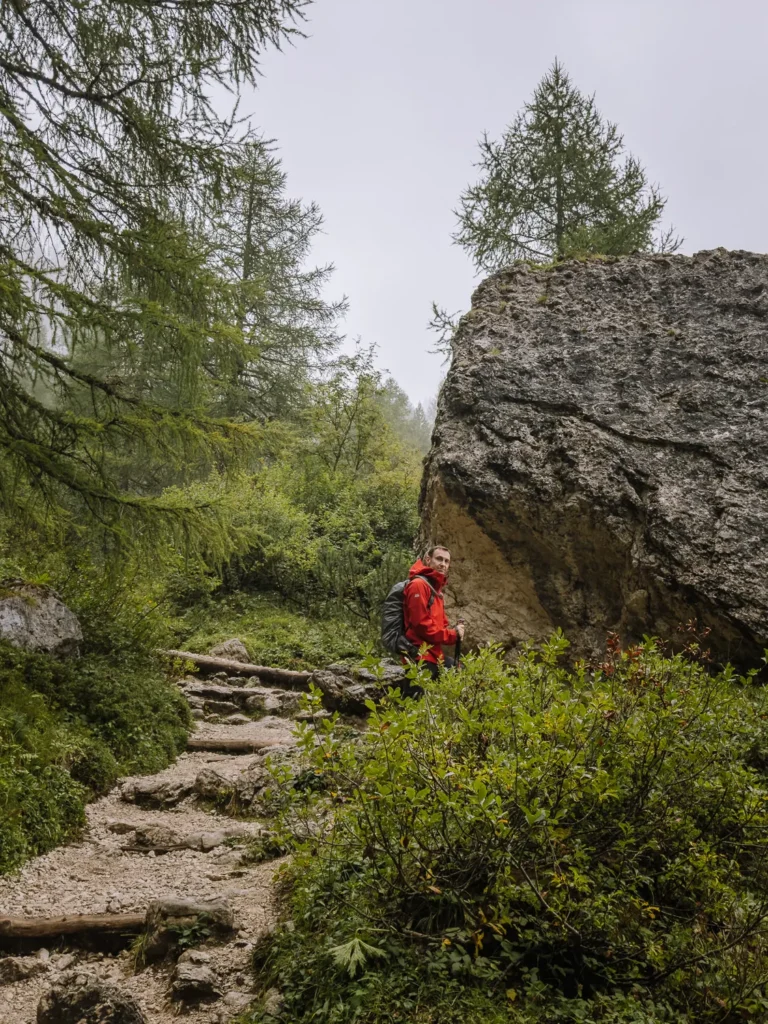
From the Rifugio Fonda Savio car park (1,805m), follow Path 115 heading eastwards on a wide gravel track through the trees. (If you park at Lago d’Antorno, use the purple path on the map above.)
At a gravel car park, the path bears right and then left across an opening between the trees.
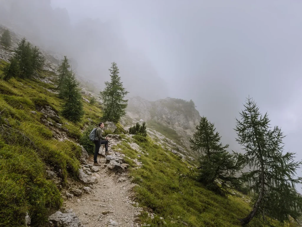
Keep following Path 115. As it begins to ascend more sharply, the path splits.
You can take either route, but the left-hand fork is a little easier. When the paths rejoin, it heads south, and the trees begin to thin. After a couple of zigzags, the trail bears eastwards again and crosses a low col.
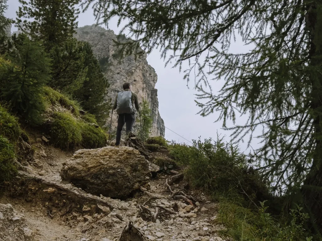
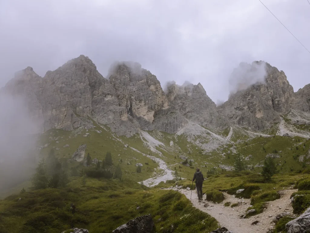
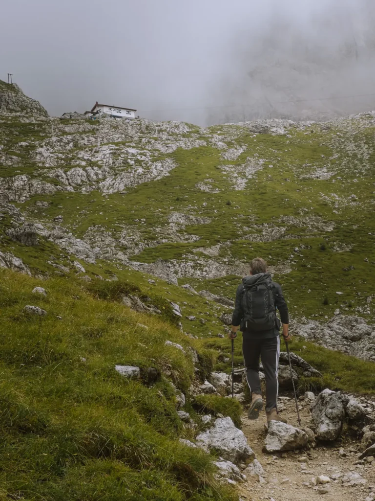
You suddenly find yourself in Ciadin dei Tocci, a scree-filled basin, surrounded by an amphitheatre of towering peaks.
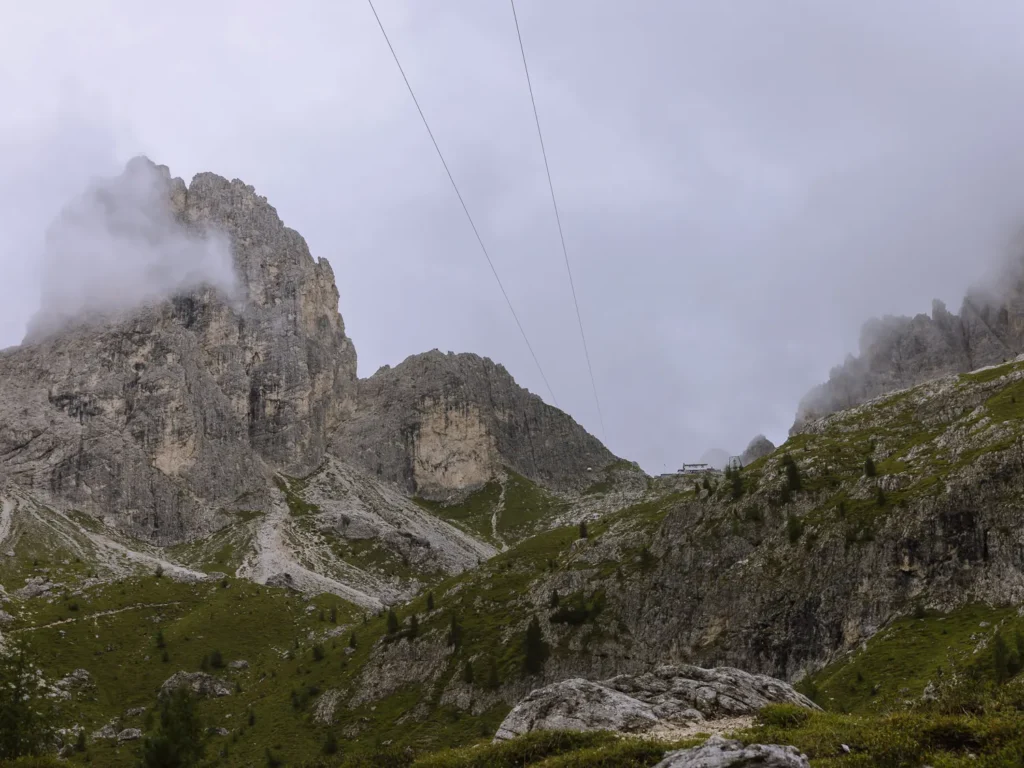
To your left is Torre Wundt, to your right is Torre del Diavolo and peering out from the ridge in front is Rifugio Fratelli Fonda Savio (2,367m).
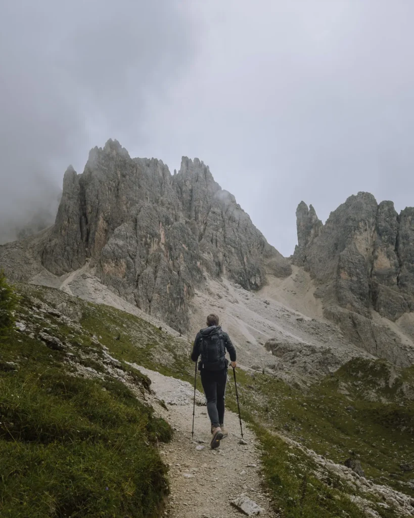
The path curves around the left-hand side of the basin. There’s a rough section up a loose scree slope and a couple more zigzags, but nothing very challenging.
Finally, the path traverses under the soaring pinnacles and ascends a short rocky gully to the rifugio.
We seemed to have lots of energy on this hike and were up in just over an hour. The rifugio is wonderfully remote, and we both had an excellent bowl of spaghetti Bolognese.
Rifugio Fratelli Fonda Savio to Lago D’antorno
As mentioned above, there are two options to return, but we did not get a chance to do the circular route due to the weather.
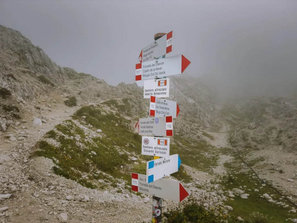
To return the way you came, simply retrace your steps down Path 115 to the car park or bus stop near Lago d’Antorno (1 hour). Just make sure you take in the view from Passo dei Tocci (behind the rifugio) before setting off.
Circular Return Instructions
To complete the circuit hike, follow Path 117 and then Path 119 back to the lake (1 hour 40 minutes).
This is a more challenging route.
Path 117 descends in a north-eastwards direction from Passo dei Tocci. From all reports, the drop is steep and aided by steps cut into the rock and a cabled section.
The path is narrow but not particularly exposed, and the cable adds extra reassurance. According to our research, the difficult section is over in about ten minutes.
The path now crosses a rocky valley and becomes easier with views across to Tre Cime opening up before you.
After a short, easy ascent, the trail reaches Forcella dei Rinbianco (2,207).
At the pass, keep left on Path 119, gradually descending north-westwards. At a junction of paths, just as the trail enters the trees, take the left-hand fork and return to Lago d’Antorno (1,886m).
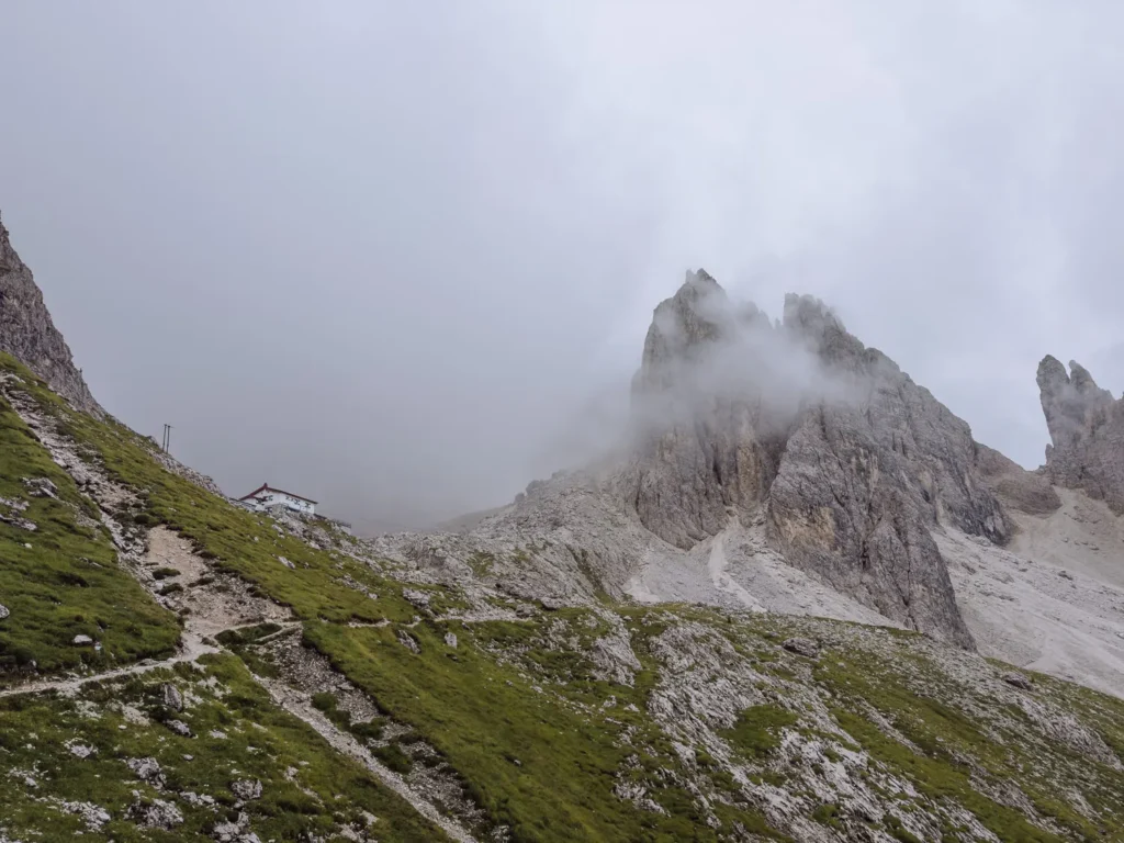
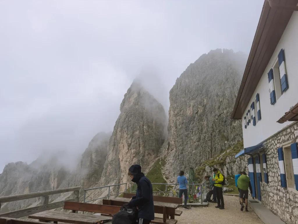
Rifugio Fratelli Fonda Savio
The wonderful Rifugio Fratelli Fonda Savio sits above the basin of Ciadin dei Tocci and right under the peak of Torre Wundt.
On a fine day, the outside terrace is filled with climbers taking a break from attempting the pinnacles that surround the hut.
On a cloudy day, it is a brooding, moody place drifting in and out of the mist.
The hut has a small, homely menu of local staples and very friendly service.
Even if you don’t complete the circular hike (which we didn’t), make sure you climb the few metres behind the hut, to the top of Passo dei Tocci, and take in the dramatic views over the rest of the Cadini di Misurina peaks.
Best Time to Hike
The best time to hike to Rifugio Fonda Savio is from early July to late September. The snow should have melted from the high ground, and the weather is at its warmest.
We hiked in mid-August, and despite it being peak season, we encountered only two other people on the walk. However, there were several people at the hut.
Being under 3 hours long, it’s a great half-day hike that you can do in the morning or afternoon.
What to Take on the Hike
Hiking Boots – The full circuit is reasonably long and paths are uneven in many places, so we suggest wearing proper hiking boots (we use something similar to these).
Hiking Poles – We’re recent converts to hiking poles. This isn’t a particularly long hike, but they still help. We use the trusty Leki sticks.
Waterproofs – Weather conditions on the walk can change dramatically (as we found out), and rain is common in the afternoon. Make sure you take a waterproof like this one.
Sun Block/Hat – Since much of the walk is not in the shade, bring sun block and a hat on hot days.
Snacks – The rifugio does great food, so there’s no need to bring lunch, but you might want to take some snacks.
Water – Make sure you have plenty of water. We used one of these hydration packs, which makes it much easier to stay hydrated on the trail. Alternatively, this is our favourite hiking water bottle.
Maps – The main route is well-marked, but it’s also a good idea to have an online map with you.
Photography – We recommend good-quality ND Filters for capturing lakes and a decent tripod; the Ultralight Sirui is the best we’ve come across.
Drones – Drones are permitted on some of these hikes, but check before you set off. We use the very light and excellent DJI Mini Pro.
More Dolomites Guides
- Here are all our favourite places to visit in the Dolomites.
- Put your trip together with our Dolomites road trip itinerary.
- Hike to the beautiful Lago di Sorapis.
- Try one of our favourite hikes in the Dolomites.
- The Sassolungo Circuit is one of our favourite walks in the world.
- Take on one of the most popular hikes in the Dolomites – Tre Cime di Lavaredo.
- Visit the beautiful Lago di Braies.

reader-supported
When you buy through links on our site, we may earn a small affiliate commission at no extra cost to you.
Thanks for your support // Paul & Mark