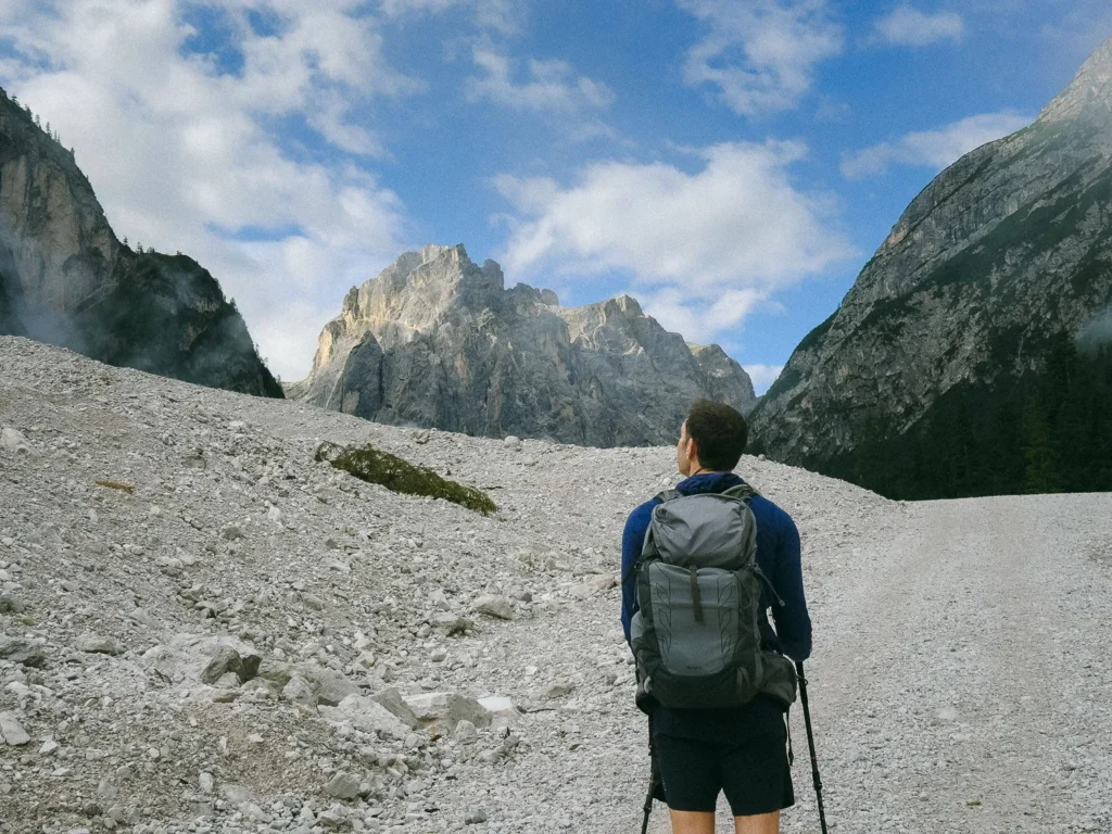
Get away from the crowds on the magnificent Torre dei Scarperi Hike and explore the heart of the jagged peaks of the Sesto Dolomites.
By: Mark Barnes | Last Updated:
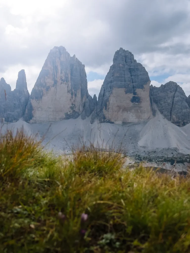
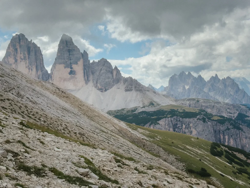
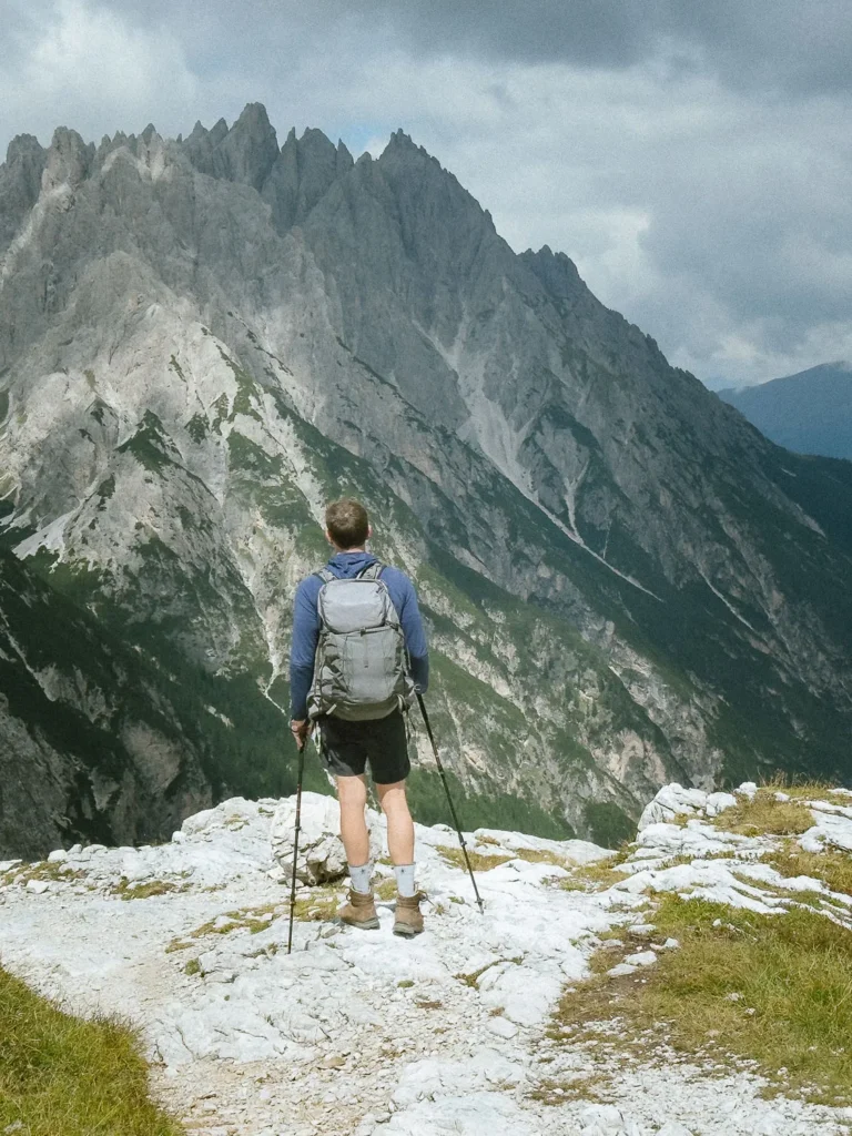
The Sesto (Sexten in German) Dolomites are home to some of the most magnificently shaped mountains in the world, including the spiky pinnacles of Cadini di Misurina and the three peaks of Tre Cime.
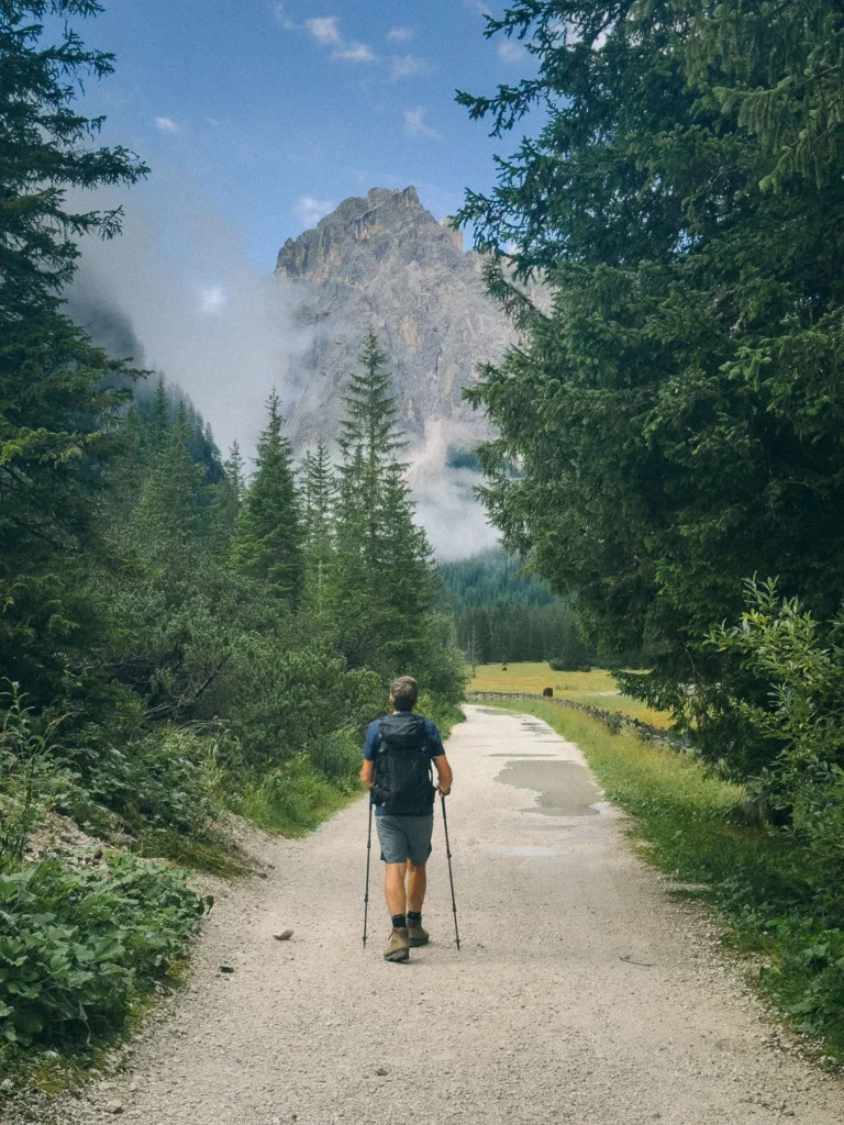
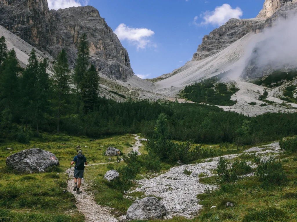
The Torre dei Scarperi circuit takes you to the very heart of this magical world, where massive limestone peaks surround sweeping valleys filled with dwarf pines.
The trail has over 1,000 metres of ascent and descent, with a steep slog up a dramatic scree slope and an aided cabled section up a chimney. But it can be completed by anyone with reasonable fitness and enough mobility to handle some scrambling.
We did this hike in peak season and saw very few people on the trail. The views after reaching the first pass were magnificent, and it instantly became one of our favourite walks in the Dolomites.
This post covers everything you need to know, including how to get to the trailhead, a map, and detailed instructions for the hike.
Torre dei Scarperi Hike Overview
- Start / Finish: Antoniusstein Parkplatz
- Distance: 13.5km / 8.4 miles
- Duration: 5 hours 30 minutes
- Elevation gain: 1,050m
- Difficulty: Medium to Challenging
The Torre dei Scarperi circuit is 8.4 miles long and takes around 5 hours and 30 minutes of walking. However, allow at least an extra hour for lunch, coffee at the rifugio, and stopping for photos.
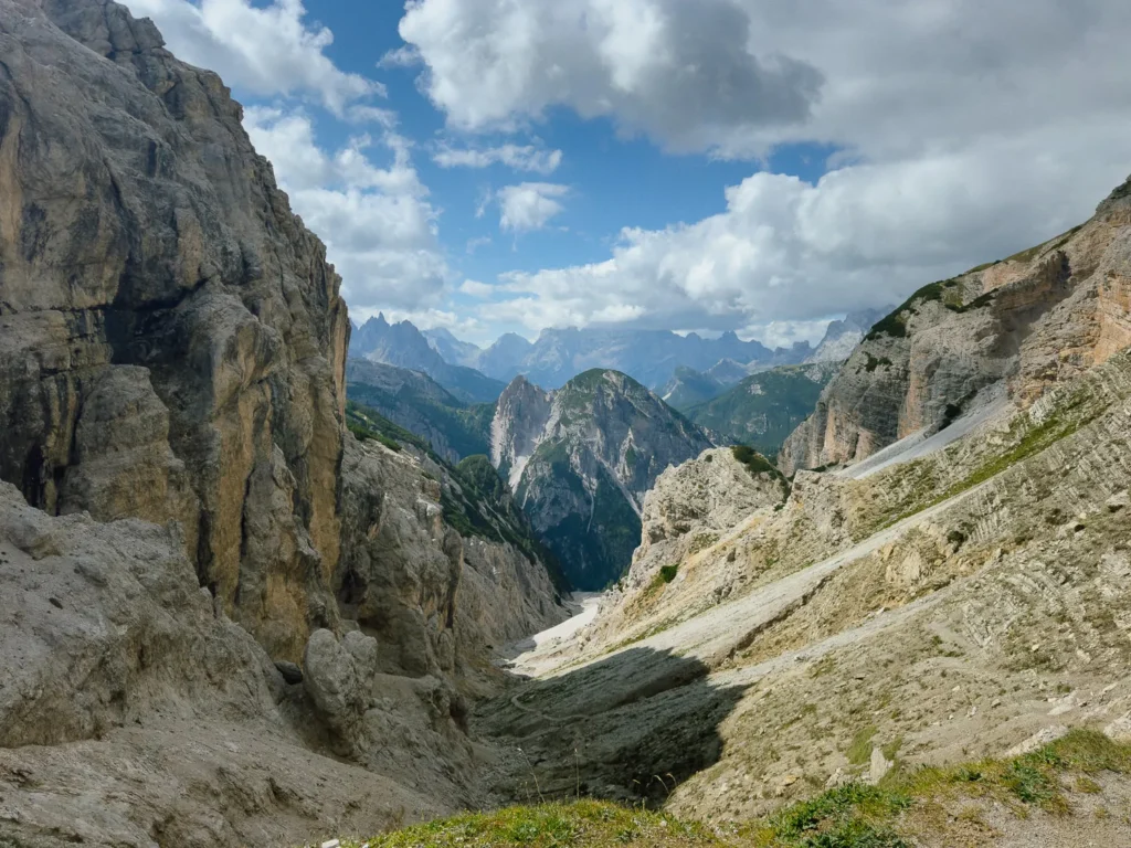
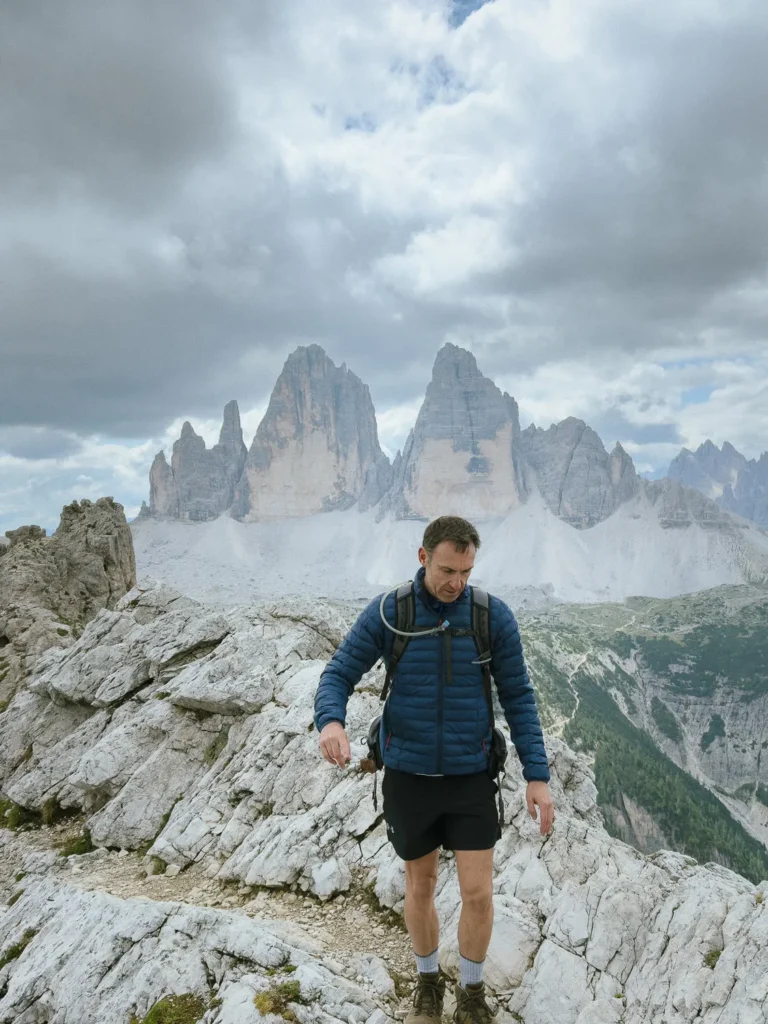
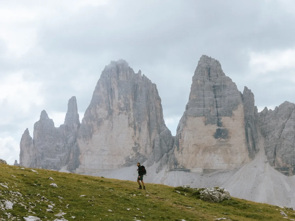
The trail starts by following the valley floor before climbing steeply to a pass (Passo dei Rondoi). It then contours beneath the tower (torre) that gives the walk its name, offering stunning views of Tre Cime and Cadini di Misurina.
Next, the trail descends along a series of scenic ledges back to the valley floor.
There is one rifugio along the route, but it is near the start of the walk (30 minutes from the car park). We took a packed lunch and had a beer and a cheeky piece of cake at the rifugio at the end.
We have rated the hike medium to challenging for two reasons.
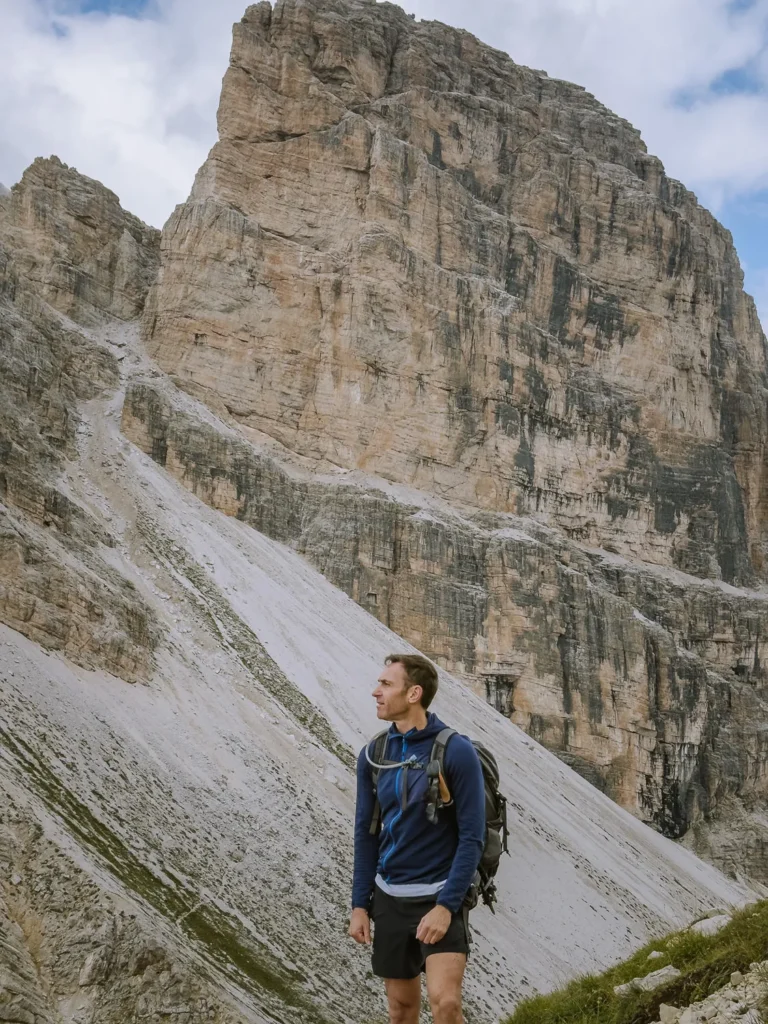
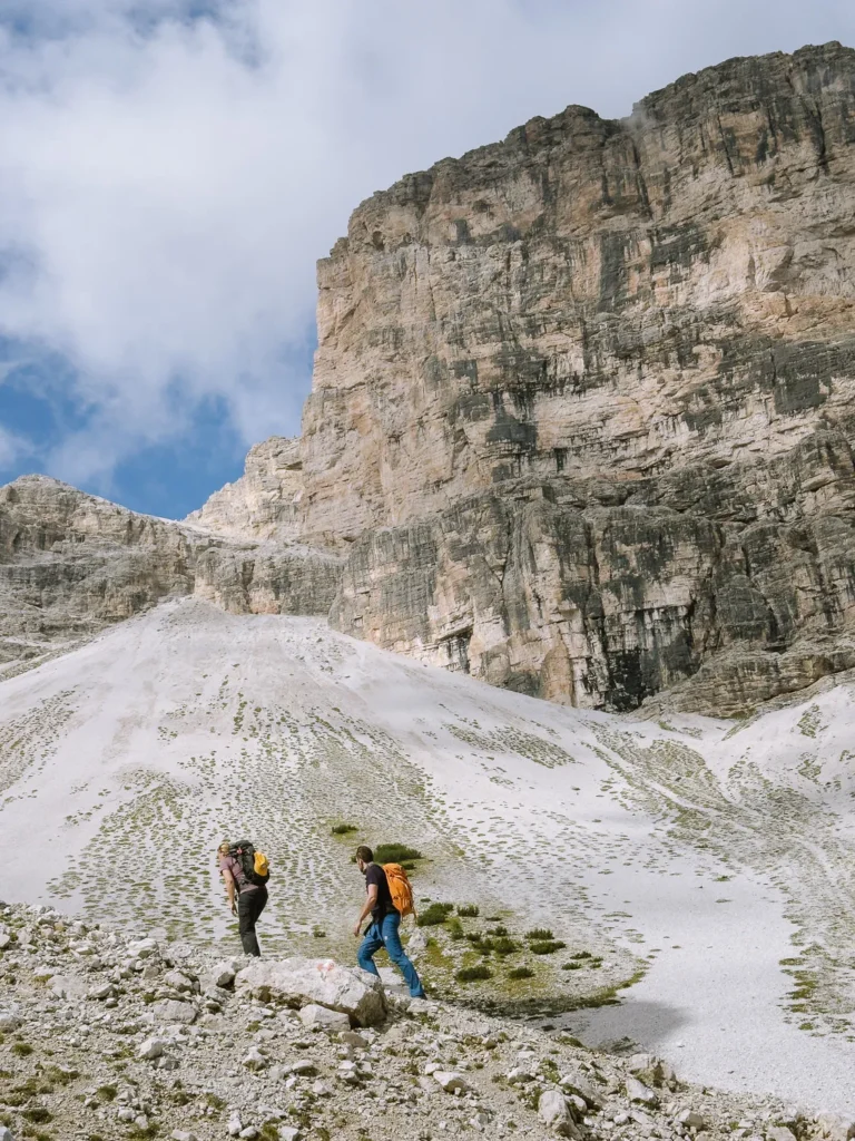
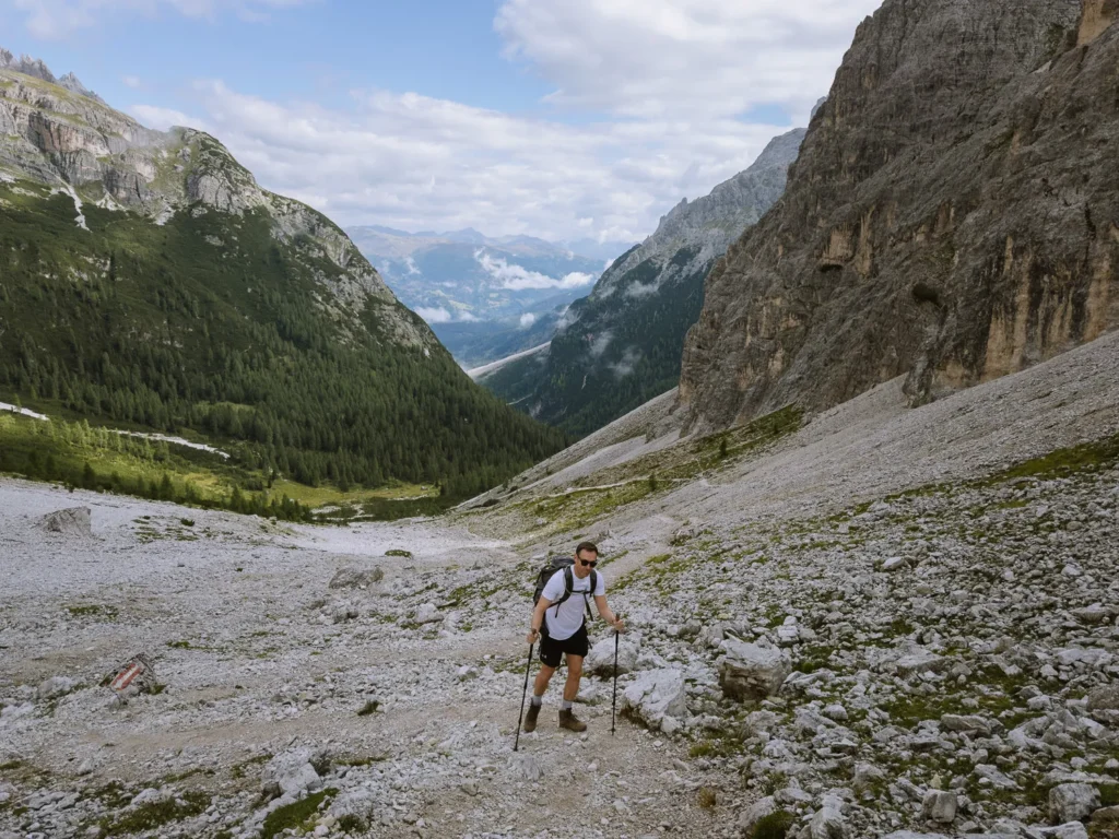
Firstly, it has just over 1,000 metres of ascent and descent, which means it requires a fair amount of effort. The ascent is a prolonged 90-minute slog. The final section crosses an increasingly steep scree slope where the gravel is loose, and hiking poles are helpful.
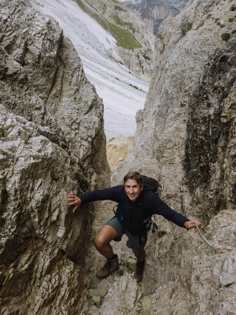
Secondly, there is a short, assisted section right after you reach the first pass. It starts with four to five exposed steps supported by a metal cable, followed by a steep chimney, where you use metal hand and footholds to climb up. The rock surrounds you on three sides, so it is not exposed, but you do need to use your hands and have enough strength to pull yourself up. We both found this section a fun challenge.
Torre dei Scarperi Map
Below is a map of the Torre dei Scarperi lollipop hike (marked in red). It is called a lollipop hike because the route begins along a straight line, then does a loop, before returning along the same straight line.
We have included the car parks and bus stops on the map (in blue) which you will need to use to reach the trailhead. Instructions for how to get there are below the map.
Click on the top right corner to open our map in your Google Maps app. Click the star next to the title to save it to your Google account.
Getting to the Trailhead
The Torre dei Scarperi lollipop hike starts at Antoniusstein Car Park. The car park is in the Campo di Dentro Valley (Innerfeldtal) just south of San Candido (Innichen). It can be accessed by either bus or car.
By Bus
To reach the Antoniusstein car park by public transport, take bus 446 that runs between Dobbiaco (Toblach), San Candido (Innichen) and Sesto (Sexten). Get off at Bivio Val Campo di Dentro (Abzweigung Innerfeldtal) and walk around the corner to the 449 bus stop.
The 449 is a shuttle bus that runs up and down the Campo di Dentro Valley connecting Bivio with Gweng and finally Antoniusstein. It operates from the beginning of June to the end of October, from 8:40 AM to 6:10 PM. Buses depart every 20 to 30 minutes, except for a 90-minute break between 12:30 and 2:00 pm. The journey takes 10 minutes and costs €4 per person, one way.
By Car
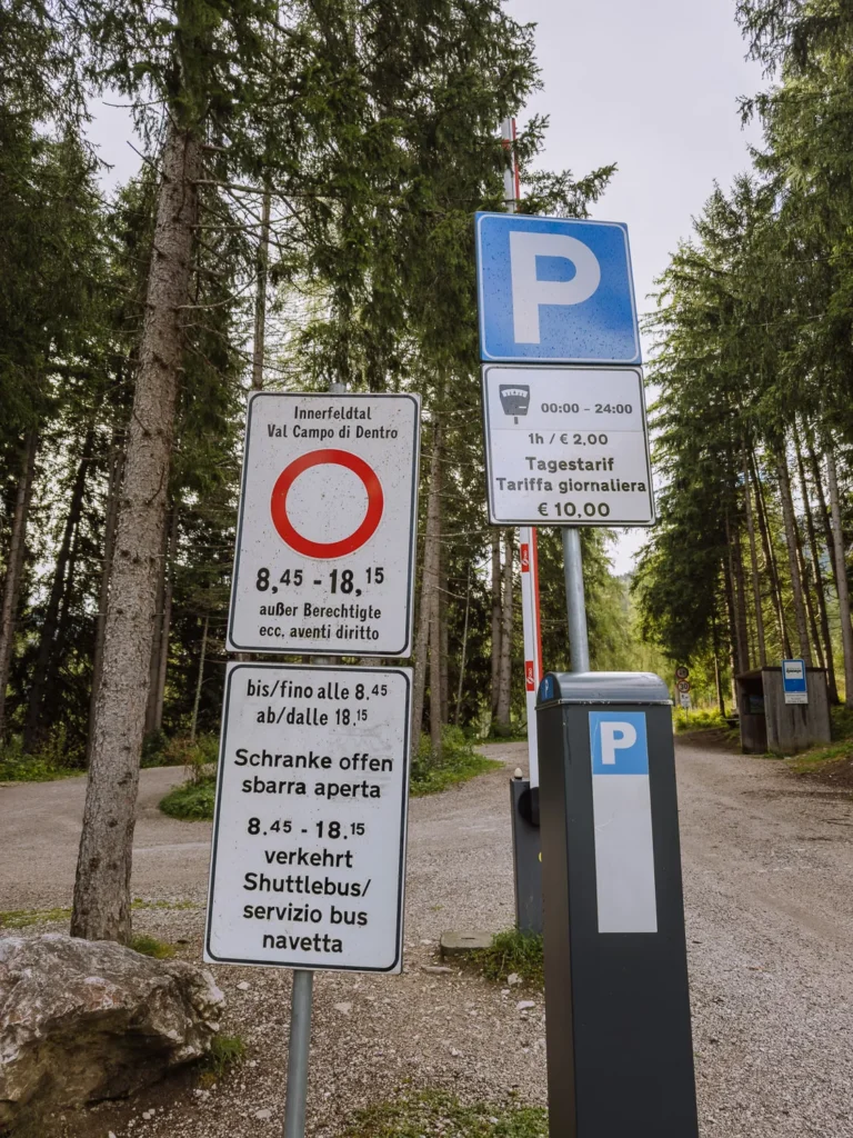
There is a car park at Antoniusstein, but the road between Gweng (see map above) and Antoniusstein is closed to traffic between 8:45 AM and 6:15 PM. This leaves you with two choices.
Your first option is to arrive at Gweng BEFORE 8:45 am, drive through the raised barrier, and park at the Antoniusstein car park. Parking at Antoniusstein is free, and you do not need to purchase a ticket from the machine located next to the barrier at Gweng.
If you return from your hike after 6:15 PM, simply drive back down the road.
However, if you return from the hike before 6:15 PM, you need to wait for the shuttle bus and then follow it down the road when it departs. The barrier will open to let you out as you approach it (the shuttle bus remains inside the barrier for the return trip).
Your second option is to arrive at Gweng AFTER 8:45 AM. In this case you won’t be able to drive to Antoniusstein. You will need to purchase an all-day parking ticket (€10) from the machine. Place the ticket in your car’s windscreen, then walk past the barrier to the bus stop and wait for the 449 shuttle bus to take you to Antoniusstein car park (€4 per person each way).
If you don’t want to take the shuttle bus, you can walk. The trail follows path 105 and takes about 1 hour. Just beware, you are adding more time onto a long walk, and through the least interesting part of the valley.
Hiking Instructions
Antoniusstein to Passo dei Rondoi (2 Hours 30 Minutes)
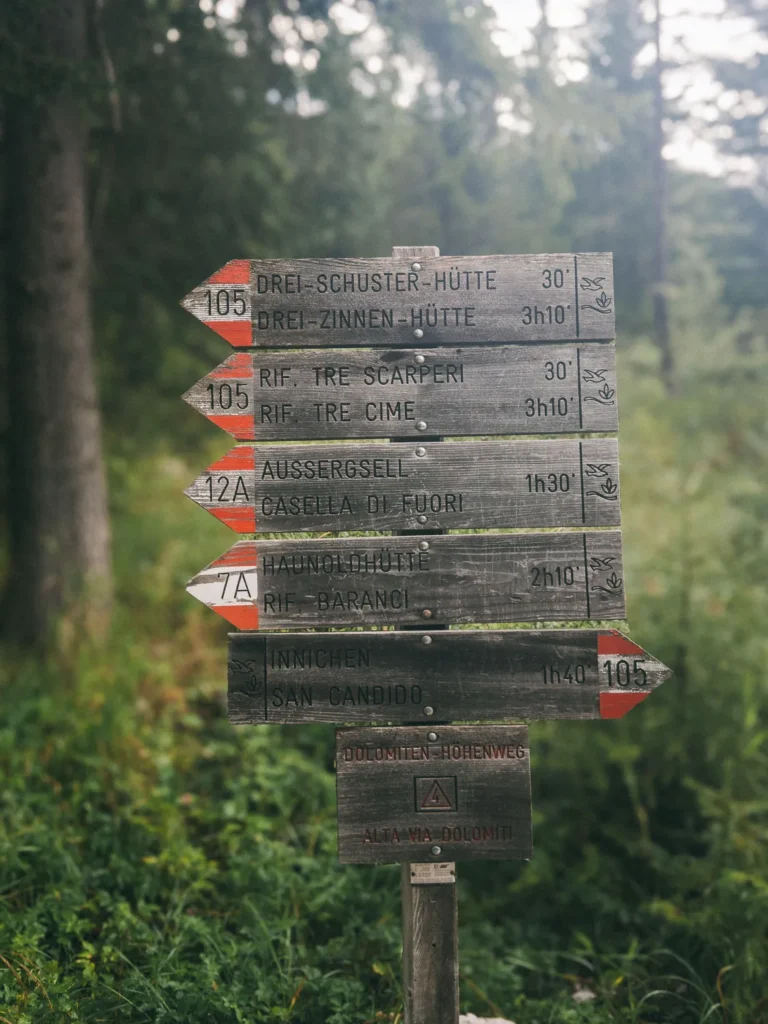
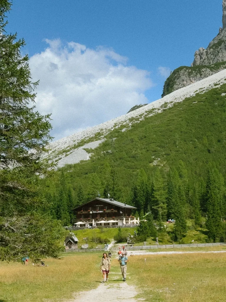
From Antoniusstein car park (1500m) follow path 105 signed to Rifugio Tre Scarperi (Drei-Schuster-hütte) and Rifugio Locatelli (Dreizinnenhütte). The path to the Rifugio Tre Scarperi takes about 30 minutes using a mixture of trail and the gravel road.
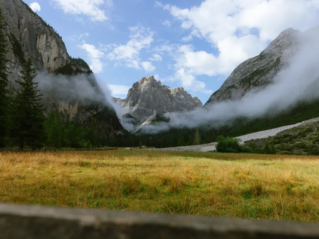
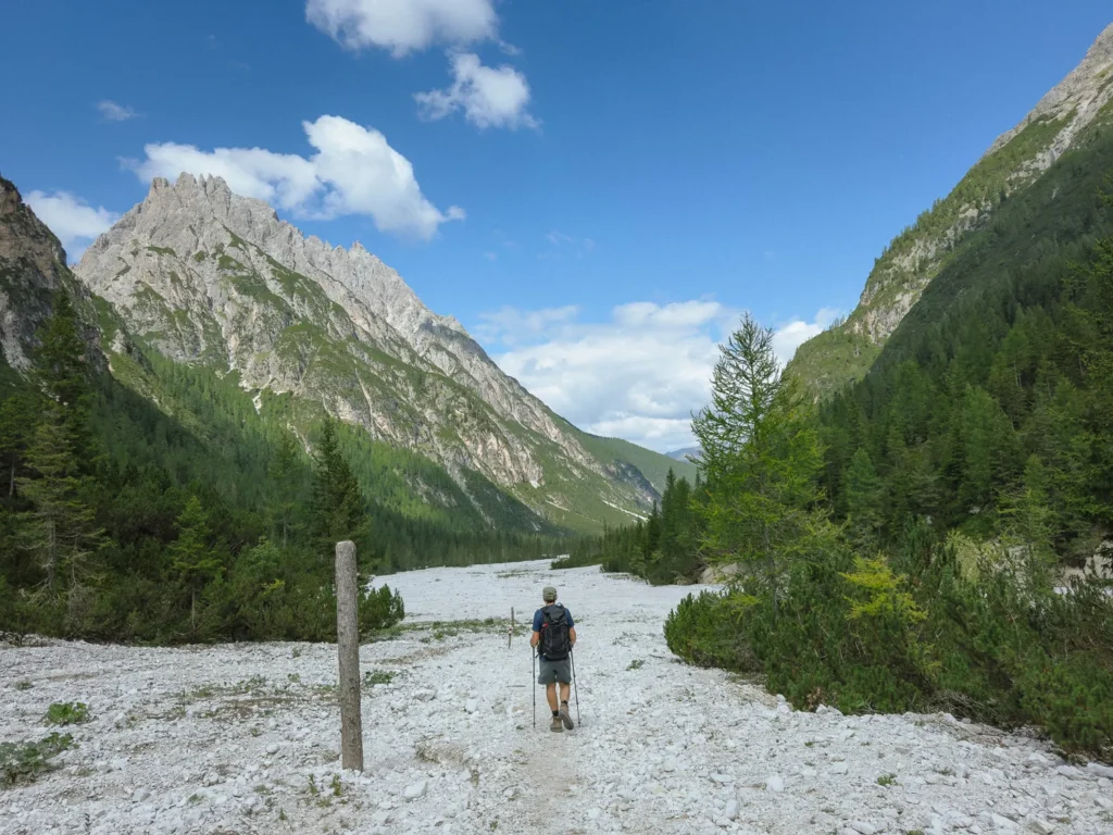
The rifugio (1635m) sits at the end of a lovely valley. The grassy valley floor gives way to a mass of white scree and dwarf pines, ending at the towering rock face of Monte Mattina.
At the rifugio, bear right through a wooden gate and continue along path 105. The path skirts the right-hand side of the large scree field as it gradually climbs.
About 30 minutes from the rifugio, you arrive at a junction of paths near a small war memorial. Turn right and follow path 9, signed to Passo Grande di Rondoi. (Sometimes labelled 10 and 11 on maps).

The path now starts to climb more steeply through the trees with Croda dei Rondoi in front of you. You cross a rocky, dry stream bed and suddenly enter a grassy meadow. There is a large rock and a bench in the meadow, which makes a good place to rest before the stiff climb to come.
At the bench, turn left following path 10 (also labelled 11 on maps) signed to Passo Grande dei Rondoi. The sign indicates it will take an hour, but what a long hour it is.
The path is relentless as it climbs through the meadow before entering a scree field. The path through the scree is decent but becomes increasingly steep as you approach the pass. Walking poles can be very helpful.
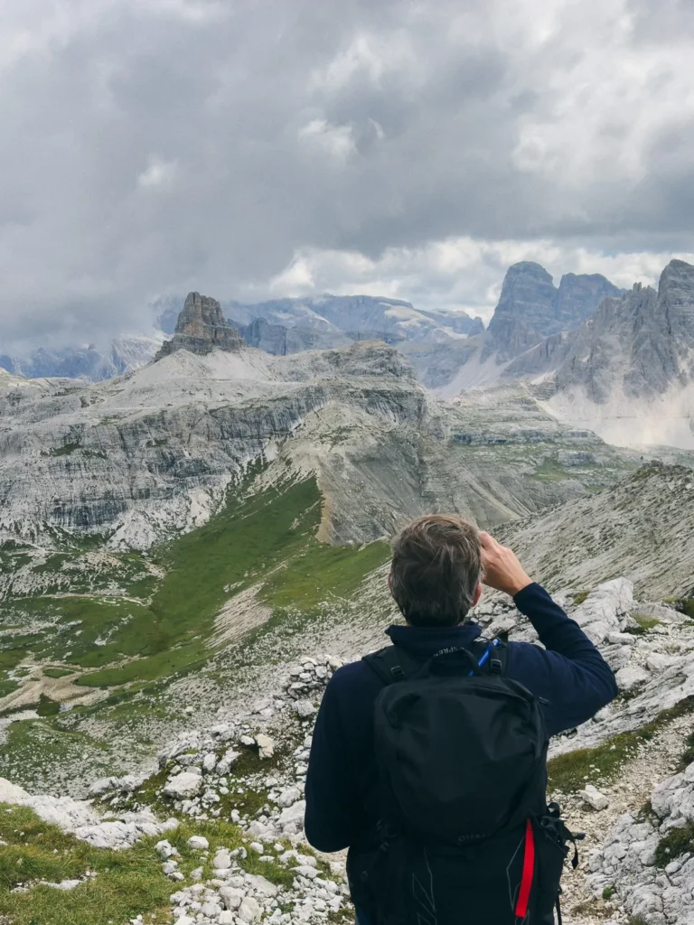
After a few final zigzags, you’ll arrive (puffing and panting) at Passo Grande dei Rondoi (2289m).
Turn around and admire the views across to Cima del Pian Basso, while you get your breath back.
Passo di Rondoi to Passo Alpe Mattina (45 Minutes)
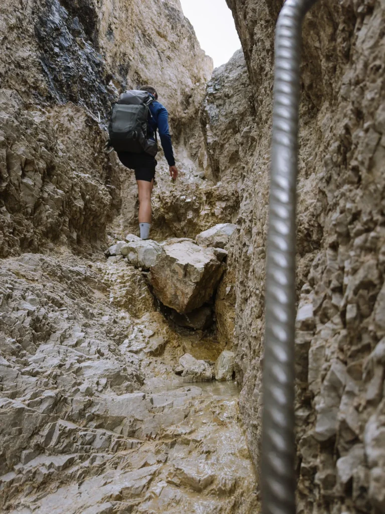
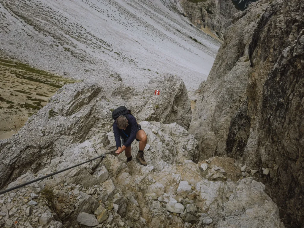
At the pass, turn left to follow path 11 as it advances along a short, narrow track to a wall of rock. Here, a cable helps you navigate four or five exposed steps, after which you enter a chimney.
The chimney is steep, and a series of metal hand and footholds help with the ascent. You will need to use your hands to pull yourself up, but with rock enclosing you on either side, it does not feel exposed or dangerous.
After about 5 minutes, you pop out the top of the chimney and follow a rocky path over the crest of the ridge.
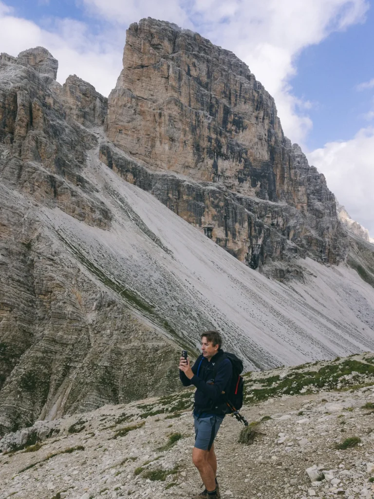
From here onwards, the views are outstanding. The spiky Cadini di Misurina and Tre Cime dominate the skyline. To the southeast, Tofane, Cristallo and Monte Piana complete this incredible view. We’ve been to many places in the Dolomites, and this is definitely one of the best views we’ve seen so far.
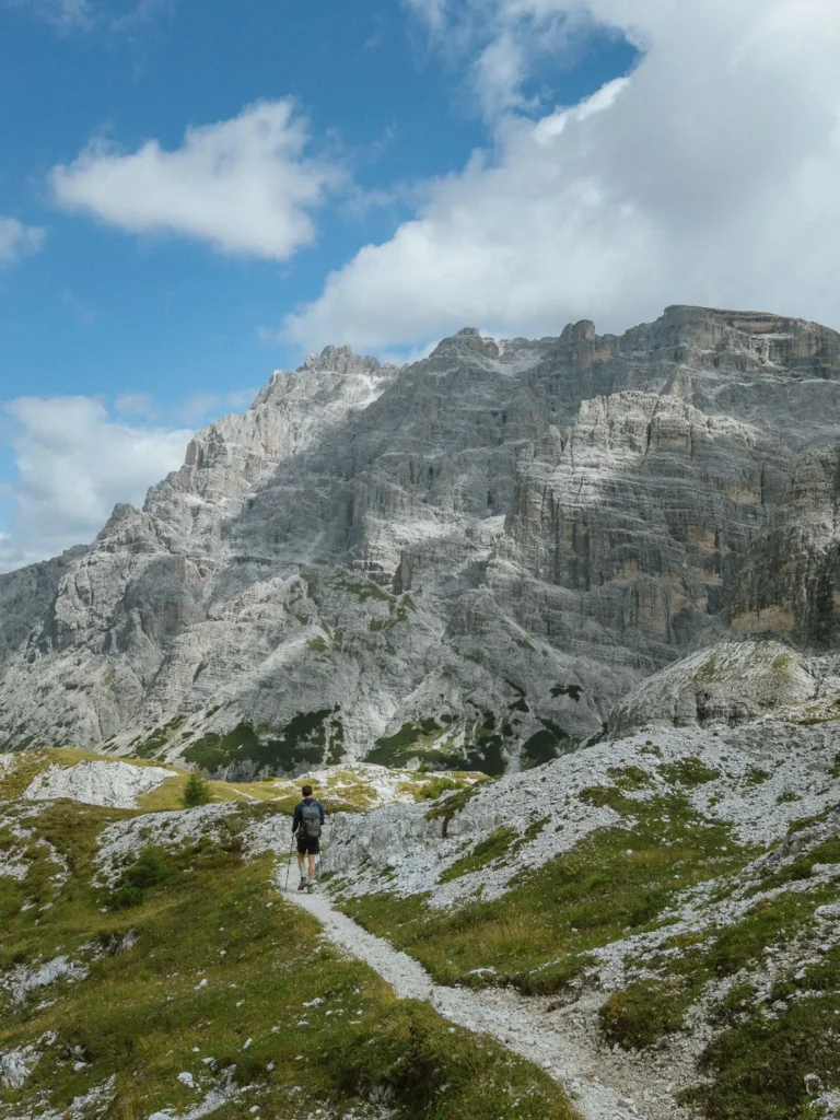
Follow the path as it traverses a gravel slope and enters Schwabenalm. This high Alpine meadow is an excellent spot for lunch with plenty of good rocks to perch on and great views in all directions.
The path climbs again to reach a grand panorama at 2,519m before descending a gravel track to Passo Alpe Mattina. As you descend, you can see Rifugio Locatelli (Dreizinnenhütte) nestled in the rocks ahead of you.
Passo Alpe Mattina to Antoniusstein (2 Hours 15 Minutes)
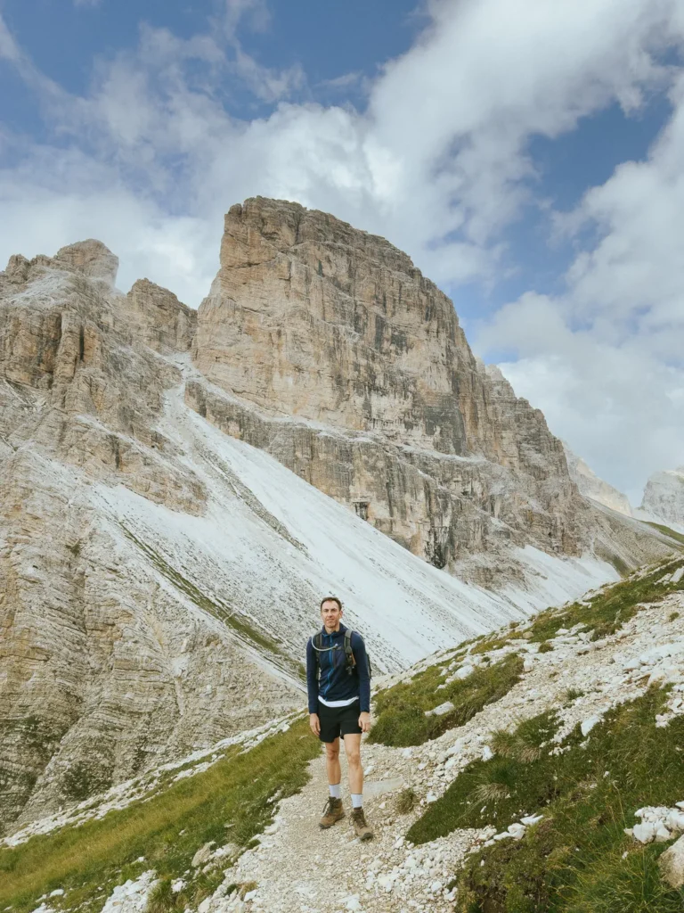
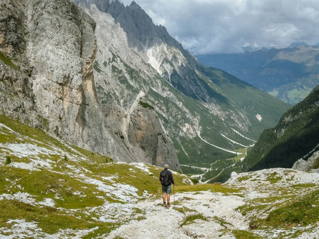
From Passo Alpe Mattina, the path bends left and enters a grassy meadow nestled under Torre dei Scarperi. The meadow conceals a series of WW1 remnants, and if you look closely, you can often see marmots running in and out of the bunkers.
At a fork in the path, keep left and follow path 11A signed to Rifugio Tre Scarperi. The trail quickly joins up with path 105 (keep left) and makes excellent use of a series of ledges to drop back down into the valley. It is a much more interesting route than the one you ascended, with views constantly changing around you.
After about 1 hour of steep downhill, the path flattens and cuts across the white rubble on the valley floor to the junction of paths at the war memorial. Now simply retrace your steps to Rifugio Tre Scarperi and the Antoniusstein parking lot.
Rifugio Tre Scarperi
Rifugio Tre Scarperi (Dreischusterhütte) is beautifully situated on the edge of Campo di Dentro Valley. Nestled beneath the rocky slopes of Cima Tre Scarperi, it has wonderful views up to Monte Mattina and across the white screes and dwarf pines that line the valley floor.
The rifugio offers a lunch menu from 11:30 AM to 3:00 PM and can get very busy with day-trippers. Unfortunately, it is near the beginning/end of the hike, so we recommend you bring a packed lunch to have at Schwabenalm, while enjoying the views of Tre Cime.
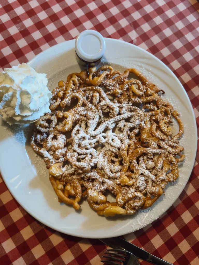
The rifugio is too lovely to miss. We had a hot chocolate on the way out in the morning, then a beer and dessert (which they serve after 3:00 PM) on the way back. It was the perfect end to an excellent walk.
Best Time to Hike the Torre dei Scarperi Circuit
The best time to hike the Torre dei Scarperi Circuit is from mid-July to late September. The snow should have melted from the high ground, and the weather is at its warmest.
We hiked in mid-August and, despite it being peak season, we only saw about 10-15 people on the entire walk. We did, however, have to wait for around 10 minutes to get a seat at the rifugio at the end of the hike.
If you are driving, try to arrive before 8:45 am. It saves the cost of parking and the shuttle bus.
What to Take on the Hike
Hiking Boots: The full circuit is reasonably long and the ascent and descent from the pass requires some scrambling. For this one, we suggest wearing proper hiking boots (we use something similar to these).
Hiking Poles: We’re recent converts to hiking poles, and for this walk, they make the ascent or descent via the steep scree section much easier. We use the trusty Leki Sticks.
Waterproofs: Weather conditions on the walk can change dramatically, and rain is common in the afternoon. Make sure you take a waterproof like this one.
Sunblock/Hat: Since much of the walk is not in the shade, bring sunblock and a hat on hot days.
Lunch/Snacks: This is a long hike, and Rifugio Tre Scarperi is at the beginning of the walk, so bring your own lunch and snacks with you.
Water: Make sure you have plenty of water. We used one of these hydration packs, which makes it much easier to stay hydrated on the trail.
Maps: The main route is well-marked, but it’s also a good idea to have an online map with you.
Drones: Drones are permitted on the Tre Scarperi hike (although, we didn’t actually get ours out of our bag on this particular walk!)
Other Hikes in the Sesto Dolomites
The Sesto Dolomites are home to the Tre Cime (Drei Zinnen) Nature Park. In our opinion, the park contains the best hiking in the Dolomites.
Jagged peaks, beautiful lakes and excellent rifugios are all connected by a series of wonderful paths.
You could easily spend a week here (which we did) and have a completely different hike every day (which we also did). Here are the ones we recommend.
- Tre Cime di Lavaredo Loop — Very popular but rightly so. An excellent 4-hour loop around the three peaks.
- Val Fiscalino Circuit – An incredibly varied 6-hour loop capturing many of the best views in the Dolomites.
- Cadini di Misurina Viewpoint – A short but popular 1-hour there-and-back hike to (probably) the best view in the Dolomites.
- Torre dei Scarperi Lollipop Hike — A demanding 6-hour hike around Torre dei Scarperi, with truly outstanding views.
- Rifugio Fonda Savio – A 2-hour hike into the heart of the spiky peaks of the Cadini di Misurina.
- Monte Popena – A short but challenging hike over the passes on Monte Popena and into the remote Popena Valley.
- Monte Piana – An easy stroll across high Alpine meadows to explore evocative WW1 trenches and memorials.
- Lago di Sorapis – Just over the border of the Sesto Dolomites, this excellent 4-hour circuit takes you to the deep green/blue lake of Sorapis.
- For more great walks ,read our best hikes in the Dolomites.

reader-supported
When you buy through links on our site, we may earn a small affiliate commission at no extra cost to you.
Thanks for your support // Paul & Mark