This excellent hike heads up to the three spires of the Vajolet Towers in the heart of the Catinaccio massif. It’s a dramatic and rugged day in the Dolomites.
By: Mark Barnes | Last Updated:
The Vajolet Towers are three spires of rock that stretch precipitously into the sky. They are perched above a basin of scree and rock and form one end of an amphitheatre of peaks and towers.
This rocky basin is in the heart of the Catinaccio, one of the most dramatic massifs in the Dolomites. In German, it is known as Rosengarten (Red Garden), and when the sun sets, a red glow can light up the peaks.
This excellent there-and-back hike meanders through green meadows, scrambles up a rocky gully and contours across a basin of scree.
The views, especially in the second half, are spectacular. The Vajolet towers are the most dramatic, but you’ll find walls of rock, giant crags and slender fingers throughout this hike.
Two of our favourite rifugios in the Dolomites are on the route. They are both great places to stop for a hearty lunch.
The walk is graded medium-difficult. You’ll need to negotiate a cable-aided gully and have a decent level of fitness.
In this blog post, we have covered everything you need to know about the Vajolet Towers hike, including how to get to the trailhead, a map, and detailed instructions for the hike.
Vajolet Towers Hike Overview
- Start / Finish: Ciamepdiè Cable Car Station
- Distance: 12.5 km / 7.8 miles
- Duration: 4 hours 45 minutes
- Elevation gain: 1,275 metres
- Difficulty: Medium to Difficult
We don’t usually love there-and-back hikes, but the sheer drama of the destination makes this hike special.
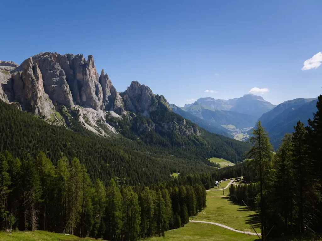
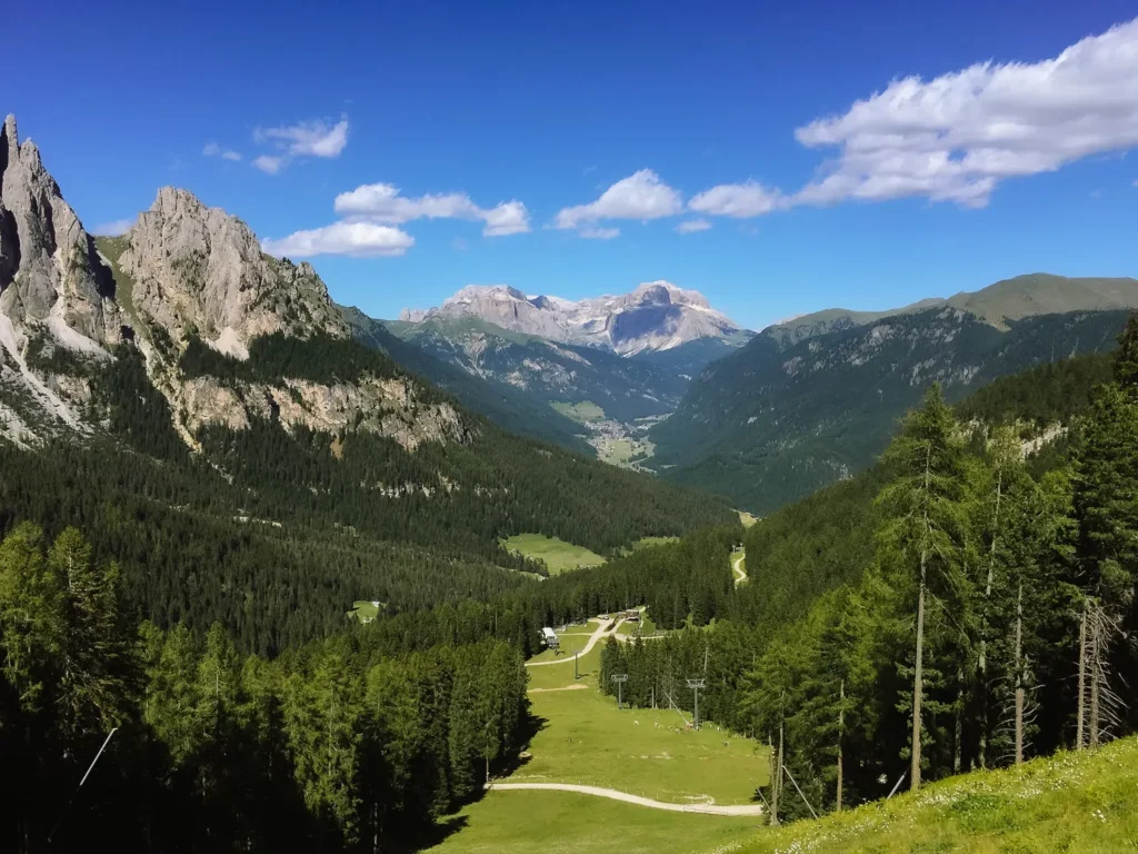
The hike begins at Ciamepdiè at the top of the Catinaccio cable car. It heads up the Vajolet Valley, cutting through grassy meadows and beneath a canopy of trees.
The trail then climbs a small outcrop to lovely views from Rifugio Vajolet, before the hard work begins.
A steep scramble up a rocky gully brings you to the majesty of Rifugio Re Alberto, set in a rocky basin beneath the Vajolet Towers and the peaks of the Catinaccio.
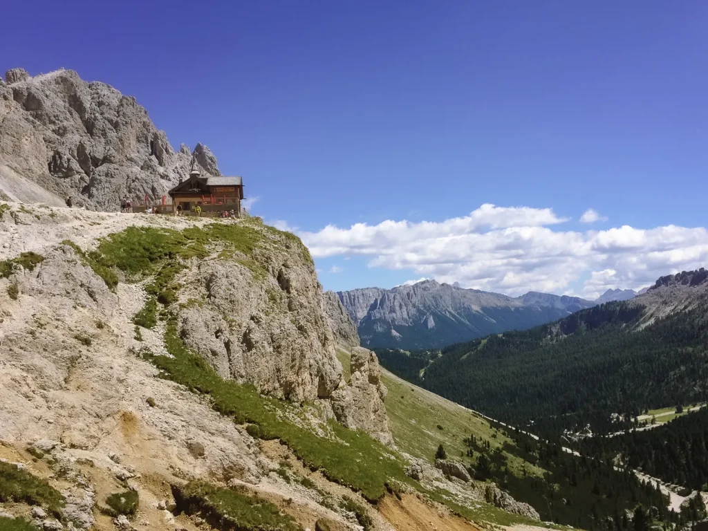
A final ascent around the edge of the basin brings you to Rifugio Passo Santner. This recently renovated hut made from steel, wood and glass contrasts magnificently with the wild surroundings.
We have rated the hike as medium difficulty for two reasons.
Firstly, the hike involves 1,275m of ascent and descent. It can be tough on the lungs going up and tough on the knees going down.
Secondly, the scramble up the rocky gully is steep and requires caution. There are cabled sections to support the most challenging part of the ascent, and there is plenty of loose rock to navigate.
We suggest hiking boots or at least shoes with good grip for this one.
It took us 4 hours 30 minutes of hiking, but in total, we spent about 6 hours taking in the views and stopping for lunch, coffee and an end-of-hike beer.
Vajolet Towers Hike Map
Below is a map of the Vajolet Towers hike with several rifugios that can be found along the route (marked in red).
The walk begins at Ciamepdiè at the top of the Catinaccio Cable Car (marked in brown).
The car parks and bus stops at the bottom of the cable car are marked in blue.
If you prefer a physical map, we recommend: Kompass 650 – Val di Fassa.
For digital maps, download the Trentino – South Tyrol region on Maps.me. It has all the trails, and you can track yourself online. Alternatively, just use our map below.
Click on the top right corner to open our map in your Google Maps app. Click the star next to the title to save it to your Google account.
Getting to the Trailhead
This Vajolet Towers hike starts at Ciamepdiè, at the top of the Catinaccio Cable Car. The cable car runs daily from 8 AM to 6 PM, from late June to mid-September. It costs €26 for a return trip (€15 for one-way).
The bottom of the Catinaccio Cable Car is located in the town of Vigo di Fassa.
By Car
Vigo di Fassa is a 20-minute drive from Canazei; 1 hour from Bolzano, Arabba or Val Gardena; and almost 2 hours from Cortina.
There is a small car park right next to the bottom cable car station in Vigo di Fassa, but it only takes a few cars and fills up quickly. Two much larger car parks are just a short walk away and are marked on the map above.
By Bus
The B101 bus runs up the Fassa Valley between Cavalese, Moena, and Canazei. It stops at the bus stop in Vigo di Fassa, from where it is a 10-minute walk to the bottom cable car station.
The bus runs every 30 minutes to an hour, depending on the time of day.
Hiking Instructions
Ciamepdiè to Rifugio Vajolet (1 Hour 30 Minutes)
Take the Catinaccio cable car from Vigo di Fassa to Ciamepdiè. Ciamepdiè means ‘field of God’, and you can see why as the green meadows of the Vajolet Valley stretch before you.
Head up to Rifugio Ciamepdiè (1,998m) and pick up signs for Path 540.
At Rifugio Negritella, ignore the signs for Path 545 and continue on Path 540 as it heads northwest through the grass before bearing left and heading into the trees.
The easy-to-follow and gentle trail heads through the forest with the peaks of the Catinaccio flickering above.
The trail descends gradually and then climbs, before reaching Rifugio Gardeccia (1,960m) and Rifugio Stella Alpina, which are situated at the base of several rock falls.
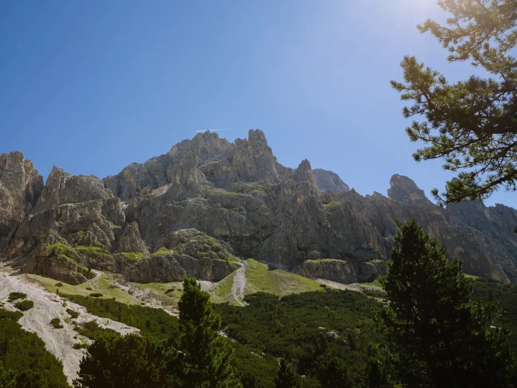
From the rifugios take Path 546 northwards. This wide jeep track heads back into the trees and up the narrowing valley. It exits the forest into a mass of loose rock and scree. The path steepens and completes a zigzag to negotiate an imposing rocky outcrop.
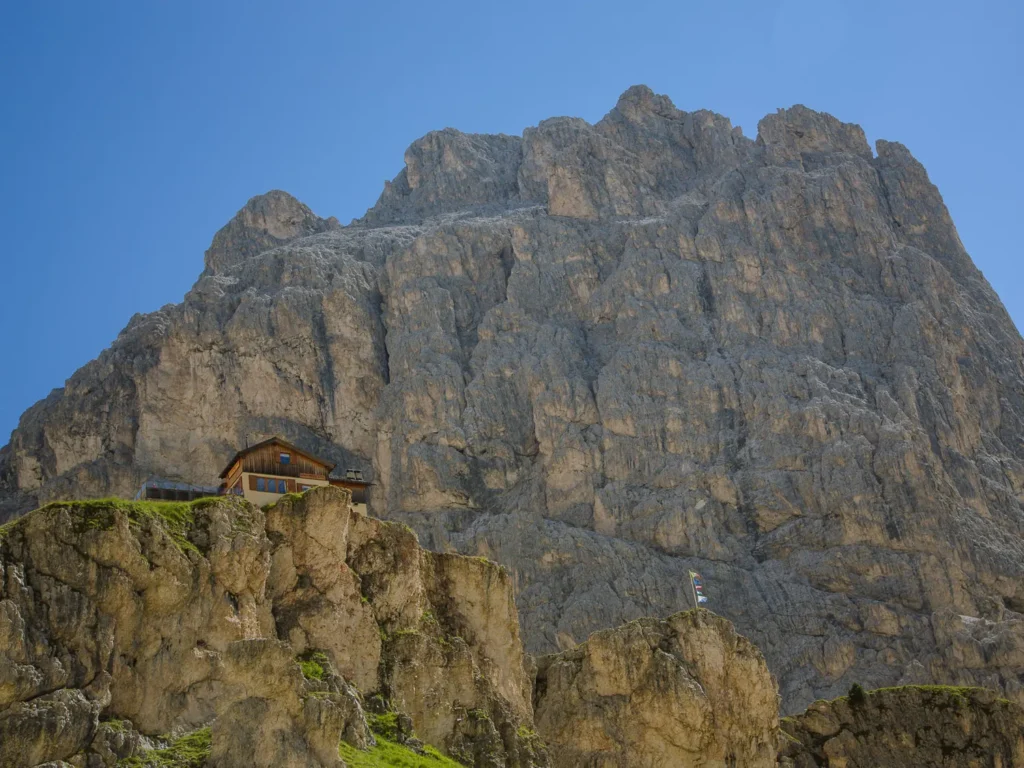
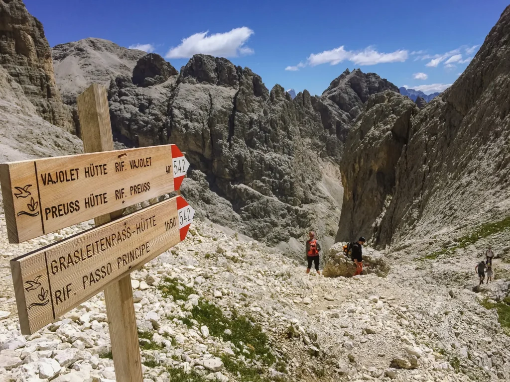
Perched on this outcrop are two rifugios: Rifugio Paul Preuss (2,243m) and Rifugio Vajolet.
We had coffee and cake at Rifugio Paul Preuss, which had great views down the valley and up to the wonderfully shaped mountains.
Rifugio Vajolet to Rifugio Passo Santner (1 Hour 15 Minutes)
Our coffee would have been more enjoyable if we weren’t staring up at the steep climb to come. The path seemed to vanish up a steep, rocky gully, with the top barely visible.
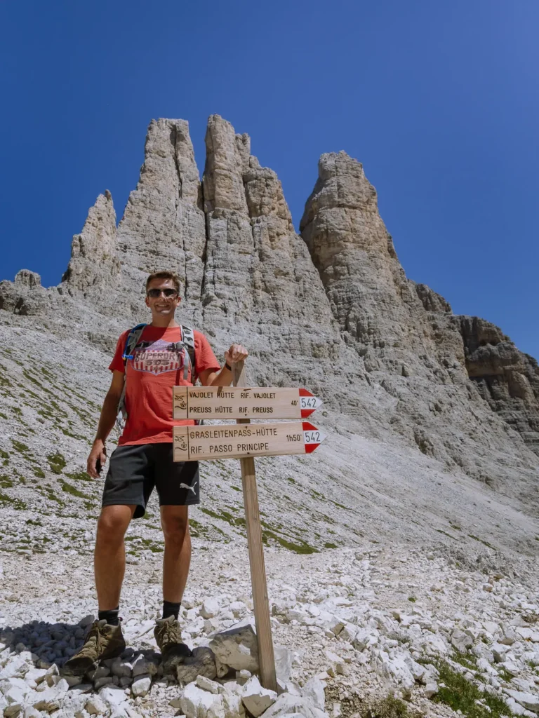
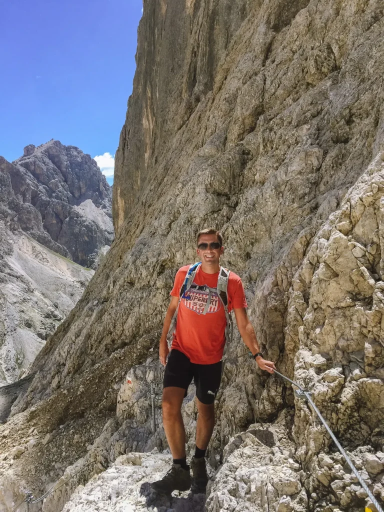
Take Path 542 westwards up this steep rocky gully.
The path is well-marked and easy to follow as it zigzags up the rock. Several sections of well-anchored and strong cables aid the ascent. But it is steep with plenty of loose rock, so care is required.
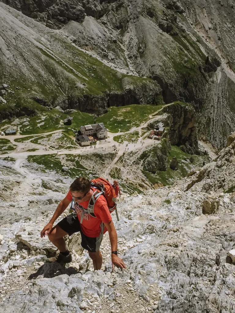
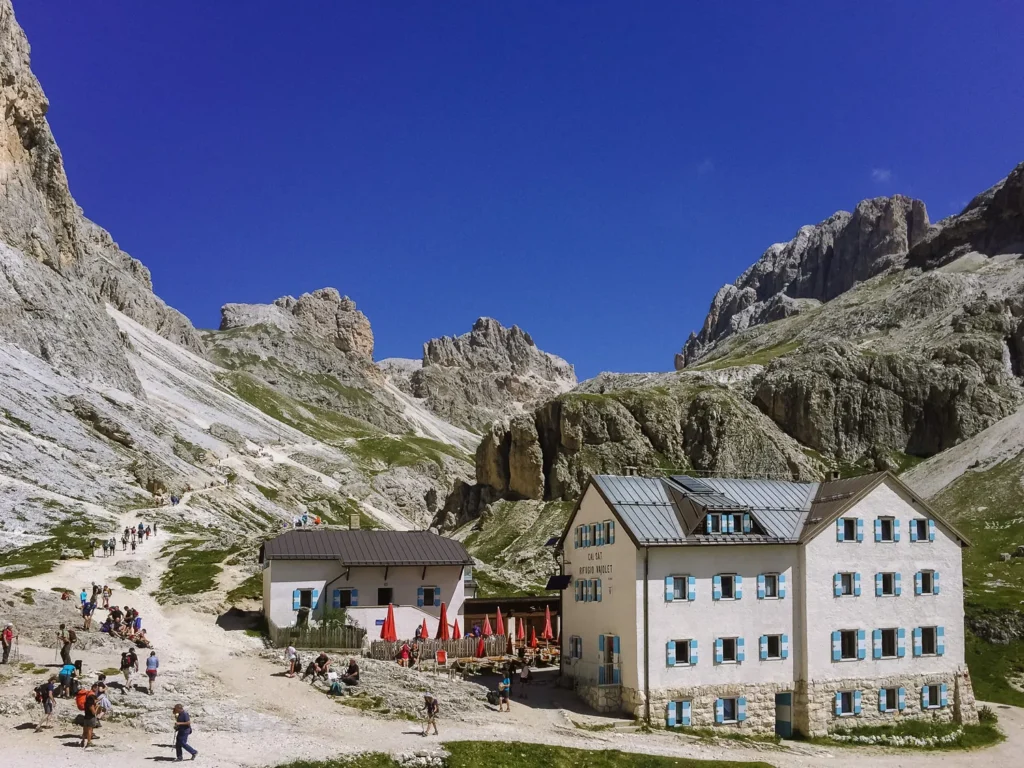
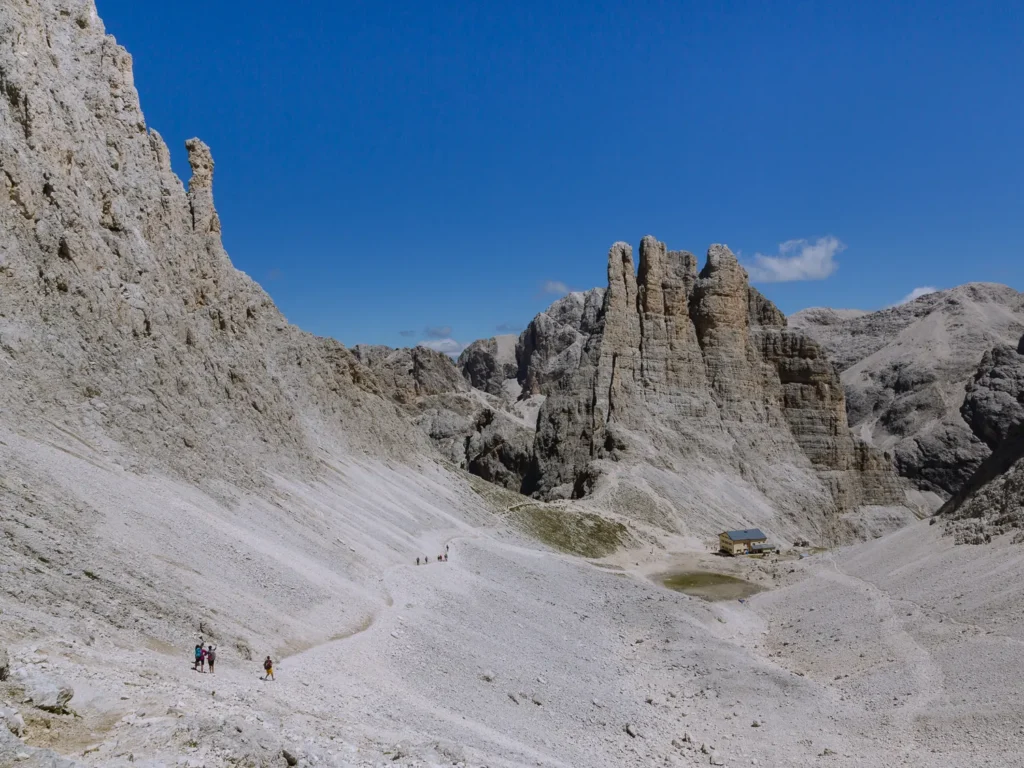
The path does not feel exposed and is not particularly narrow. Nevertheless, it takes just under an hour to climb the 450m to Rifugio Re Alberto (2,700m).
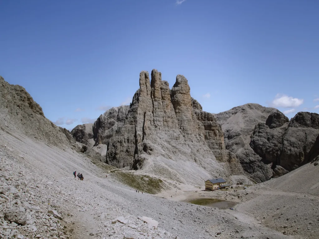
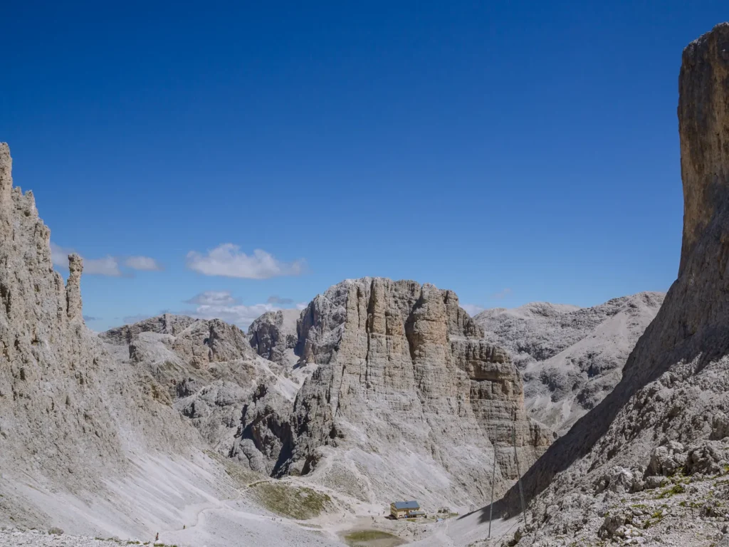
There are few more dramatically set rifugios than Rifugio Re Alberto. It is nestled in a sea of rock, next to a picturesque lake and beneath the three Vajolet Towers.
It is a wild and rugged place, and a sensational place to grab lunch. Keep your eyes peeled for climbers working their way up the spires.
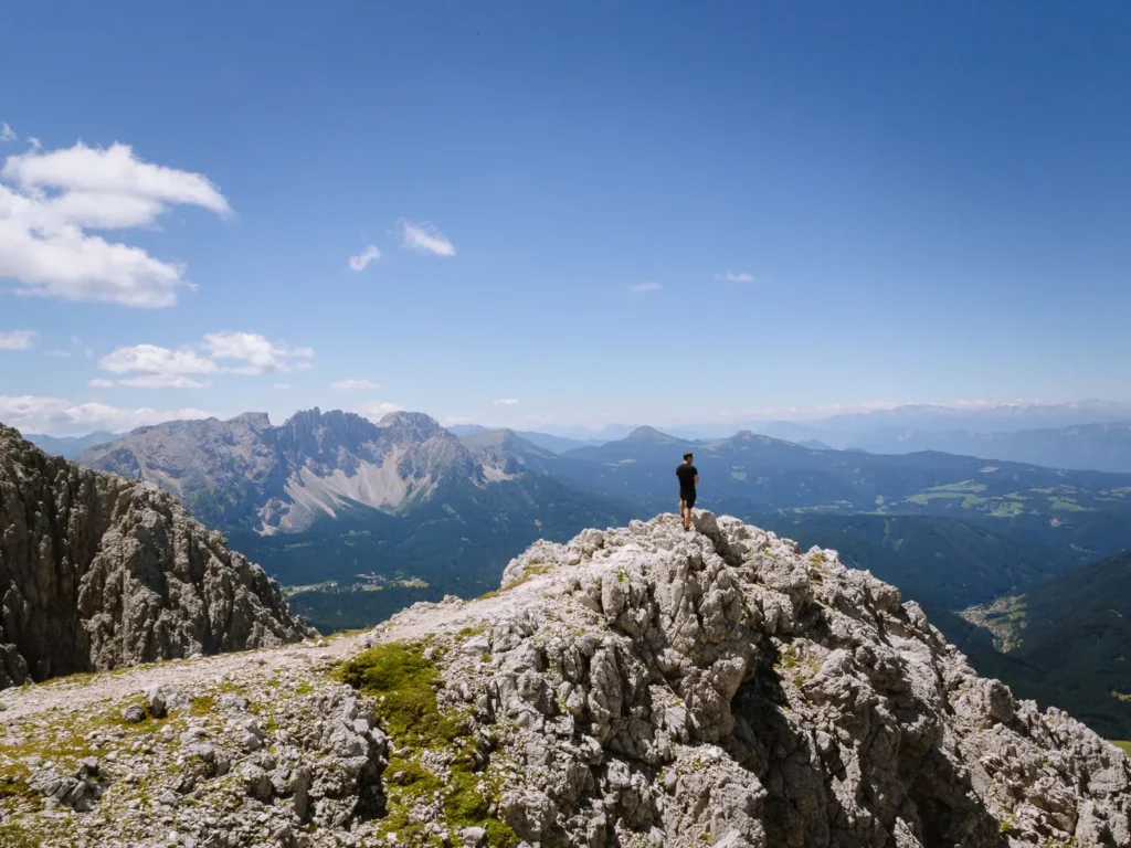
From the rifugio, continue on Path 542 as it curves uphill around the edge of the rocky basin, which has great views back to the three towers.
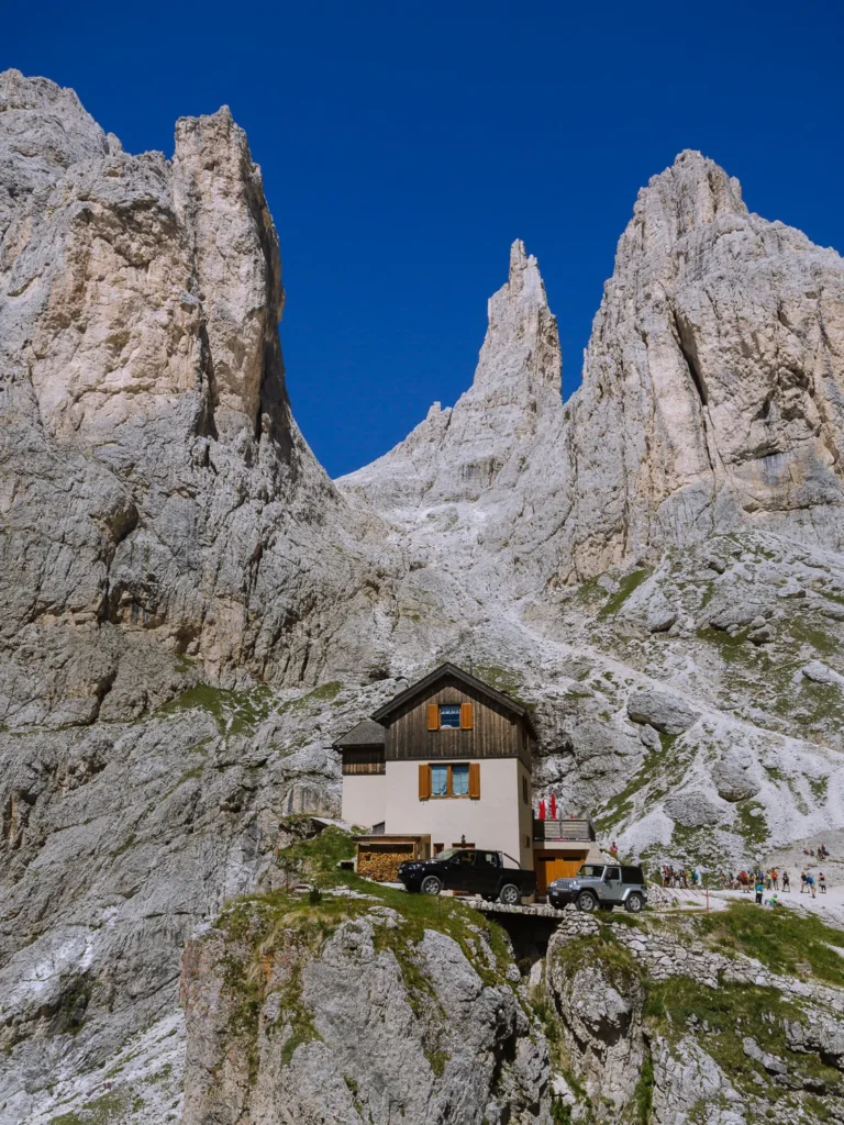
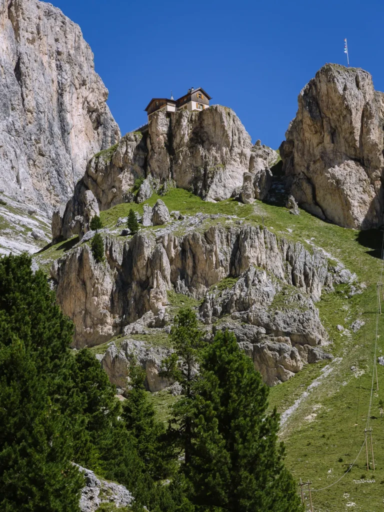
The hiking trail ends at Rifugio Passo Santner (2,741m), wedged in a cleft in the rock between Cima Catinaccio to the south and King Laurin Crag to the north.
This is another wonderfully set rifugio, and it has recently been restored into a very modern steel structure.
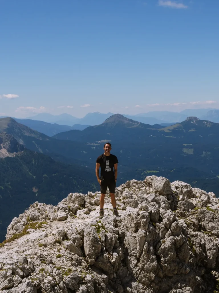
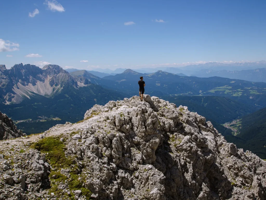
Perched on the western face of the Catinaccio, there are fantastic views across to the spiky peaks of Latemar and Sciliar and down to Bolzano. Take your time and soak it all in.
All that’s left is to head back the way you came.
Rifugios on the Route
One of the great things about the Dolomites, and particularly this hike, is having lunch and breaks at the rifugios.
There are many rifugios on route, but we have picked our favourite three.
Rifugio Re Alberto
Set in a basin of rock and under the imposing Vajolet Towers, this is one of the best situated huts in the Dolomites.
Lunch is served from 11:30 AM to 2:30 PM, focusing on traditional Ladin and Tyrolean dishes. The rifugio opens from mid-June to early-October and sleeps 60 people.
Rifugio Passo Santner
The rifugio at Passo Santner was formerly a small wooden hut with an outside toilet in a tiny shed. In 2022, reconstruction commenced, and by 2023, a new modern structure made of wood, glass and steel opened. Looking like Frank Gehry’s Bilbao Museum, it is a striking contrast to the surrounding rocks.
It’s open from mid-June to mid-October and they serve traditional South Tyrolean dishes. For overnight guests, they serve a 4-course tasting menu. We can’t wait to go back to check it out.
Rifugio Ciamepdie
This welcoming rifugio at the end of the hike is set amongst meadows. If the sun is shining, grab a drink, pick your spot on the grass and rest your weary limbs while staring at the Vajolet Valley.
Best Time to Hike to Vajolet Towers
The best time to hike to Vajolet Towers is from early July to mid-September. The rifugios and cable car are open, the snow should have melted from the high ground, and the weather is at its warmest.
We hiked in mid-July, in near-perfect conditions. The trail was busy up to Rifugio Vajolet, but far fewer people made the climb up to Rifugio Re Alberto. Take one of the first cable cars in the morning to avoid the crowds during peak season.
What to Take on the Hike
Hiking Boots: The full circuit is reasonably long so we suggest wearing proper hiking boots (we use something similar to these).
Hiking Poles: We’re recent converts to hiking poles as they make everything much easier. We use the trusty Leki Sticks.
Waterproofs: Weather conditions on the walk can change dramatically, and rain is common in the afternoon. Make sure you take a waterproof like this one.
Sunblock/Hat: If it’s not raining, you’ll need sunblock and a hat for when you’re out of the shade.
Water: Make sure you have plenty of water. We use one of these hydration packs, which makes it much easier to stay hydrated on the trail.
Maps: Make sure you have a map with you. The physical map for this hike is 650: Val di Fassa, or you can use our Google Map which is at the top of this post.
Drones: Drones are permitted at Vajolet Towers, and it’s a great place for aerial photography.
More Dolomites Guides
- Here are all our favourite places to visit in the Dolomites.
- Put your trip together with our Dolomites road trip itinerary.
- Hike to the beautiful Lago di Sorapis.
- Try one of our favourite hikes in the Dolomites.
- The Sassolungo Circuit is one of our favourite walks in the world.
- Take on one of the most popular hikes in the Dolomites – Tre Cime di Lavaredo.
- Visit the beautiful Lago di Braies.

reader-supported
When you buy through links on our site, we may earn a small affiliate commission at no extra cost to you.
Thanks for your support // Paul & Mark
Wow — this guide makes the Vajolet Towers hike sound absolutely epic! The mix of rugged gully scrambles, alpine meadows & dramatic spires is so well captured.
It’s a really great hike. Hope you get to experience it someday.