This walk explores the best of the South Downs Way. Our 2-Day Lewes to Eastbourne route takes in Firle Beacon, Alfriston and the Seven Sisters cliffs. It’s easy to get to from London and is a great weekend break.
By: Mark Barnes | Last Updated:
The South Downs Way is one of England’s great long-distance trails — 100 miles of chalk ridges, river valleys and clifftop paths stretching from Winchester to Eastbourne.
But with 7 to 10 days needed to walk the whole thing, it’s out of reach for any short break.
The good news is that the very best of it, including a dramatic ridge walk, the medieval village of Alfriston, and the jaw-dropping Seven Sisters cliffs, is all packed into the eastern half.
This 2-day walk from Lewes to Eastbourne covers all the best bits, and both start and finish are less than 90 minutes from London by train.
We’ve walked this route multiple times, and it’s one of our favourite weekends away in England.
Here’s all the information you need to plan your own escape.

The Official South Downs Way Route
The official South Downs Way is 100 miles long and runs between Winchester and Eastbourne. We’ve hiked extensively in the UK, and we can assure you this is a great walk, but there are some downsides.
Firstly, it takes between 7 and 10 days to complete, so it uses a chunk of your holiday time and requires a decent level of fitness.
Secondly, there are sections with very limited places to stay. So if you were to take the full official route, you’d have some 17-mile days or have to stay in some less-than-charming accommodation.
Thirdly, the western half can be a little uninspiring, and it takes 2 or 3 days before the views really open up.
Fortunately, many of the highlights of the South Downs Way can be seen in just 2-days.
Our 2-Day South Downs Way Walk
This 2-day walk covers the best section of the South Downs Way. It starts at the market town of Lewes, spends a night in the picturesque medieval village of Alfriston and ends in Eastbourne.
Along the way, you’ll hike across chalk ridges, follow a meandering river, pass through little villages and end at the stunning Seven Sisters cliffs.
There’s an excellent pub for lunch on the first day and possibly the best picnic views in the UK for the second.
Both the beginning and the end of the walk are easily accessible by train from London in under 90 minutes.
In our opinion, it is a great way to see the best of the South Downs, without all the effort of hiking the entire South Downs Way.
2-Day South Downs Way Walk Details
- Day 1: Lewes to Alfrison (11.7 miles)
- Day 2: Alfriston to Eastbourne (12.5 miles)
This walk is 24.5 miles long, beginning at Lewes (60 minutes by train from London) and ending at Eastbourne (90 minutes by train from London).
It lasts 2 days and covers about 12 miles per day. Each day should take between 5 hours 30 minutes and 6 hours 30 minutes of leisurely walking time. By the time you have added an hour for lunch, rest stops, and taking photos, both are full days.
There is about 1,500 to 2,200 feet of ascent and descent each day, but the steady pace means you will get tired, but should not be too exhausted.
Lunch on the first day can be at a great country pub or a picnic. The night in the middle is spent in the medieval village of Alfriston. Lunch on the second day is a choice between two cafes or a picnic overlooking the Seven Sisters White Cliffs.
We have put the two days together on this OS Map so you can see an overview of the walk.
Highlights of the Walk
This two-day route has many of the best views in the South Downs National Park. Here are some of the highlights:
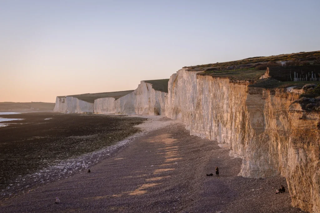
- Seven Sisters – Finest white cliffs in England
- Beachy Head – Iconic red and white ringed lighthouse
- Firle Beacon – 217m high beacon with grand views over the South Downs
- Lewes – A charming market town with a quirky castle
- The Ram Inn – Old school country pub with great beer garden
- Alfriston – A medieval village packed with atmosphere
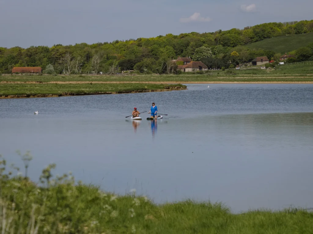
- River Cuckmere – A meandering river winding between chalk hills
Getting There-And-Back
The walk begins in Lewes and ends in Eastbourne. Both towns have train stations that are on the same train line, which runs from London Victoria.
By Train – To get to the start of the walk, take the train to Lewes train station. From London Victoria, direct trains run every half hour and take 1 hour.
If you are travelling midweek, the first off-peak train leaves just before 10 am and arrives just before 11 am. If you plan on doing the walk between April and October, this gives you plenty of time to complete Day 1 before it gets dark.
If you plan on walking in late Autumn or winter, you might want to pay more for an earlier train or stay in Lewes the night before.
At the end of the walk, get the train back from Eastbourne train station. Direct trains to London Victoria run every half hour and take 90 minutes.
By Car – If you plan on driving, you can park (for a fee) near Lewes train station. When you have completed the walk, get the train from Eastbourne to Lewes. Direct trains run every half hour and take 25 minutes.
Where to Stay
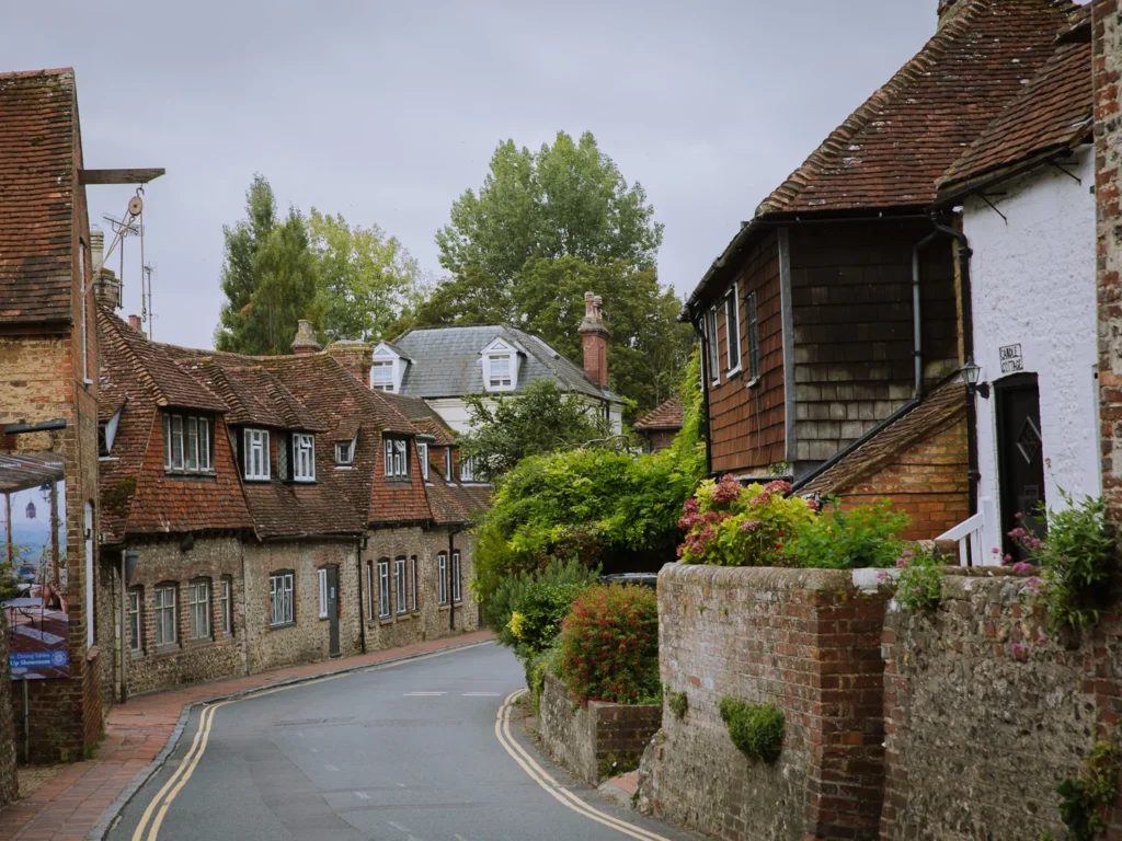
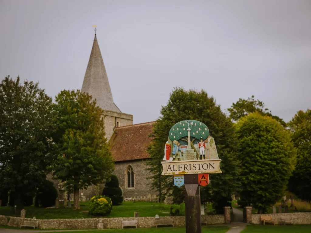
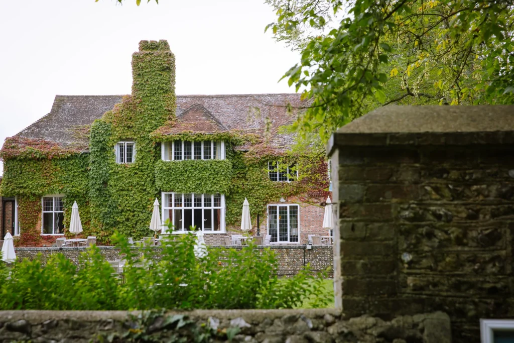
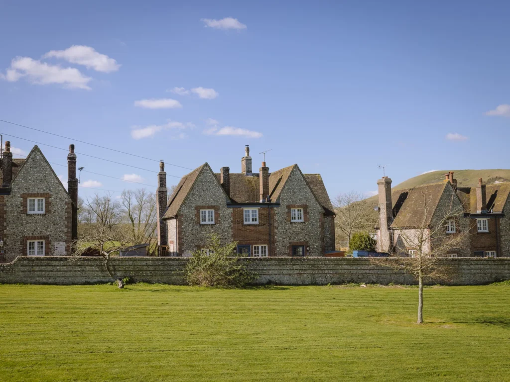
The end of the first day is spent in the village of Alfriston, a pretty chalk-stream village nestled in the Cuckmere Valley. It is often called the “Capital of the South Downs” and sits right on the South Downs Way.
There are several options for where to spend the night. We like the atmospheric, but compact Ye Olde Smugglers Inne.
However, we have also stayed in The Alfriston, which has lovely outdoor spaces. And whenever we have walked past Wingrove House, it looks very inviting.
If you want to splurge, the 15th-century Star Inn underwent a renovation and reopened in June 2021. It is now a 29-bedroom luxury hotel; we have not been inside it, but by all reports, it’s quite special.
Finding somewhere to stay midweek (outside the summer holidays) is not usually a problem. But Saturdays in spring and summer can book up months in advance.
So if you plan to do the walk over the weekend, book well in advance.
Day-By-Day Detailed Itinerary
Below is a day-by-day outline of the hike. We have included the start point, end point, walking distance, and elevation change.
It also has an expected walking time, but be sure to add another 60 to 90 minutes for lunch, rest, and enjoying the views.
If you walk a lot in the UK (like we do), then OS Maps are a great resource. They cost a £36 a year subscription for all the Ordnance Survey Maps of the UK.
The app allows you to save hikes, download the routes offline and follow your progress as you walk. They are incredibly detailed, and with them, it’s almost impossible to get lost.
We use them all the time, and below we have provided a link to an OS Map for each day of the walk.
Day 1–Lewes to Alfriston
- Start: Lewes Train Station
- End: Alfriston
- Distance: 11.7 miles
- Elevation: 1,500 ft ascent and descent
- Time: 5 to 6 hours walking time
- High Route Map: OS Map South Downs Way Day 1
Morning
On day 1, after arriving by train from London, we hiked from Lewes to Alfriston. It’s a lovely walk, first around Mount Caburn and then along the top of the South Downs ridge. It stops at a great pub for lunch and superb views from Firle Beacon.
Exiting the train station, we grabbed a coffee in town and followed the map through Lewes, crossing the river and slowly making our way up and down the undulating hills surrounding Mount Caburn.
It took a bit of puff to start the day, but soon we were descending into Glynde. This pretty village has a grand manor house and a pretty cricket pitch.
Crossing over the railway line and then the main road, we followed the track into Firle.
Lunch
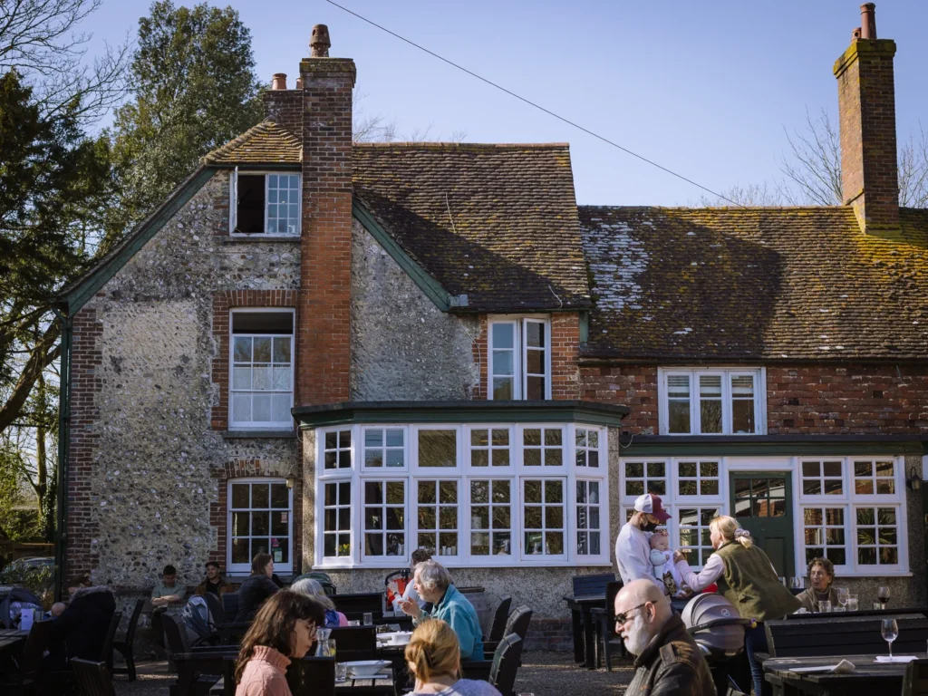
Concealed within this pretty village is The Ram Inn. It’s a great spot for lunch. You can eat in the traditional bar, in the cosy snug, the smart courtroom, or in the beer garden out back. Given it was a lovely day, we ordered, grabbed a pint and ate outside.
Come midweek, you should not have any trouble getting a table, but during the summer holidays or at weekends, it’s a good idea to book.
To help with reservation timings, it takes about 2 hours and 30 minutes to walk from Lewes to Firle.
Afternoon
Immediately after lunch comes the stiff climb. It’s 600 feet of ascent from the pub to the top of the ridge.
On a still day, it’s lovely with views across the South Downs National Park and across the English Channel. But we have also been up here on a windy day, and it can be bitter, so come prepared.
It is on the ridge that you join the South Downs Way for the first time, and you won’t leave it until the walk ends in Eastbourne.
A short distance along the ridge, and we reached 217m high Firle Beacon. The area around the beacon is rich in prehistoric remains, including a Neolithic long barrow and several Bronze Age round barrows. A bowl barrow at the summit itself was opened in 1820, with finds including two cremation urns.
We spent the next hour walking along the top of the ridge before dropping into Alfriston, where we spent the night.
Evening
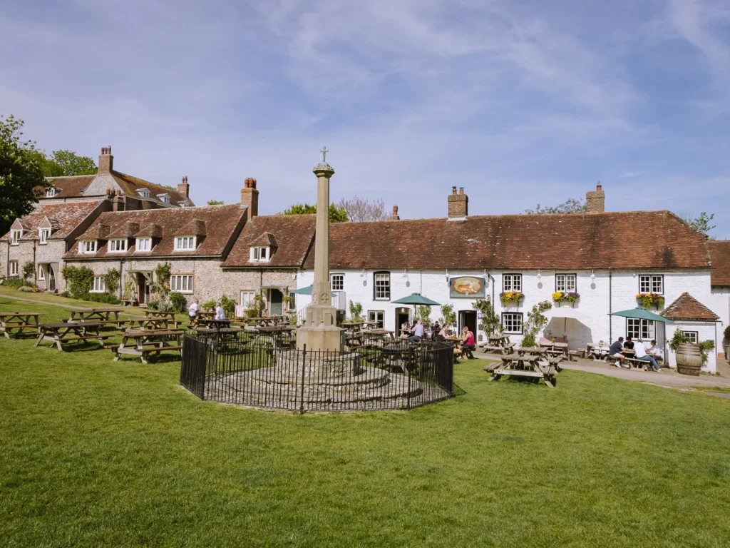
I have a soft spot for Alfriston. The village centre is a beautifully preserved cluster of timber-framed medieval buildings lining a narrow high street.
The 14th-century St Andrew’s Church, known as the “Cathedral of the Downs”, and a National Trust Clergy House sit on the edge of the village green.
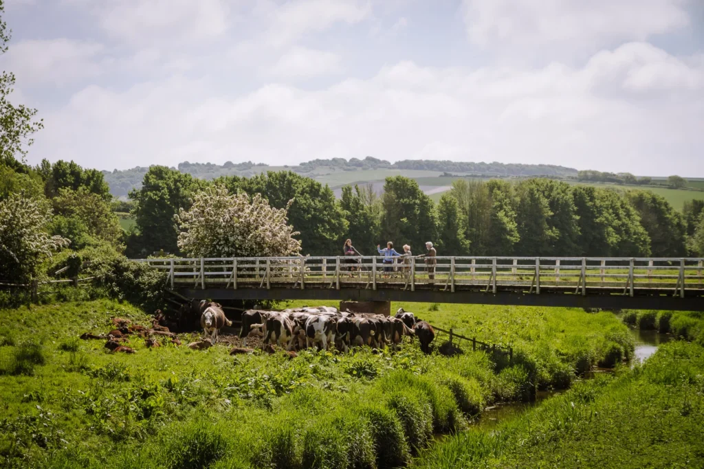
The River Cuckmere winds quietly nearby, and the surrounding water meadows give the whole scene a gentle, almost timeless quality.
We highly recommend you spend some time exploring the village before grabbing dinner and going to bed. There are three great pubs to eat in:
The George Inn – A beautiful 14th-century inn right on the High Street in a historic setting.
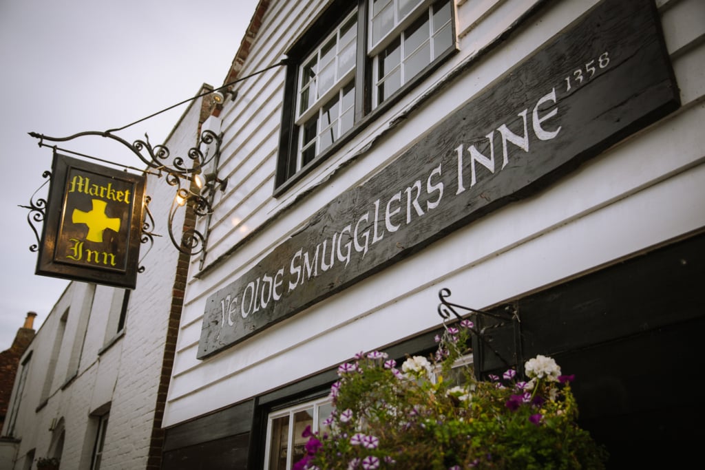
Ye Olde Smugglers Inne – A wonderfully atmospheric old smugglers’ pub.
Six Bells – A proper, unpretentious pub overlooking the village green, beloved for its homemade pies. Closed Mon–Tue.
More often than not, we have found ourselves downing a pint and grabbing a pub classic at the George Inn. Book ahead at weekends.
Day 2 – Alfriston to Eastbourne
- Start: Alfriston
- End: Eastbourne
- Distance: 12.6 miles
- Elevation: 2,200 ft ascent and descent
- Time: 6 to 7 hours walking time
- High Route Map: OS Map South Downs Way Day 2
Morning
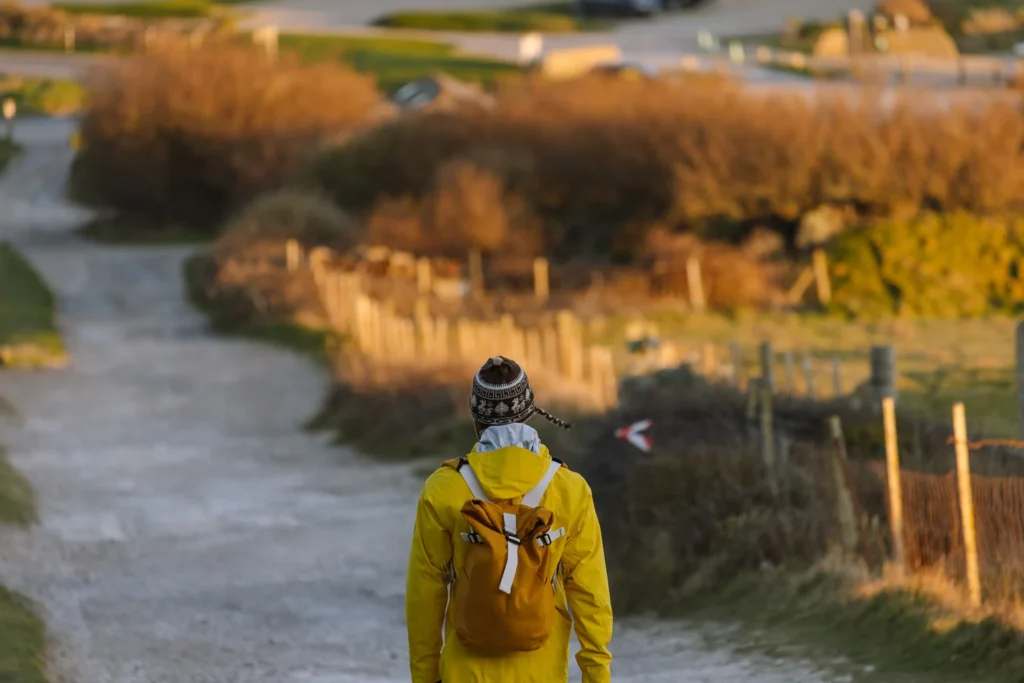
Day 2 is one of my favourite day hikes in England.
I love the amble along the river, exploring the rocky beaches, peering up and down to the lighthouses, and the unmatched views over the white cliffs of the Seven Sisters. One time, it was even warm enough to go for a swim.
After breakfast, we left Alfriston and followed the South Downs Way along the east bank of the River Cuckmere. At Litlington, the path leaves the river, climbs through the western edge of Friston Forest and pops out at Exceat.
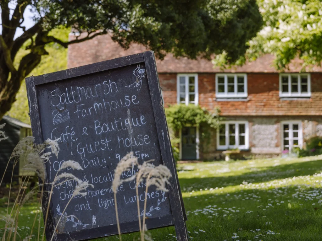
Exceat is home to the Seven Sisters Country Park Visitors Centre, and it’s a good spot to get a snack. The Grab and Go Cafe serves a selection of takeaway snacks, sandwiches, hot and cold drinks and tubs of ice cream. It is open every day from 10 am.
A better option is the Saltmarsh cafe. Tucked behind the visitors centre, it has a casual cafe serving toasties, bagels, daily specials, soups, cake and coffee from the counter (open daily from 9 am). Or smarter dining in the ‘Friston’ restaurant with a set menu.
We picked up a couple of bagels and a cake, packed them in our backpacks, and headed on.
Lunch
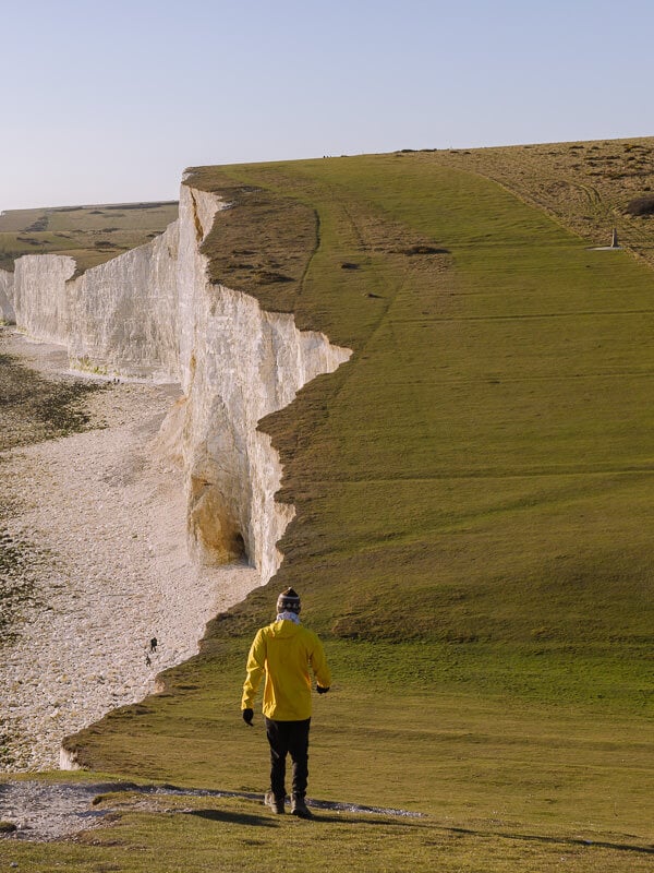
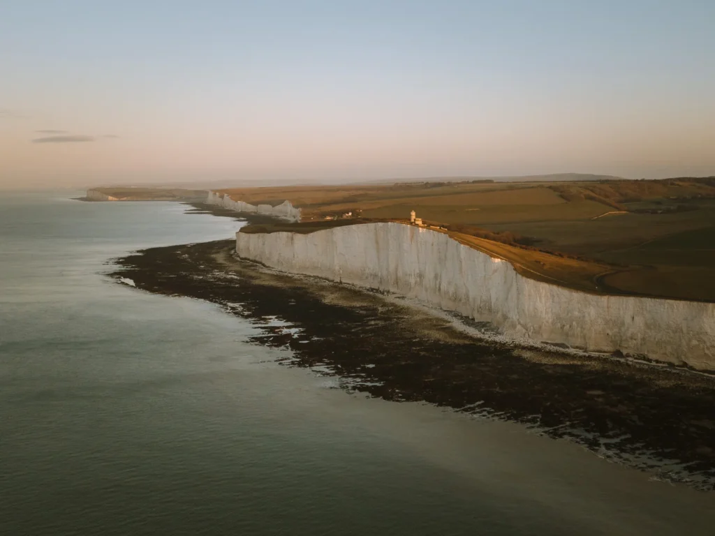
Leaving Exceat, we continued on the South Downs Way. The path climbed to a fine viewpoint over the Cuckmere Haven estuary, dropped back to the river, before finally rising again onto the white cliffs.
For the next 5 miles, the path follows the edge of the cliffs. The views over undulating white cliffs, topped with green fields and battered by the surging blue sea, are breathtaking.
Stop anywhere along here and have lunch, the spot on top of Brass Point is possibly my favourite picnic spot anywhere in the country.

Afternoon
Walking along the cliffs, we came to a number of different sights. First up is Birling Gap, where a National Trust Cafe (of mixed quality) sits above a pretty beach. We recommend heading down to see the cliffs from below.
On a warm day, you can also go for a swim, which we have only managed to do once, all the times we have been here.
After Birling Gap is Belle Tout Lighthouse, a 19th-century lighthouse now a unique boutique Bed & Breakfast. Next up is Beachy Head Lighthouse, the iconic red and white ringed lighthouse that sits on the rocks below the cliffs.
After about 2 hours and 30 minutes of walking along the clifftops, the path descends and enters Eastbourne. The final section follows the seafront parade and, being tired, we found it dragged a little.
But after 45 minutes, you reach Eastbourne train station and enjoy a well-deserved rest before heading back on the train.
Tip: There is an alternative way to end this walk. After seeing Beachy Head Lighthouse, turn inland and head to East Dean. There’s a beautiful pub (the Tiger Inn) on a village green, perfect for an end-of-walk pint. Then take the bus (which runs very regularly) to Eastbourne train station and make your way home.
You can find all the information on our Seven Sisters Walk.
More Day Trips
- Pick from one of our 20 curated day trips from London.
- See the achievable highlights on our 1-day Cambridge itinerary.
- Enjoy a medieval weekend break with our Rye day trip.
- Hit the beach on a relaxing day out in Brighton.
- Explore the rich history on our Canterbury day trip from London.
- Scoff the freshest oysters with our Whitstable day trip.
- Enjoy the regal side of life with our Bath day trip itinerary.
- Pick from one of our 10 Cotswolds day trip ideas.
- Hike the white cliffs on our Seven Sisters day trip.

reader-supported
When you buy through links on our site, we may earn a small affiliate commission at no extra cost to you.
Thanks for your support // Paul & Mark