The Cadini di Misurina viewpoint has an uninterrupted view of the jagged peaks and spires that make the Dolomites so unique. Here’s everything you need to know about getting to the Cadinia di Misurina viewpoint.
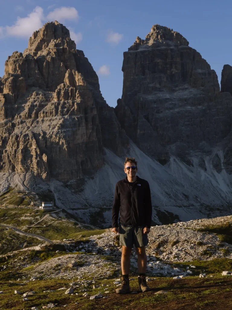
By: Paul Healy | Last Updated:
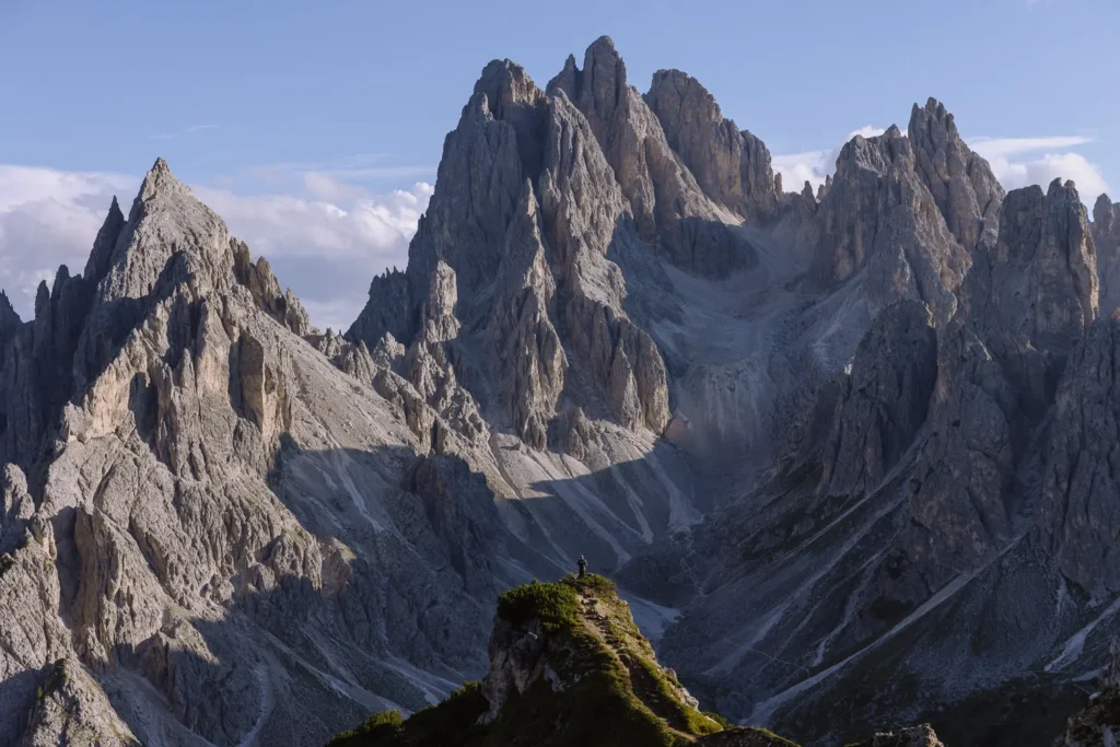
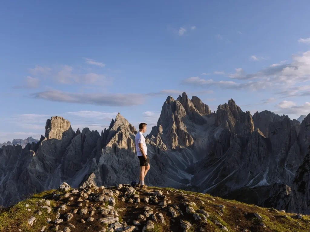
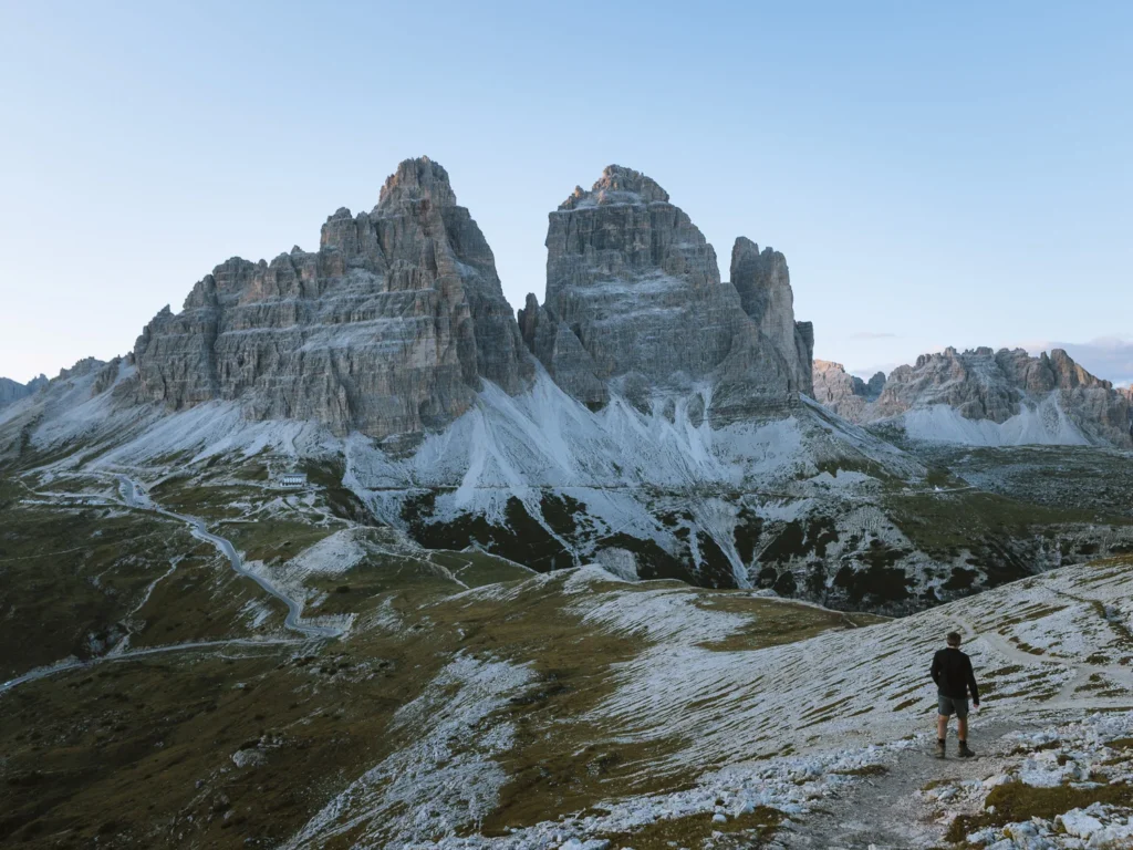
The Cadini di Misurina viewpoint has one of the best views in the Dolomites.
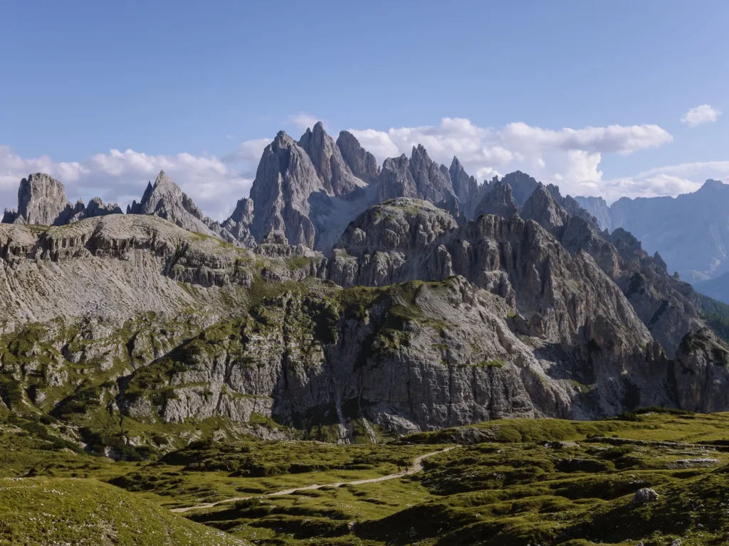
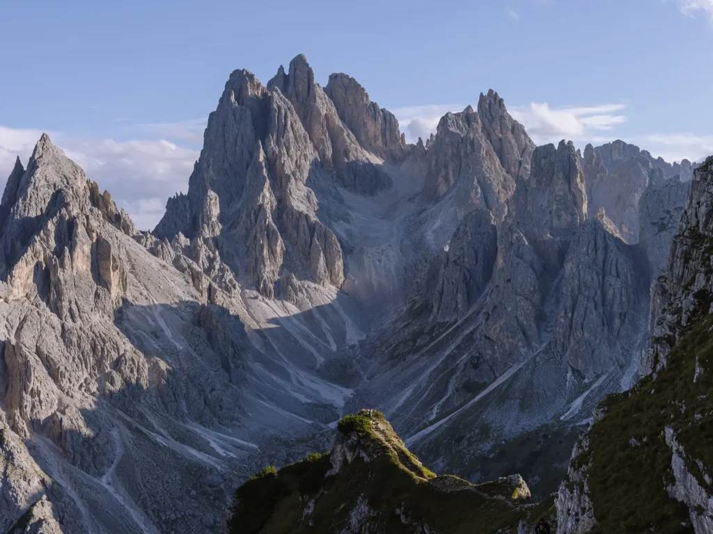
It stands on a small rocky outcrop that juts out of Monte Campedelle and overlooks a horseshoe of peaks and spires that make up the Cadini di Misurina massif.
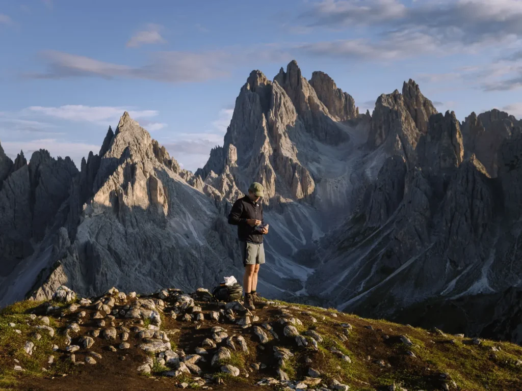
Jagged pinnacles rise out of a sea of scree and rock. The distance between the viewpoint and the dramatic shapes provides the right amount of distance to form the perfect backdrop for photos.
The view is amazing at any time of day, but we were here at dusk, and the light on the mountains was spellbinding.
The viewpoint is a 45-minute walk from Rifugio Auronzo. The walk is not strenuous, but the path is narrow and a little exposed.
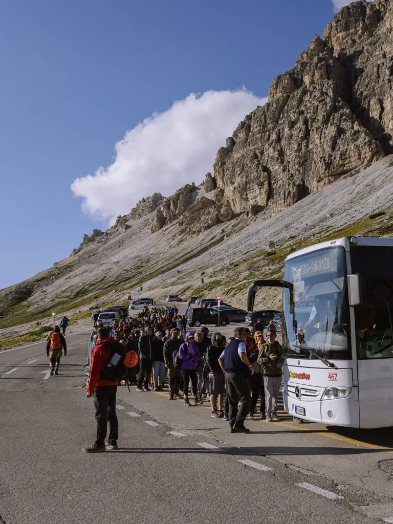
One of the most popular hikes in the Dolomites, Tre Cime di Lavaredo, also starts from Rifugio Auronzo, so the area has become very busy.
Parking (via a toll road) now needs to be booked online in advance, and there can be a queue at the viewpoint.
In this post, we cover everything you need to know, including how to get to Rifugio Auronzo, what the hike is like, and tips for avoiding the crowds.
Cadini di Misurina Hike Overview
- Start / Finish: Rifugio Auronzo
- Distance: 1.7 km / 1 mile each way
- Duration: 45 minutes each way
- Elevation gain: 180 meters
- Difficulty: Medium
The round-trip hike to the Cadini di Misurina viewpoint starts at Rifugio Auronzo. It is 1 mile each way and takes 30 to 45 minutes (90 minutes round trip).
The walk is not strenuous, but the second section of the hike follows a narrow path with precipitous drops on one side.
Paul and I don’t love exposed trails, but we found the path manageable. We also skipped the very last section by taking a detour on easier ground (more detailed instructions are below).
In general, the hike can be done by anyone of reasonable fitness with a decent head for heights. Allow about 2 hours to complete the hike and take photos.
Cadini di Misurina Hike and Viewpoint Map
We have outlined the Cadini di Misurina hike and the best viewpoints in red on the map below. Rifugio Auronzo and the car park and toilets are marked in orange.
The bus stops and toll booth for the road to the rifugio are marked in blue.
Click on the top right corner to open our map in your Google Maps app. Click the star next to the title to save it to your Google account.
Getting to Rifugio Auronzo
The hike to the Cadini di Misurina viewpoint begins at Rifugio Auronzo, which you can reach by car, bus, or on foot.
By Car
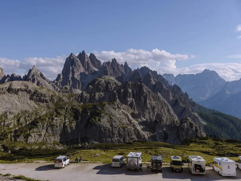
There is a large car park right next to Rifugio Auronzo, known as the Tre Cime di Lavaredo parking lot. Pre-booking a space in this car park became mandatory in 2025.
Your reservation is checked at a ticket booth (Parking Casello on Google Maps), which is on the road to Rifugio Auronzo, about 10 minutes before you reach the parking area.
You will not be allowed past this ticket booth without a reservation, so reserve parking online in advance.
Here is the important information about parking at Rifugio Auronzo:
- You must reserve parking online in advance by setting up an account at Parking Tre Cime di Lavaredo.
- Reservations cost €40 for a car.
- You can pick any time of day (every 30 minutes) or night (every hour).
- Tickets are valid for 12 hours from the time you select.
- You can drive through the ticket booth up to 29 minutes before your selected time. Parking is available next to the ticket booth, with a 30-minute limit if you plan to wait.
- You must enter a car registration number when reserving a spot. If you are renting a car, leave the field blank, then log back into your account at Parking Tre Cime di Lavaredo after you pick up your rental car to add the registration number. You must do this before arriving at the ticket booth.
- Cancellation is free up to 5 days before your selected time, but after that, there is no refund.
Our experience is that in peak season, the slots from midnight to 4 PM fill up quite quickly (because this gives you time to hike the Tre Cime di Lavaredo Loop (3 to 4 hours) before it gets dark or your slot expires).
However, slots from 5 PM onwards are often available the day before.
If you plan on hiking Tre Cime di Lavaredo Loop AND Cadini di Misurina, book a week or more in advance.
If you are only hiking Cadini di Misurina, you can risk waiting for a weather report and booking a late afternoon / early evening slot a few days in advance.
This is the best time to be there anyway.
By Bus
During the hiking season, you can take a bus to Rifugio Auronzo.
This means you can get there without a car and avoid paying the €40 parking fee. But it means you cannot be there at sunrise or sunset unless you spend the night at the hut.
The 050 shuttle bus runs every 30 minutes (8 AM to 6 PM) between Misurina Genzianella and Rifugio Auronzo. It costs €10 for the round trip. To get to Misurina Genzianella, take the 051 bus from Cortina (30 minutes) or the 445 bus from Dobbiaco (30 minutes). There is also parking available next to the Misurina Genzianella bus stop.
The 444 shuttle bus runs hourly from Dobbiaco (Toblach) directly to Rifugio Auronzo (50 minutes). It operates from mid-June to the end of September from 7:30 AM to 6 PM.
Please be aware that many people return on the bus between 4 PM and 6 PM, so queues for the bus in peak season can be extremely long.
The last time we were there, the queue for the bus was horrendous, and the authorities were telling people there was a 60 to 90-minute wait to get on the bus.
By Walking
Path 101 goes from just south of the toll booth (Parking Casello) to Rifugio Auronzo and takes about 1 hour 15 minutes (one-way). Unfortunately, parking at the toll booth is limited to 30 minutes.
There are, however, a few spots on the left-hand side of the road at Lago d’Antorno (immediately after Chalet Lago Antorno). These spots are free and have no time limit (unlike the 2-hour limit on the other side of the road). Get there early to grab a spot.
It’s a 15-minute hike up the road to the toll booth and Path 101, so allow 1 hour 30 minutes in total (one way).
Hiking Instructions
Rifugio Auronzo to Cadini di Misurina Viewpoint (30 to 45 Minutes)
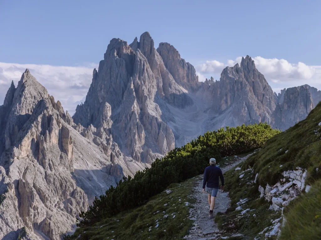
From Rifugio Auronzo, take Path 117 southwards, signed toward Rifugio Fratelli Fonda Savio.
The path descends a short grass and gravel slope before ascending over another hill. There is quite a bit of loose rock, and it’s a good idea to have shoes or boots with good grip.
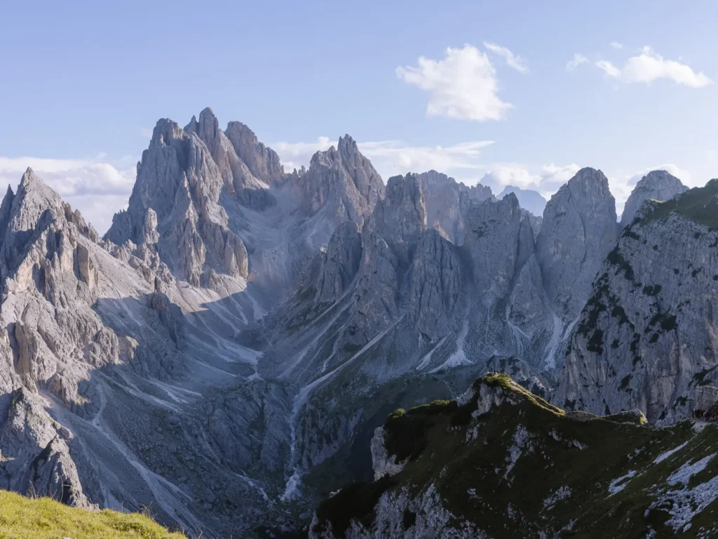
From the top, the spiky pinnacles of the Cadini di Misurina are still hidden from view.
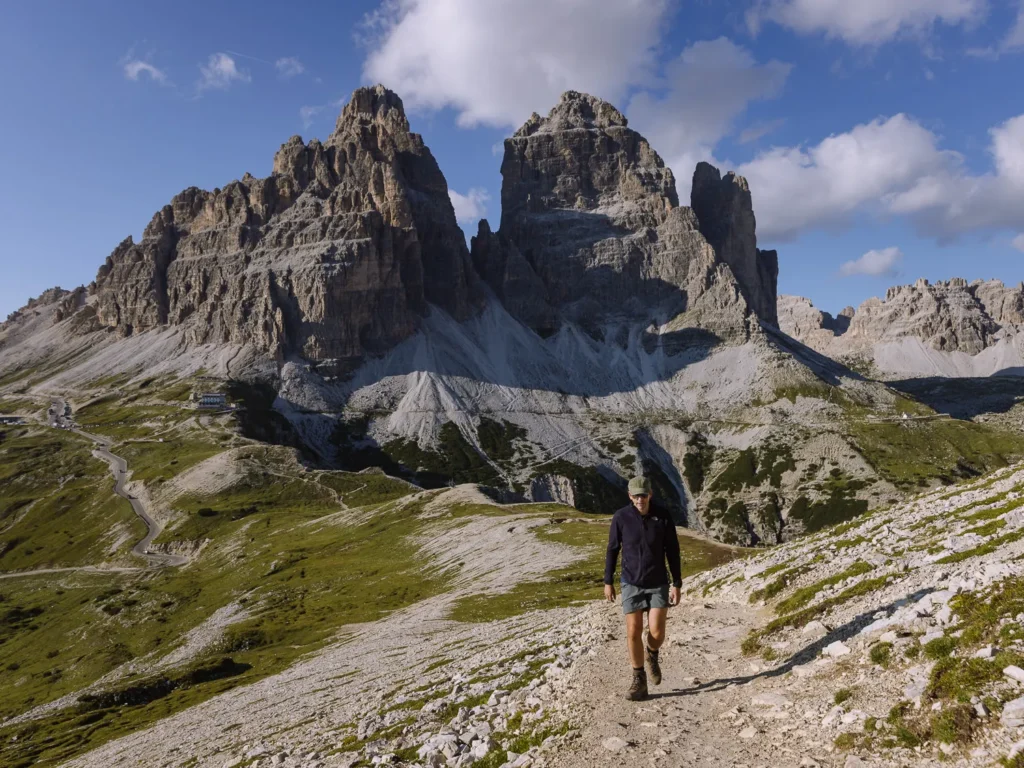
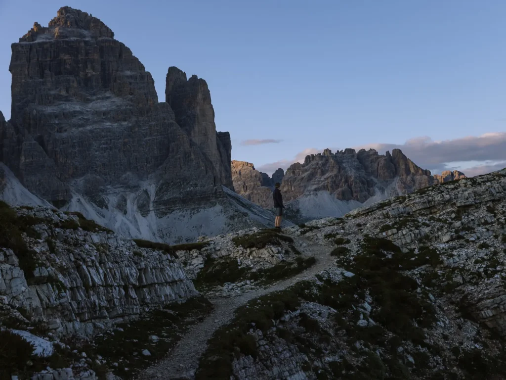
But there are great views back to Rifugio Auronzo nestled under the three peaks of Tre Cime, and (to the southeast) you can often see the town of Auronzo in Val Marzon about 10 kilometres away.
The trail then drops down the other side and bears right. It rises gently to the edge of the ridge, and you get your first glimpse of the Cadini di Misurina (marked First View on Map).
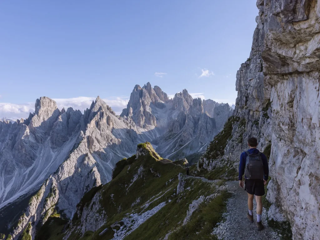
From here, you have a choice of paths. You can take the right-hand fork (purple on map) or the left-hand fork (red on the map). Both are narrow with steep drops on one side.
The right-hand fork follows a path under the summit of the ridge. It does not have as good views, but it is a little less exposed. However, as long as you have a decent head for heights, we suggest taking the left-hand fork.
This narrow trail clings to the edge of the ridge as the spiky peaks flicker in and out of view. There is a vertical drop on your left, and the path is only about 2 feet wide. Fortunately, the trail is pretty flat, and the surface is good. Just be extra careful in wet conditions.
The most challenging section is just after the walking symbol on the map. However, there is an option here to clamber onto the flat top of the ridge and complete the final section on the broader summit.
Cadini di Misurina Viewpoint
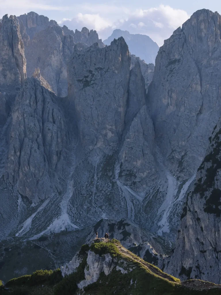
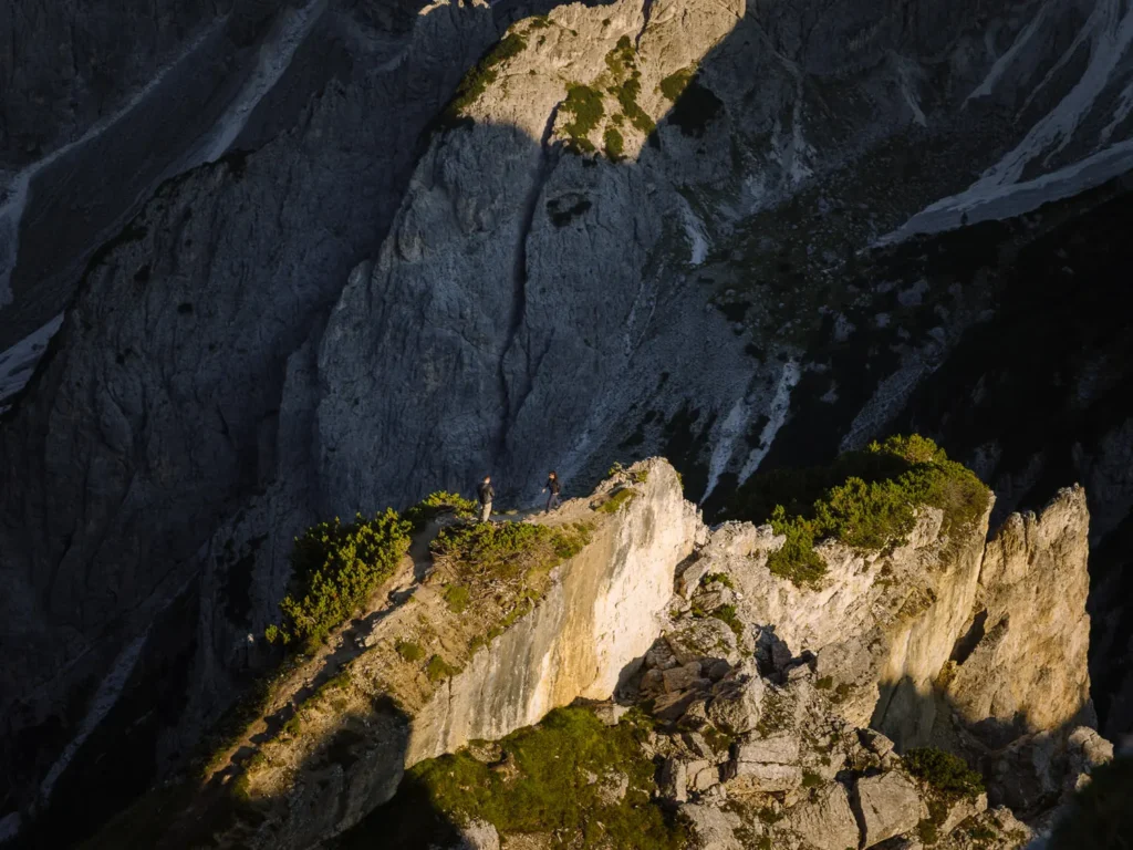
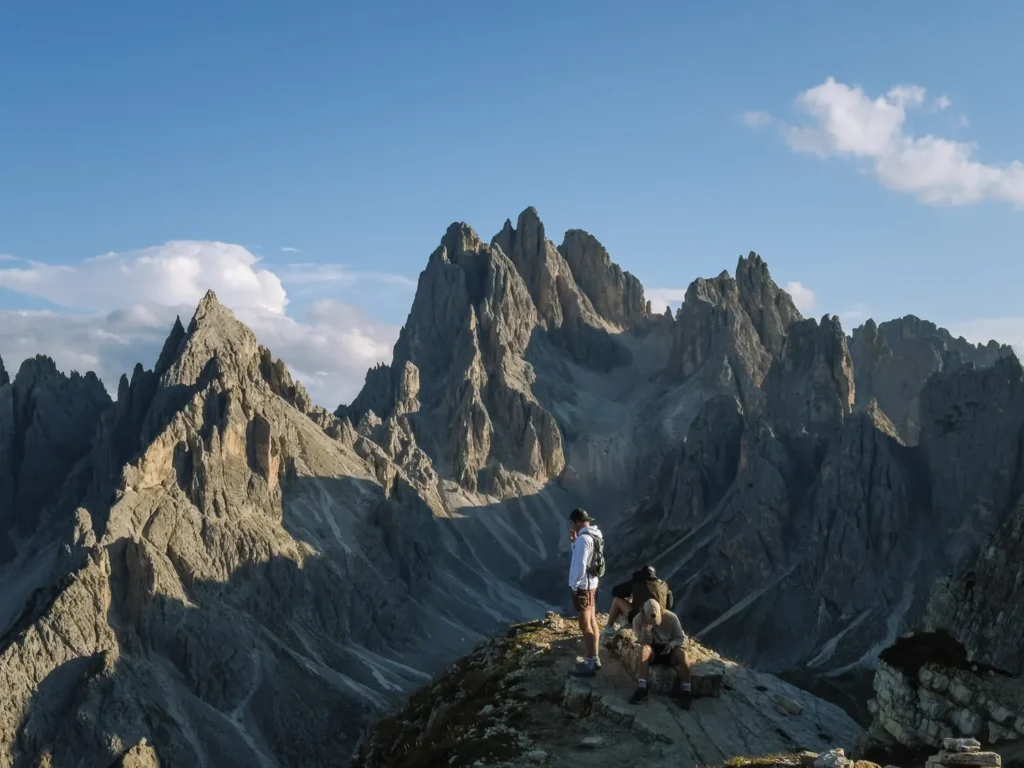
You can now see the famous Cadini di Misurina viewpoint in front of you, sticking out on a little outcrop (red star on map).
To reach it, you head down a narrow path traversing under a rock face and then cross a short arête with drops on either side. It’s not far, and we think it’s easier than the walk you took to get here.
Many people come here to get the iconic photo of themselves standing on the viewpoint with the spiky peaks all around.
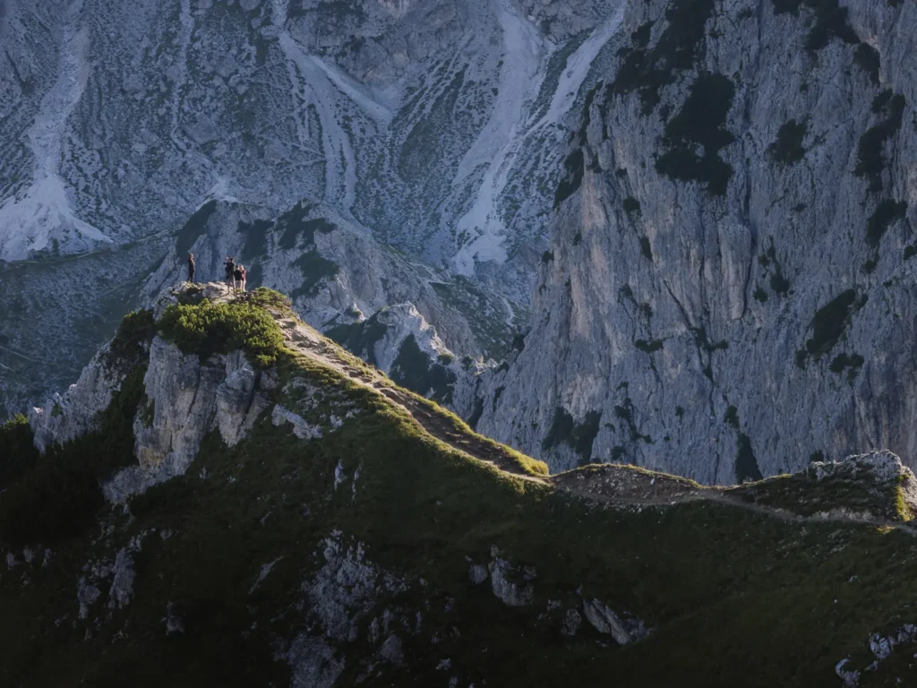
However, that means you have to cross the arête, get your photo, and head back across the arête before the next person heads over. A queue can build up at the beginning of the arête and along the path under the rock face. The queues are longest in peak season, mid to late morning and mid-afternoon.
If the queues are long and you cannot be bothered to wait, there is another great viewpoint just another 100 meters further along Path 117 (marked Great Viewpoint on map).
It is possible to continue on Path 117 to Rifugio Fratelli Fonda Savio, nestled in the heart of the Cadini di Misurina. However, this is a very challenging path, with significant erosion and exposure. Do not attempt it unless you have lots of hiking experience. (If you are keen to hike in the Cadini, we suggest you try this Rifugio Fratelli Fonda Savio hike on another day.)
When you have finished soaking in the views and taking photos, head back the way you came and enjoy the view of the Tre Cime peaks in front of you. If you have more time, you could always hike the Tre Cime di Lavaredo Loop (3 to 4 hours).
Best Time to Go
The toll road to Rifugio Auronzo is usually open from late May/early June until late October/early November. The dates vary each year and depend on the prevailing snow and ice conditions.
Snow can often stay on the trails until late June. So, the best time to plan your visit is from early July to the end of September. The trails are open, the days are long, and the weather is at its finest. To avoid the crowds, September is optimal.
In our opinion, the best time to get to the Cadini di Misurina viewpoint is about 90 minutes before sunset. The afternoon clouds and storms have often faded away, the sun is clipping the spiky peaks, and the queue at the viewpoint has all but disappeared.
Hang around for an hour to get your photos in nice light, and if you are lucky, as the sun descends, a red glow might light up the peaks of Tre Cime behind you. It makes for a magical hour or so, and you still have time to walk back to the car before it gets too dark.
If you come by bus, then try to avoid mid to late-morning and mid-afternoon when the hike and viewpoint are at their busiest.


Facilities on the Hike
There are no facilities on the hike, but there is a rifugio and toilets at the start/end.
Rifugio Auronzo – Due to the large number of people that visit the area, Rifugio Auronzo can get extremely busy and has lost some of the charm of many other mountain huts. It has a bar serving drinks and a restaurant. The restaurant is self-service, with hot meals, sandwiches, and desserts. It’s more school cafeteria than Dolomites rifugio.
If you are walking or using the bus and want to be here for dawn or dusk, then you can stay the night at the rifugio. It has 99 beds split between 5-6-bed dormitories and private rooms. It’s very popular, so book well in advance.
Toilets – There are toilets in the rifugio as well as toilets at the parking lot. Both cost €1. Bring coins (although the one in the car park often has an attendant).
Where to Stay?
The most convenient places to stay when visiting Tre Cime, Cadini di Misurina and the surrounding area are Misurina, Cortina d’Ampezzo, or Dobbiaco. Here are our recommendations:
€€ | Chalet Lago Antorno – Lovely little chalet standing all alone on the edge of Lago Antorno. It is just north of Misurina on the road to Rifugio Auronzo and could not be better positioned for visiting the Cadini di Misurina. The views from the front door are excellent, the rooms are cozy, and the restaurant serves traditional Italian fare.
€€ | Chalet Alpenrose – A few years ago, Chalet Alpenrose burned down. It has since been rebuilt as a set of splendid modern apartments. The views from the terraces over Sorapiss, Tre Cime, and Lago Misurina are superb, and the extra space of an apartment is very helpful — especially if you have lots of hiking gear.
€€€ | Hotel Rosengarten – The town of Dobbiaco sits at the junction of three valleys, and with roads heading off in each direction, it is an excellent base from which to explore, both by car and bus. This characterful family-run hotel is 700m from the main town and has a play area for kids. The friendly hosts are always on hand to help, and they run a free shuttle bus to the train station.
€€€€ | Romantik Hotel Santer – A really lovely hotel with a wellness centre consisting of one indoor and two outdoor heated pools, 6 different saunas, a Kneipp bath, infrared couches, a fitness area and a massage centre. The traditional old-style chalet sits seamlessly next to its modern amenities. Perfect for a romantic getaway.
CORTINA // Cortina makes a great base for exploring this part of the Dolomites. You can find the best things to do and where to stay in our summer in Cortina post.
More Dolomites Guides
- Read our first-timer guide for visiting the Dolomites with practical information.
- Try one of our favourite hikes in the Dolomites.
- Where to stay in the Dolomites has our pick of the best areas.
- Cortina d’Ampezzo is one of the most popular places to base yourself in the Dolomites.
- Find out what’s good to do around Val Gardena.
- Read about more beautiful places to visit in the Italian Alps.
- How to visit Lago di Braies covers all the information you need to know.
- Read our complete guide to hiking Tre Cime – the best hike in the Dolomites.

reader-supported
When you buy through links on our site, we may earn a small affiliate commission at no extra cost to you.
Thanks for your support // Paul & Mark