

Our guide to the easiest route up Scafell Pike includes full directions, a map, parking tips, when to go, where to stay and our favourite descent via the Corridor Route.
By: Mark Barnes // Last Updated:
Over the years, we’ve climbed Scafell Pike many times, and this is the easiest route. At least, as easy as it gets climbing the country’s highest mountain.
The main benefit of this route is that it gets you on the summit in under three hours, and it’s a very straightforward path. There’s no scrambling, just a fairly relentless climb with excellent views at the top.
While there are more interesting routes to the summit, this is the shortest and quickest.
If you are looking to tick Scafell Pike off your bucket list or you’re completing the National Three Peaks Challenge, then this is the route you should take.
Below is everything you need to know, including where to park, and a more scenic way down than the bog standard route.
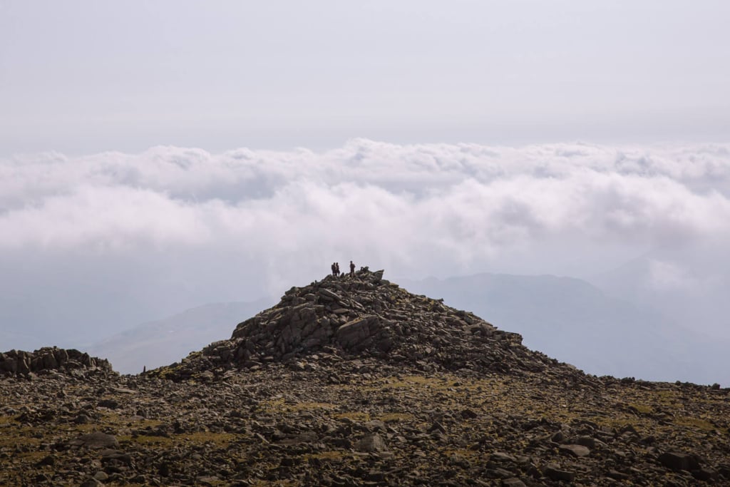
Scafell Pike Easy Route Overview
- Start / End – Wasdale Lakehead National Trust Car Park
- Distance – 2.6 miles (4.2km) one-way
- Elevation – 3,000 feet ascent
- Walking Time – 2 hours 50 minutes one-way
- Best Time – May, June, September & October
- Difficulty – Medium (but still the easiest route to the summit)
There are 5 excellent routes up Scafell Pike, but this is the easiest and the quickest.
The trail starts at the Wasdale Lakehead National Trust Car Park in the remote valley of Wasdale.
It ascends alongside pretty Lingmell Gill, crosses a ford (which can be tricky after heavy rain), and follows a relentless series of stone steps up the shoulder of Brown Tongue.
From here, the trail crosses a wilderness of scattered rocks called Hollow Stones, before reaching the saddle at Lingmell Col. Turning right, the path heads across loose rock to the summit.
If the skies are clear, you’ll have great views across to Scafell, Great Gable and Bowfell and down to Wastwater and Eskdale.
The hike is a relentless climb with 3,000 feet of ascent, and it takes just under 3 hours. The route is clearly marked and easy to follow. Apart from crossing the ford after heavy rain, there are no technical challenges.
Most people return via the same route (1 hour 30 minutes), but we prefer to descend via the Corridor Route and Moses Trod (2 hours). Details to follow.
Don’t miss an end of walk pint at the Wasdale Head Inn, we never do.

Map: Scafell Pike Easy Route
Below is a Google map of the walk. The easy route to Scafell Pike is marked in red. The descent via the Corridor Route and Moses Trod is marked in purple. We have also marked the car parks and the best places to stay.
If you have Google Maps open on your phone as you walk around, you can track your progress.
If you are a regular walker in the UK, we highly recommend OS Maps. You can plot your own routes, download routes onto your phone, and track yourself as you progress on the walk. You don’t need to pay for an account to use the OS Map, but you do need to create a profile.
Here is an OS Map of the easy route up Scafell Pike.
Click on the top right corner to open our map in your Google Maps app. Click the star next to the title to save it to your Google account.
When to Do the Walk
Our favourite time of year to do the walk is May to June. The days are long, the valleys are blooming with flowers, and the summer crowds have not yet arrived. Most importantly, these are statistically the driest months in what is the wettest part of England.
The summer months of July and August are great weather-wise, but they bring much higher crowds and getting into the car parks can be tricky unless you arrive early.
The shoulder season of September and October is another excellent time to do the walk. The valleys turn brown and red, the summer crowds thin, and Wastwater is often covered in an eerie mist.
Winter months can be harsh with strong winds, cold temperatures and snow on the summits.

What to Take with You
There are no facilities on the walk, so make sure you bring plenty of food and water to stay energised.
Last time we hiked this route, we started in glorious sunshine, wearing just t-shirts at the bottom. However, by the top, the cloud had come over, the wind had picked up, and the temperatures had dropped, so we quickly found ourselves adding a fleece and raincoat to stay warm.
The path is straightforward, but there is loose rock near the top, so wear walking boots and shoes or trainers with a good grip.
When using an online map, we always take a spare power bank to recharge our phones.
There are toilets at the Wasdale Lake Head National Trust car park and at the Wasdale Head Inn, but none on the trail.


How to Get to the Trailhead
The path to the summit starts in the valley of Wasdale, which is dominated by Wastwater, the deepest lake in the Lake District.
Wasdale is one of the most remote valleys in the Lakes, and driving to it can take time. For example, from Keswick it takes 1 hour 20 minutes, from Ambleside 1 hour 40 minutes and from Windermere 1 hour 45 minutes.
The views for the last 20 minutes are stunning, but it does mean about 3 hours of your day might be taken up just driving there and back.
We usually choose to spend one or two nights in the valley. You can see our recommendations for where to stay at the end of the post.

The easy route up Scafell Pike begins at the Wasdale Lakehead National Trust Car Park. Parking is £10 for all day (free for members). Reception can be poor, so either bring cash or download the JustPark app before setting off.
There is another smaller National Trust (The Green) Car Park 0.7 miles further along the valley (just before the Wasdale Head Inn). This is the best place to park if you want to save some money, end the walk with a pint at the Wasdale Head Inn, or complete a loop by descending down the Corridor Route and Moses Trod rather than the shorter there-and-back hike.
In the summer months and on fine weekends, the car parks and the road to them can get busy. Try to arrive early (before 8:30 am) to secure a spot. Another reason why we spend the night before in the valley.
If you cannot find a parking spot or the roads are packed, you can park in Nether Wasdale and take the Wasdale Explorer. This bus shuttles people up and down the valley on Saturdays, Sundays and bank holiday Mondays between May and the end of August. There are 6 buses a day between May and mid-July, rising to about 12 buses a day over the summer holidays. It costs £3 all day.
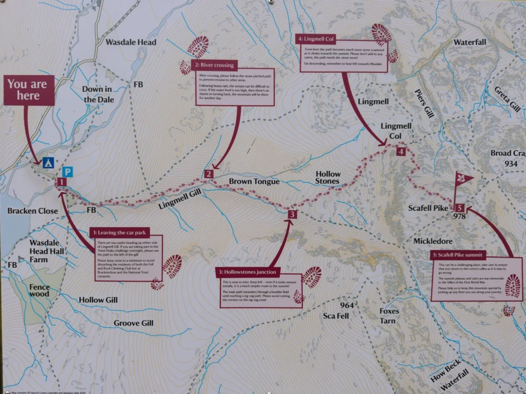
Scafell Pike Easy Route Instructions
Lingmell Gill
The easy route up Scafell Pike starts at Wasdale Lakehead National Trust Car Park. At the car park, there is a large sign showing the route you will follow to the summit (see above).
The path exits the car park and crosses a footbridge over Lingmell Gill. It follows the gill (which is now on your left) for about 5 minutes before crossing back on another footbridge.
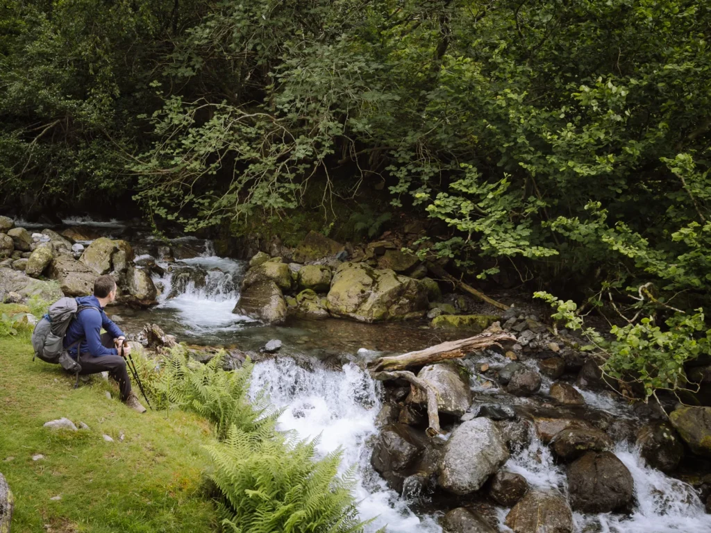
Keep following the gill (now on your right). It’s one of the prettiest sections of the walk, with little waterfalls dropping through a small grassy ravine.
About 30 minutes after leaving the car park, you reach a wooden gate (marked 1 on the Google map). Pass through it and continue to follow the gill (on your right).
The path becomes a stone staircase as it relentlessly climbs. After bending right, it crosses Lingmell Gill. There is no footbridge, so you have to work your way across the rocks.
The crossing is usually fine, except it can be tricky after heavy rain. Having walking poles is helpful.
Brown Tongue & Hollow Stones
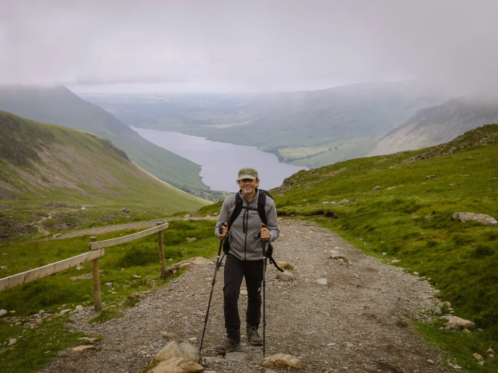
After crossing the river, the stone staircase continues its relentless ascent up the shoulder of Brown Tongue. Views over Wastwater appear behind you, and the craggy facades of Scafell and Scafell Pike loom in front.
As you reach the crest of the shoulder, make sure you keep left (marked 2 on the Google map) and follow the path that cuts across an area known as Hollow Stones. Do not go straight ahead here, as that path takes you up Mickledore, a much steeper and trickier ascent to the summit.
The trail through Hollow Stones is a gravel/stone track roughly the width of a car. It’s not the prettiest, but it’s not as steep as Brown Tongue, and it slowly zig zags its way to Lingmell Col (marked 3 on the Google map).
Lingmell Col & Summit
Lingmell Col is where the easy route up Scafell Pike meets the Corridor Route. Make sure you keep right on the wide and increasingly stony track to the summit.
We often find this last section drags a bit. The track is well marked, and cairns mark the way, but the trail is covered in loose rock. Having a good grip on your boots/shoes and hiking poles is helpful.
After about 40 minutes from the col, you should reach the summit, where you’ll find a trig point and a large circular shelter.
We have been on the summit about 10 times. We would say about 6 of them have been in the cloud, and 4 have had good views. If you get lucky, make sure to explore the whole summit.
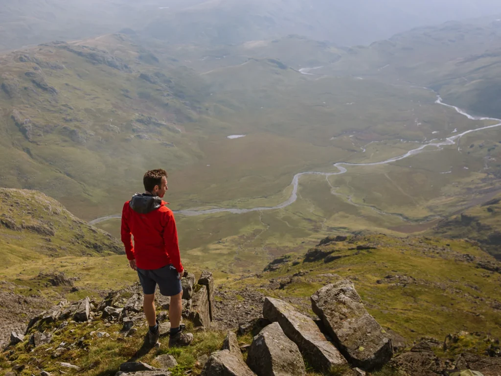
To the south, the River Esk cuts through the tufty grass of the Great Moss. To the west is the rocky face of Scafell and the green fields of Wasdale Valley.
To the north is the imposing peak of Great Gable. To the east is the triangular summit of Bow Fell and much of the rest of the Lake District.
The entire walk to the summit should take about 2 hours and 30 minutes to 3 hours.


Possible Descents
Easy Route
The easiest way to get back is to return the way you came. Downhill is usually much faster than going up, so allow about 1 hour to 1 hour and 30 minutes to descend.
Add time for lunch and photo breaks, and the entire hike should take about 5 hours.
Mickledore
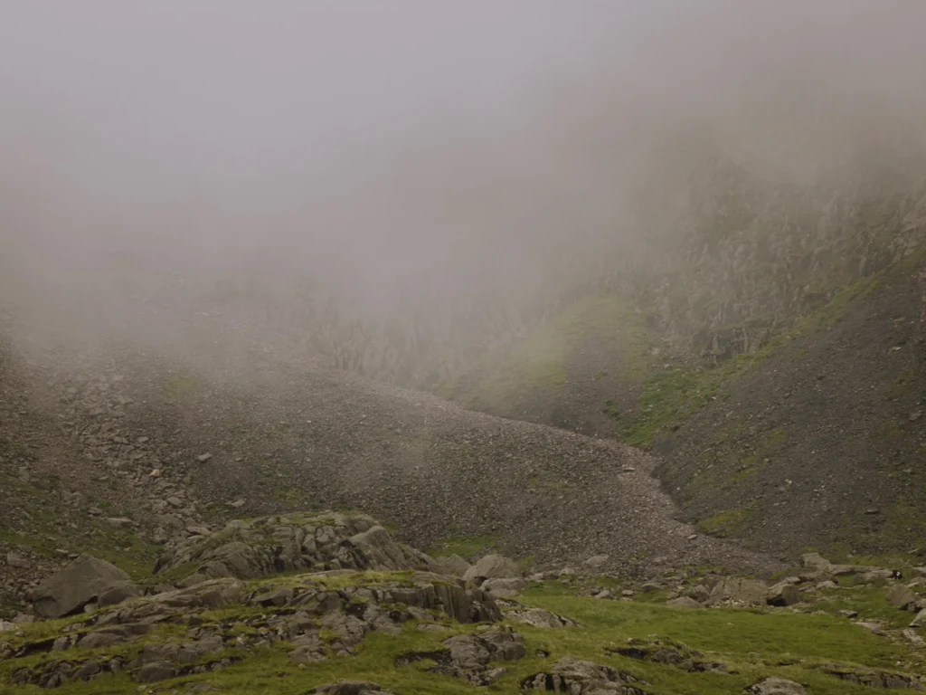
Another option is to descend via Mickledore. However, we do not recommend it. The trail descends through a scree slope. It is extremely steep with lots of very loose rock. It is easy to slip, and in thick clouds, it can be difficult to find your way.
Corridor Route and Moses Trod
We highly recommend descending via the Corridor Route and Moses Trod. This beautiful route is one of our favourite walks in the Lake District. It’s longer than the easy route, but the views are much better, and the path is more interesting.
From the summit, head back the way you came to Lingmell Col. But instead of turning left towards Hollow Stones, turn right and descend on a path known as the Corridor Route.
The path is not a wide rocky track that you could get a bus down, but a narrow mountain path cutting across the northern flank of Scafell Pike.
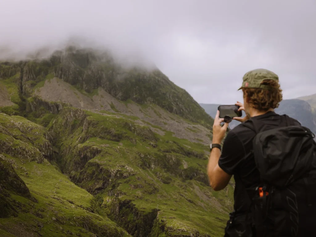
On your right is the imposing craggy facade of Great End. On your left are wonderful views over dramatic, deep-sided ravines.
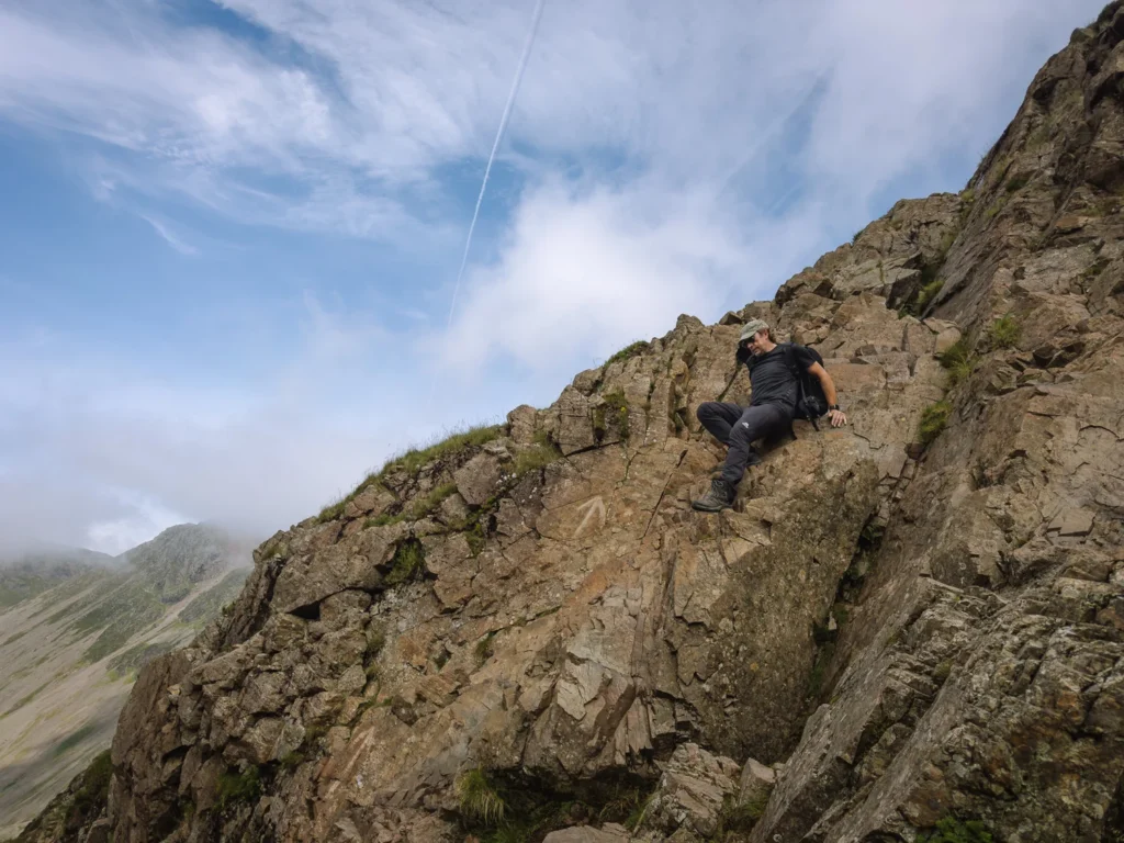
There are two places where you need to use your hands. A short scramble up ‘a bad step’ about halfway to Styhead Tarn, then a short descent down Skew Gill. Both are over in less than 1 minute. You can find more information about these two tricky sections in our post on Scafell Pike via the Corridor Route.
The Corridor Route ends at the ridge above Styhead Tarn. Here, turn left and follow Moses Trod back to Wasdale.
The descent is 4.6 miles and takes about 2 hours.
The entire loop is 7.5 miles and takes 5 hours and 30 minutes to 6 hours.
The best place to park to complete the loop is the free National Trust car park just before the Wasdale Head Inn. Perfect for an end-of-walk pint.
You can follow the loop on the Google map above or use this OS Map.

Where to Stay in Wasdale
Wasdale is remote, so we always recommend spending a night here rather than trying to do the walk as a long day-trip.
Wasdale Head Inn – Our favourite. A proper old-school hikers’ pub with excellent food (we get the steak and ale pie almost every time). Rooms are a little tired, but the atmosphere makes up for it. Packed lunches available for £11 (sandwich, chocolate bar, drink, and biscuits or crisps).
Burnthwaite Farm B&B – Well-rated, 10 minutes’ walk from the inn. Georgina is a brilliant host, and the breakfasts are excellent.
Wasdale National Trust Campsite – Right at the trailhead, at the Wasdale Lakehead Car Park. 120 pitches, 2-night minimum.
Wasdale Inn Campsite – Attached to the Wasdale Head Inn. No reservations — we’re told they’ve never turned a walk-in away. £10 per person, £1 for showers. Camper’s breakfast served 8–9.30 am.


More Lake District Walking Guides
- Check out all our favourite walks in the Lake District
- Find the best areas to stay for your hiking trip.
- Choose from the 5 different routes up Scafell Pike
- Or pick the best and hike Scafell Pike via the Corridor Route
- For a quicker option, take the easy route up Scafell Pike
- Test yourself by scrambling Helvellyn via Striding Edge
- For a more challenging scramble try Blencathra via Sharp Edge
- Our favourite walking route up the Langdale Pikes.
- Want more than a day hike? Try our 3-5 day Lake District hike
- For remote scrambling and hiking, choose Wasdale Head.

reader-supported
When you buy through links on our site, we may earn a small affiliate commission at no extra cost to you.
Thanks for your support // Paul & Mark