

By: Mark Barnes // Last Updated:
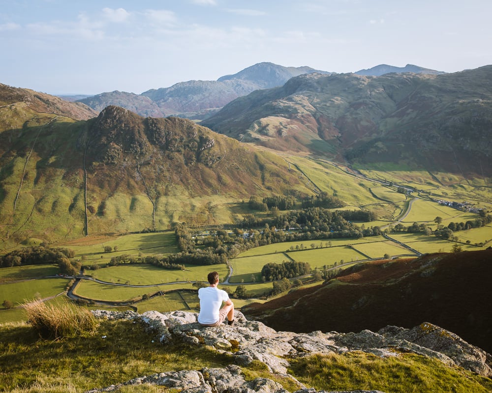
Our favourite Langdale Pikes walk: a 4.8-mile circular via Stickle Ghyll, Pavey Ark and Dungeon Ghyll with an optional ascent of Jack’s Rake. The route summits 4 Wainwrights and has sweeping views over Great Langdale.
There is something special about the Langdale Pikes.
They may not be the highest, but this jagged skyline of rocky summits rising dramatically above Great Langdale is one of the great sights of the Lake District.
Fortunately, the walk to their summits is just as distinctive as the peaks themselves.
We’ve walked plenty of other routes around the Langdale Pikes over the years, but we keep coming back to this one — it has the best of everything in one loop: a proper climb, a scramble if you want it, four summits, and a wonderful descent alongside a dramatic ravine.
It summits all 4 of the Langdale Pikes – Pavey Ark, Harrison Stickle, Pike o’Stickle and Loft Crag – and has magnificent views almost all the way round.
If you rush, you can be done in 3 hours and 30 minutes, but take a packed lunch and a camera and you’ll want about 5 hours.
The New Dungeon Ghyll Hotel and Sticklebarn both offer food and drink at the trailhead. We always stop for an end-of-walk pint at one of them, and sometimes at both.
Langdale Pikes Walk Overview
- Start / End – New Dungeon Ghyll Hotel
- Distance – 4.8 miles (7.7 km)
- Elevation – 2,500 feet of ascent and descent
- Walking Time – 3 hours 30 minutes
- Best Time – May, June, September & October
- Difficulty – Medium
There are many walking routes around the Langdale Pikes, but this is my favourite.
It is just under 5-miles and takes about 3 hours 30 minutes of walking time. Assuming you stop for photos and have a picnic lunch along the way, allow about 5 hours.
The walk starts at the New Dungeon Ghyll Hotel in Great Langdale which can be reached by car or bus.
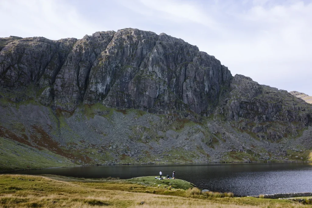
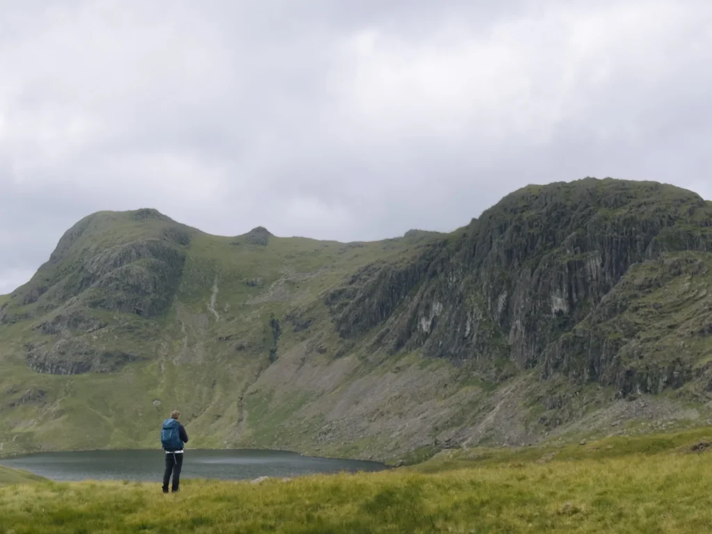
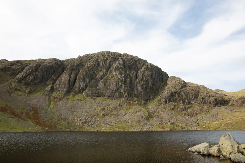
The path ascends alongside Stickle Ghyll, a pretty steeply sided rocky ravine with little waterfalls and pools. After an hour, it reaches Stickle Tarn, where you will get views of the Pavey Ark, the highest cliff face in the Lake District.
From here, there are three routes to the top. Almost everyone should take the Easy Route, which ascends a steep but manageable rock-strewn slope to the summit.
The trail now crosses the peaks of Harrison Stickle, Pike o’Stickle, and Loft Crag. Each peak has hardly any up and down, and before you know it, you have completed 4 Wainwrights, all with excellent views.
The descent is one of my favourites in the Lake District. A grassy slope, running alongside Dungeon Ghyll, provides a dramatic but easy way down. After a short detour to Pike Howe for stunning views over Great Langdale, you are soon back at the New Dungeon Ghyll Hotel.
There is nothing technical on the walk, although the ascent up Pavey Ark is steep and you may need your hands in places.
The path is generally easy to follow, although it is rocky over the summits and the cairns can be difficult to spot in cloud. We recommend using an offline map (see below).

Map: Langdale Pikes Walk
To help you get your bearings, below is a Google map of the walk. The walking route is marked in red. The car parks and bus stops are in blue.
The path up and down the Langdale Pikes is relatively easy to follow; however, the route over the summit of Pavey Ark and Harrison Stickle can be tricky to find, especially in cloud.
Furthermore, like most paths in the Lake District, they are not signed.
I have done my best to mark it on Google Map, but we strongly advise you to take a high-quality offline map.
If you are a regular walker in the UK, we recommend OS Maps. You can plot your own routes, download routes to your phone (for offline use), and track your progress. It costs £35 a year and is well worth the money.
Here is an OS Map of this Langdale Pikes Walking Route.
Click on the top right corner to open our map in your Google Maps app. Click the star next to the title to save it to your Google account.
When to Do the Walk
Our favourite time of year to do the walk is May to June. The days are long, Great Langdale is bright green and in full bloom, and the summer crowds have not yet arrived. Most importantly, these are statistically the driest months in what is the wettest county in England.
The summer months of July and August are great weather-wise, and swimming in Stickle Tarn is at its best, but they bring much higher crowds and getting into the car parks can be tricky unless you arrive early.
The shoulder season of September and October is another excellent time to do the walk. The valleys turn brown and red, and the summer crowds thin.
Winter months can be harsh with strong winds, cold temperatures and snow on the summits.
What to Take with You
There are no facilities on the walk, so make sure you bring plenty of food and water to stay energised.
We have hiked the Langdale Pikes in glorious sunshine and heavy cloud (as you can see from the different photos), and often got both conditions in the same day. Make sure to take a fleece and raincoat in case conditions change.
The path is straightforward, but there is loose rock on the final ascent of Pavey Ark, so wear walking boots or shoes or trainers with a good grip.
When using an online map, we always take our phone with a downloaded map and a spare power bank to recharge.
There are toilets at Stickle Ghyll car park, but none on the trail. Food and drink are served at Sticklebarn and at the New Dungeon Ghyll Hotel, which are right next to the car park.

How to Get to the Trailhead
The path to the summit starts at the New Dungeon Ghyll Hotel in the valley of Great Langdale.
It is one of the most central valleys in the Lake District and easily reached from several of the most popular places to stay.
By Car
To drive to New Dungeon Ghyll Hotel, it takes 25 minutes from Ambleside, 35 minutes from Grasmere and Windermere, and 50 minutes from Keswick.
The last 15 minutes of the drive are along a narrow-ish lane that is single-track in places but has plenty of passing spots. It is not steep and is usually in good condition, making it one of the easier remote roads to drive.
There are two car parks very close to the start of the trail. The National Trust Stickle Ghyll car park has just over 30 spaces. It is pay and display (free for members) with payment machines that accept cards. You can also use the JustPark app; make sure to download and set up an account before arriving.
If it is full, then just across the road is the New Dungeon Ghyll Car Park.
In peak season, both can fill up quickly, so try to arrive early (before 9 am). We often book a night or two at the New Dungeon Ghyll Hotel. It has free parking for guests, and is a beautiful place to stay whenever everyone has left for the day.
By Bus
The 516 bus runs roughly every hour between New Dungeon Ghyll Hotel and Ambleside, and the journey takes 30 minutes. If you are staying in Grasmere, Keswick, Windermere or Bowness, you’ll need to get a bus to Ambleside and change.
Langdale Pikes Walking Route Instructions
Stickle Ghyll
Leave the car park or bus stop and walk up the driveway between Sticklebarn and the Dungeon Ghyll Hotel. When the path splits, keep left (don’t go over the footbridge) and then keep right. Stickle Ghyll should now be on your right-hand side, and you are going to follow it for the next hour.
The ghyll is a steep, boulder-strewn beck tumbling down from Stickle Tarn to Great Langdale, and it’s as good a warm-up as any walk in the Lakes gives you. There’s no gentle valley stroll first, just straight into the climb.
The path is easy enough to follow, but the stone steps can feel a bit endless. About two-thirds of the way up we always tell ourselves the tarn is “just around the next corner” a few corners too early.
After about an hour of steady effort, though, it’s there, and the view over Pavey Ark, the highest cliff face in the Lakes, makes it all worthwhile.
Pavey Ark
The next section of the walk takes you from Stickle Tarn to the summit of Pavey Ark. There are three ways to the summit. Almost everyone should take the easy route, which is the route shown on the maps above.
However, we have described the other two routes as well, just in case you want more of an adventure.
Easy Route
Upon reaching Stickle Tarn turn right, cross over the dam, and follow the trail keeping the tarn on your left. At the eastern end of the dam, when the path splits, keep left (next to the tarn). Cross over a small stream and, keeping left again, follow the second stream (keeping it on your left) as the path rises towards Pavey Ark.
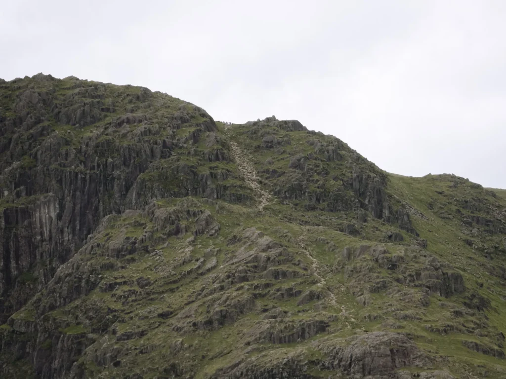
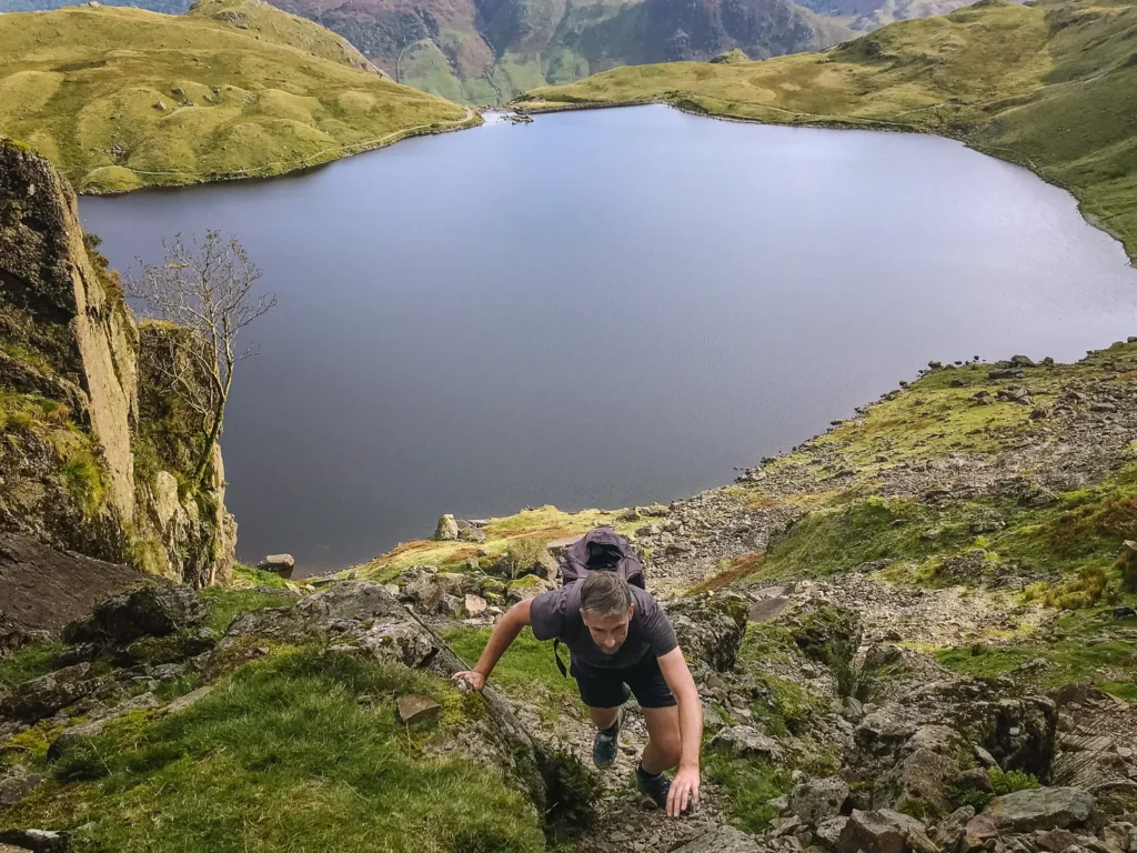
The trail is gradual at first, but after crossing over the stream, it steadily steepens. The last section of the path is a massive scar of loose rock and stone (see picture below). It is not technically difficult, but we usually need to use our hands in a few places.
Last time we went up, we were confidently putting one foot in front of the other, thinking we were making good progress, when a team of Gurkhas suddenly ran past us. It was both impressive and depressing at the same time.
At the top of the loose rubble, the trail flattens and continues across the rocks to the summit. Cairns mark the route, but still the path is not always clear. It’s very helpful to have an offline map – especially in cloud.
The actual summit is just a short there-and-back walk from the main path, from where you are rewarded with excellent views down to the tarn and back across Great Langdale.
If you plan on taking this route to the summit, you can now skip to the Harrison Stickle section.
Jack’s Rake
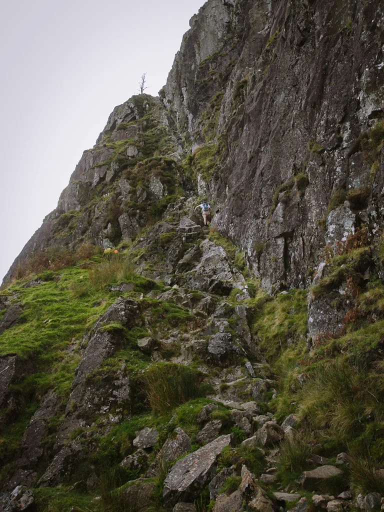
An alternative route to the summit is Jack’s Rake.
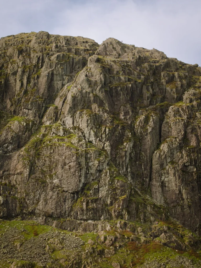
Jack’s Rake is a groove that cuts diagonally across the face of Pavey Ark. At first glance, it looks like only climbers could make their way up. But the narrow groove has stacks of rock, which allow you to pull yourself up.
Several handholds are required, and you need to contort your body into odd positions, but providing you ignore the temptation to come out of the groove, there is rock on either side of you.
The chimney stack ends at a narrow unprotected ledge (nerve-wracking if you don’t like heights), before entering a series of blocks and grooves linked by ledges that ascend to the summit of Pavey Ark.
This alternative route up Pavey Ark is ranked as a Grade 1 scramble and should only be undertaken by those with a sense of adventure and no fear of heights. I have completed it when I was younger, but now I tend to prefer the easy route!
To reach the beginning of Jack’s Rake, turn left when you reach the tarn and go anti-clockwise around the tarn to the far side to meet the bottom of the groove (see Google Map above).
Easy Gully
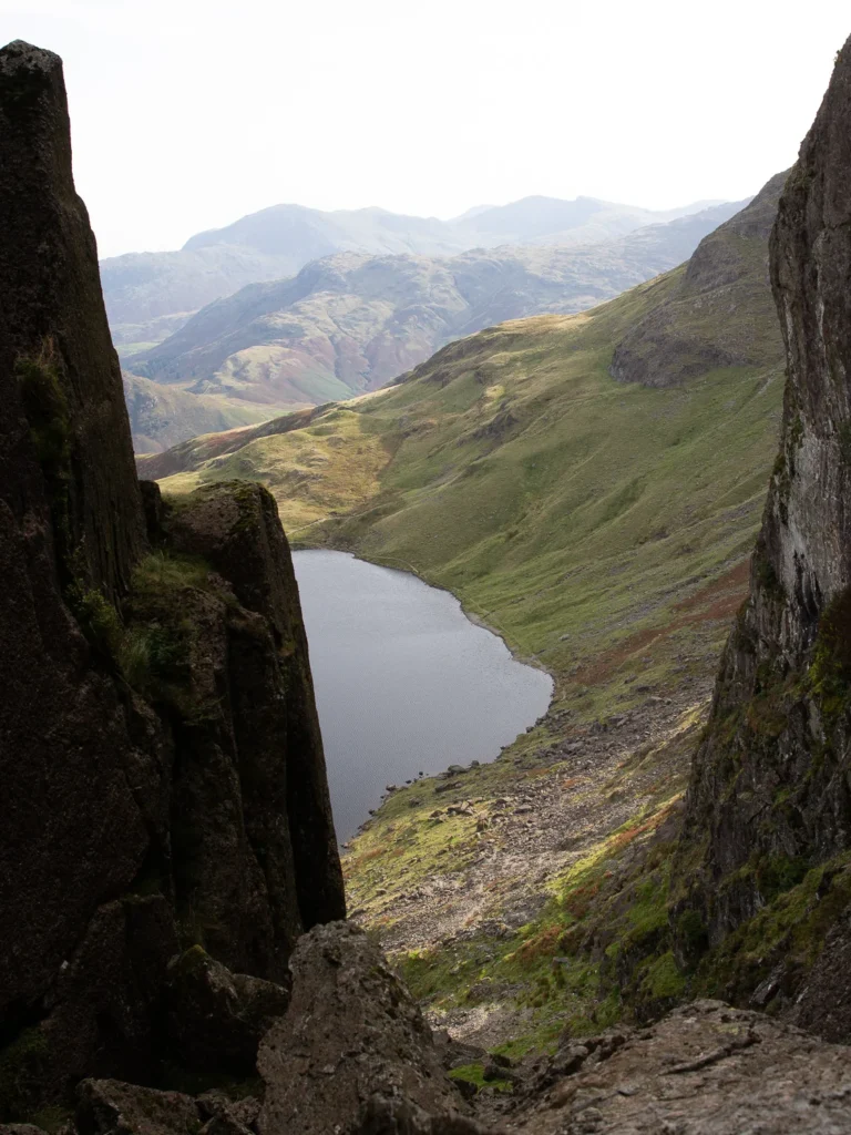
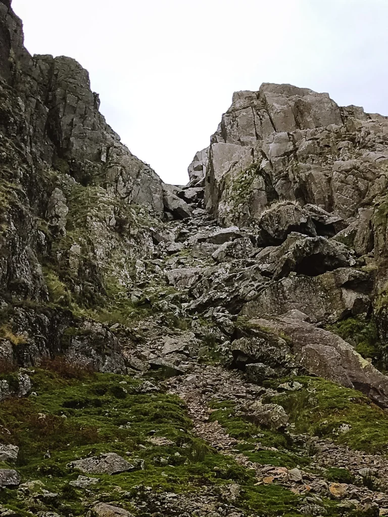
The badly named Easy Gully is no easier. This alternative route to the summit leaves from the far side of the tarn at the same point as Jack’s Rake. But instead of heading left up the chimney, it heads right up a scree and boulder-strewn gully.
It’s steep and slippery underfoot, but the real challenge is a collection of large boulders that block the route near the top of the gully.
Wedged between two walls, there is no way around, so you have to go over. This requires contorting your body backwards and pulling yourself up with just your hands.
We’ve made it over the boulder block a couple of times over the years, hauling ourselves backwards over the wedged rock with more determination than grace. Last time, though, we got about two-thirds of the way up and simply couldn’t find a way through.
We admitted defeat, climbed back down, and finished the ascent on the easier path instead. A useful reminder that “easy” in Easy Gully is doing very little work.
If you get past the boulders, the Easy Gully joins the Easy Route, just before the steep scarred path to the summit.
Harrison Stickle
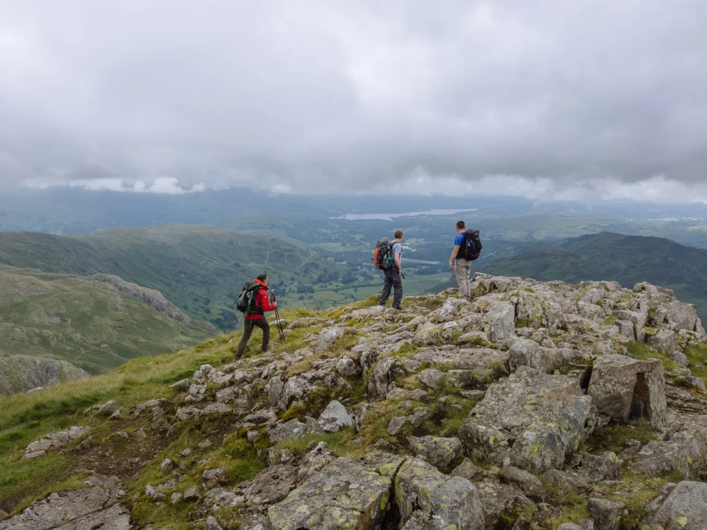
From the summit of Pavey Ark, it’s a rocky path over to Harrison Stickle, with cairns marking the way that can be surprisingly easy to lose in cloud. We’ve second-guessed ourselves here more than once, and have often been happy to have an offline map.
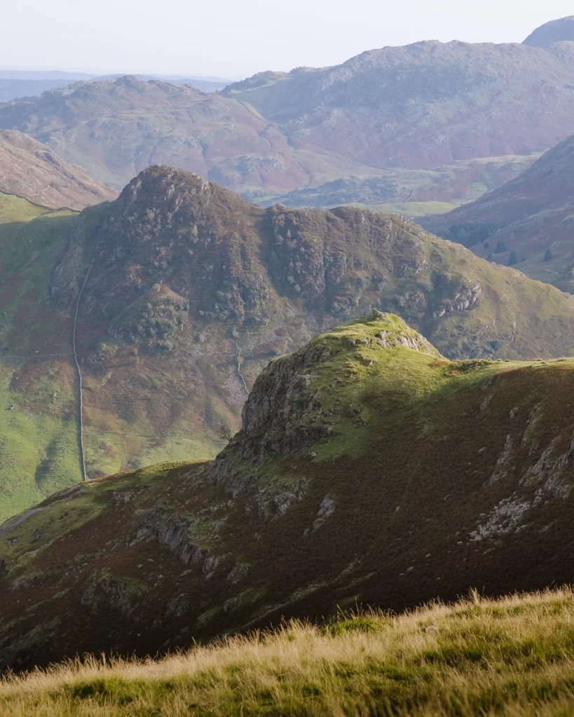
Harrison Stickle is the highest of the Langdale Pikes at 736m. It has a distinctive pointed summit and is the Langdale Pike which dominates the skyline from the valley below.
From the top, there are lovely views down to Stickle Tarn and across to Windermere. Though we’re still waiting for the day we get up here in actual sunshine rather than the grey we always seem to bring with us.
There are plenty of rocks all over the summit that make a good seat for lunch.
Pike O’stickle & Loft Crag
Head west off the summit of Harrison Stickle and follow the cairns down to a grassy area between the peaks. Cross the stream and continue westwards over a sometimes boggy path to Pike o’Stickle.
This mountain is a prominent pike when viewed from Langdale, but looks little more than a pimple when approached from the back.
Fortunately, it has great views down the Langstrath Valley and across to the triangular peak of Bowfell and the craggy facade of Crinkle Crags.
Next, head southeast following a trail that passes the summit of Loft Crag and then Thorn Crag. From there, bear north, cross over the top end of Dungeon Ghyll, turn right and head downhill, keeping the ghyll on your right.
Dungeon Ghyll
The descent alongside Dungeon Ghyll is one of my favourites in the Lake District. The path is narrow in a couple of places, but Paul, who has a bit of a fear of heights, did not have a problem.
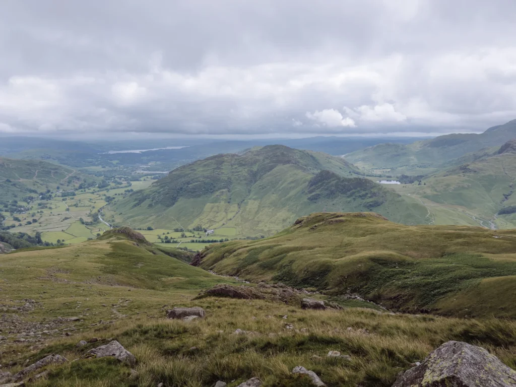
Heading over a grassy shoulder, the trail is gentle underfoot and not too steep, making progress quick and comfortable. The stream has carved a deep, dramatic ghyll, with several waterfalls and pools.
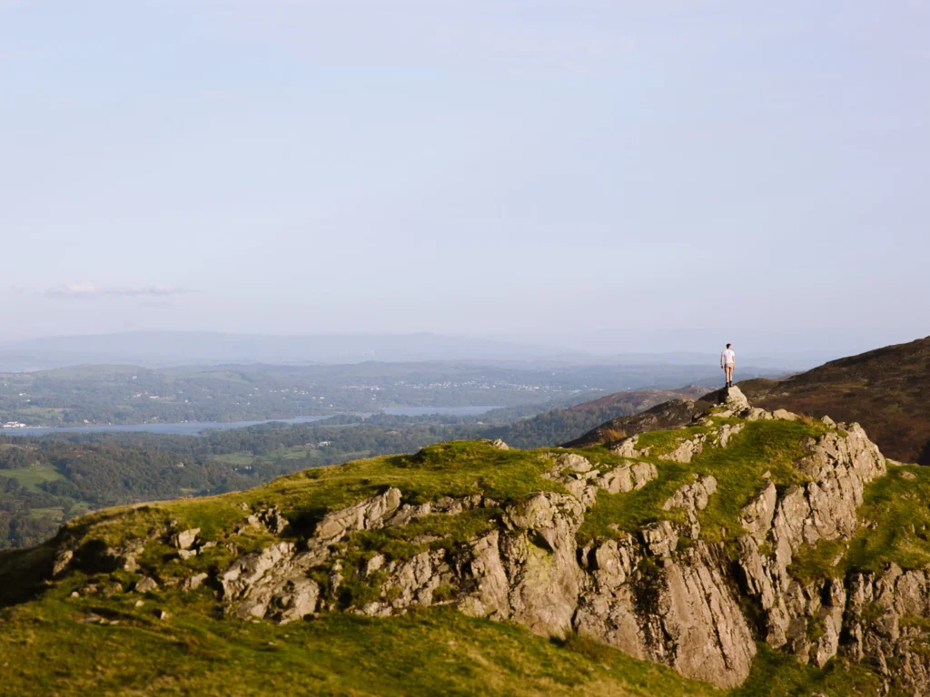
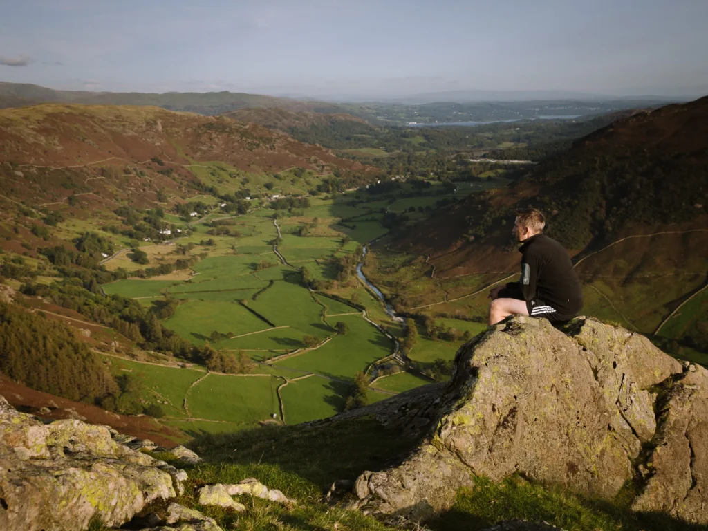
The scenery in front of you is magnificent throughout. When the path starts to bend right, we always take a quick detour to the summit of Pike Howe, where a rocky promontory provides an excellent photo stop above Great Langdale.
Continuing on, the path steepens slightly as it drops alongside Pike Howe before passing the Dungeon Ghyll Force waterfall. At the bottom, keep left and return to Dungeon Ghyll Hotel, where we always grab a well-earned drink.
Where to Stay in Great Langdale
Great Langdale is the prettiest valley in the Lake District and, being central, it can make a great base for exploring the Lakes.
You can find all our favourite areas to stay in our Where to Stay in the Lake District, but below are our recommendations in Great Langdale.
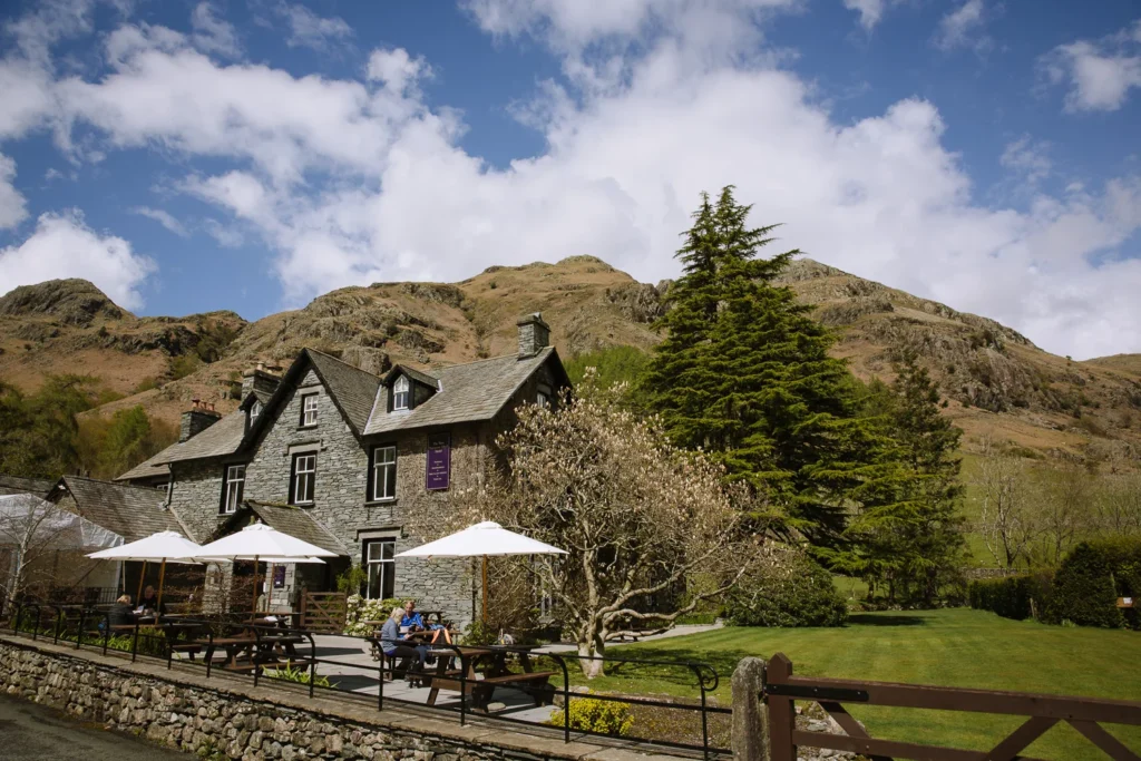
New Dungeon Ghyll Hotel – The rooms could do with an update (based on our last stay), but you cannot complain about the location. Perfectly positioned at the beginning of the walk in the most beautiful of valleys, there are few better spots to stay. Free parking for guests means you’re not rushing to the trailhead in peak season.
Old Dungeon Ghyll Hotel – Old-school hikers’ pub with rooms, just 20 minutes’ walk from the New Dungeon Ghyll Hotel. Very atmospheric and the best place in the valley for an end-of-walk pint. Free parking for guests and numerous trails head from its door, including routes up Bowfell and Crinkle Crags, and across Stake Pass.
The Britannia Inn – An excellent pub in pretty Elterwater, at the entrance to Great Langdale Valley. A good compromise between being in the heart of the valley and having easy access to Ambleside and the rest of the Lake District.
Langdale Hotel & Spa – Splash out on a little luxury in one of the most beautiful properties in the Lakes. On offer are award-winning dining, a pampering spa treatment, and leisure facilities, including a gym and an indoor pool. We have never stayed here, but one can dream.
Chapel Stile Cottage – Chapel Stile is a charming little village halfway along Great Langdale. There is a pub (Wainwright Inn), a shop (Co-op), and a great spot to wild swim, making it an excellent village for an Airbnb. There are a few cottages to choose from, but Silver Howe is a good option for a family with two kids and dogs.
More Lake District Walking Guides
- Check out all our favourite walks in the Lake District
- Find the best areas to stay for your hiking trip.
- Choose from the 5 different routes up Scafell Pike
- Or pick the best and hike Scafell Pike via the Corridor Route
- For a quicker option, take the easy route up Scafell Pike
- Test yourself by scrambling Helvellyn via Striding Edge
- For a more challenging scramble try Blencathra via Sharp Edge
- Our favourite walking route up the Langdale Pikes.
- Want more than a day hike? Try our 3-5 day Lake District hike
- For remote scrambling and hiking, choose Wasdale Head.

reader-supported
When you buy through links on our site, we may earn a small affiliate commission at no extra cost to you.
Thanks for your support // Paul & Mark