Combine the dramatic setting of Rifugio Nuvolau with the open-air museum at Cinque Torri on this excellent circular hike.
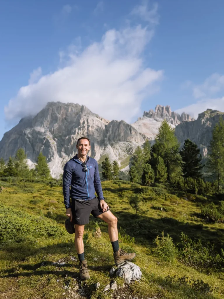
By: Mark Barnes | Last Updated:
Rifugio Nuvolau is one of the most dramatically situated huts in the Dolomites. Perched on a rocky outcrop with sheer sides, it seems unreachable. Yet an excellent path winds its way to the summit for spectacular Dolomites views.
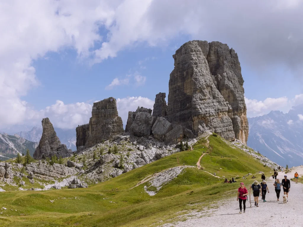
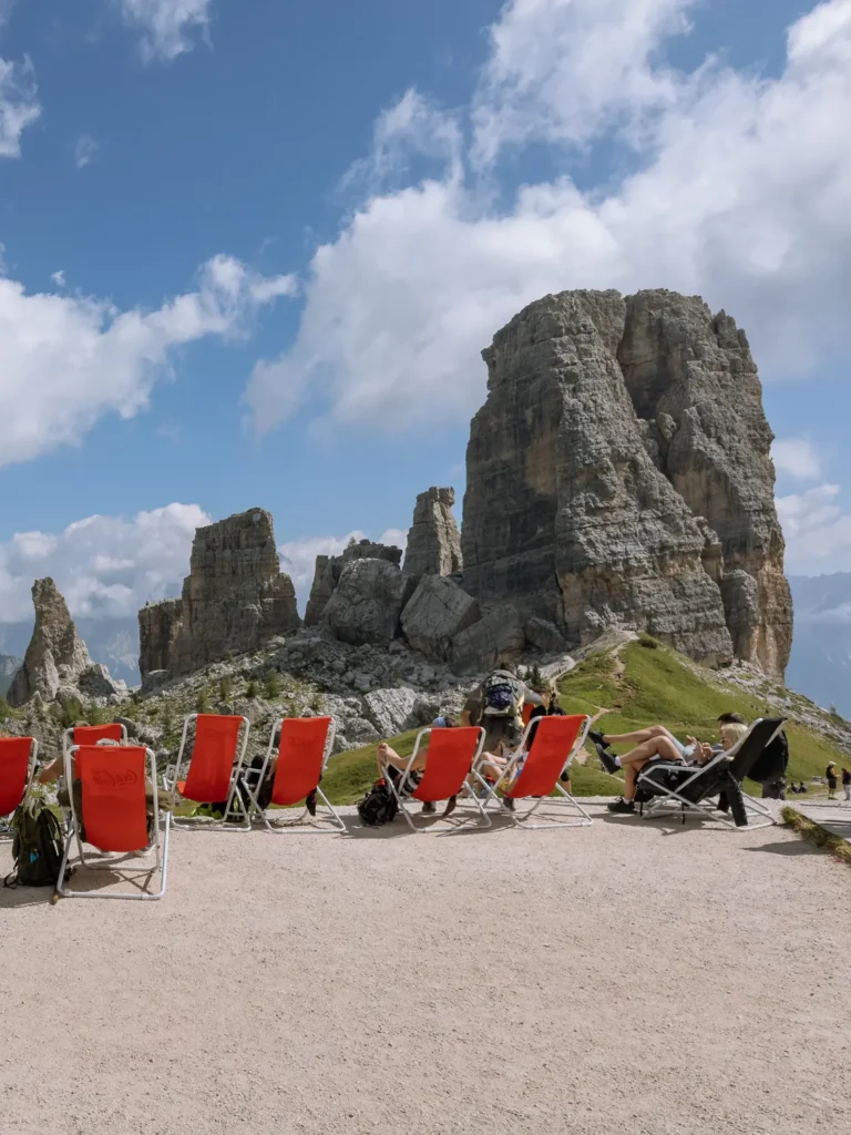
The second section of this hike includes a stop at Cinque Torri, five dramatic towers of rock, with an open-air museum formed around the remaining WWI trenches and fortifications.
In this guide, we have created a circular hike that combines both Rifugio Nuvolau and Cinque Torri.
The route is just under 7 miles with 680 metres of ascent and descent. The path is relatively straightforward, offering excellent and varied views, with three huts along the way where you can take a break and recharge.
We completed the walk in August and barely saw anyone else on the ascent and final descent. However, it can get busy during the middle section of the hike.
Nevertheless, its interesting features and constant views made it one of our favourite hikes in the Dolomites.
Below, we have covered everything you need to know, including how to get to the trailhead, a map, and detailed instructions for the hike.
Rifugio Nuvolau & Cinque Torri Hike Overview
- Start / Finish: Col Gallina
- Distance: 10.8 km / 6.7 miles
- Duration: 4 hours 15 minutes
- Elevation gain: 680 metres
- Difficulty: Medium
For a moderately challenging hike, this excellent circular walk combines breathtaking views with several fascinating features.
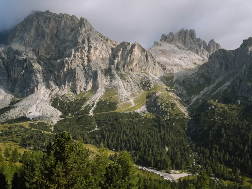
It begins at Col Gallina, with views of the towering massifs of Lagazuoi and Tofane behind you. The path climbs steadily to Lago Limedes, a picturesque lake beneath the rocky face of Monte Averau.
The route continues upward and steadily ascends to Forcella Averau, then crosses a scree slope to Rifugio Averau, and makes a final climb up a rocky shoulder to Rifugio Nuvolau.
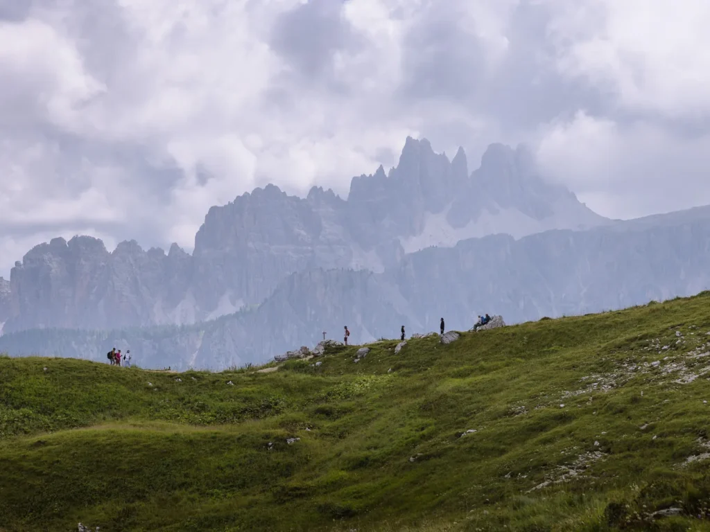
From this stunning and dramatic vantage point, the southern half of the Dolomites unfolds before you, from Sorapis and Croda da Lago in the east, to the Sella and Puez-Odle Groups in the west.
It’s an excellent place for lunch.
A short descent brings you to the intriguing Cinque Torri open-air museum, before a longer descent on a rocky but well-maintained trail brings you back to Col Gallina.
We have rated the hike as medium difficulty. The walk is just under 7 miles with 680 metres of ascent and descent. The ascent and descent are steady without ever being too steep.
There is nothing technically challenging; however, a short stretch across the top of a scree slope requires some care.
It took us just over 4 hours of hiking, but in total, we spent almost 6 hours taking in the views, having lunch, and exploring the WWI remains.
Rifugio Nuvolau Hike Map
Below is a map of Rifugio Nuvolau and Cinque Torri hike (marked in red).
There are three rifugios on the route:
- Rifugio Averau
- Rifugio Nuvolau
- Rifugio Scoiattoli
We have marked the car park and bus stop at Col Gallina in blue and the chairlifts (for information only) in brown.
If you prefer a physical map, we recommend: Kompass 617 — Cortina d’Ampezzo.
For digital maps, download the Belluno region on Maps.me. It has all the trails, and you can track yourself online. Alternatively, just use our map below.
Click on the top right corner to open our map in your Google Maps app. Click the star next to the title to save it to your Google account.
Getting to the Trailhead
This Rifugio Nuvolau and Cinque Torri hike begins at Col Gallina near the top of the Falzarego Pass.
By Car
Col Gallina is just over a 30-minute drive from the towns of Cortina, Corvara, and Arabba.
There are numerous parking spaces on either side of the road. Parking is free, and it is one of the less busy spots in the Dolomites. Nevertheless, try to arrive early in peak season.
We began our hike around 8 AM in mid-August, and there were plenty of spaces, but it was quite full when we returned.
By Bus
The 052 bus runs between Cortina, Pocol, and Passo Falzarego, stopping at Col Gallina on the route. From Cortina it takes only 32 minutes, but the bus is not very frequent. There are only three buses in the morning and three buses in the afternoon, so timing your journey is important.
Hiking Instructions
Col Gallina to Forcella Averau (1 Hour 30 Minutes)
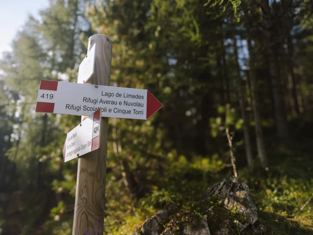
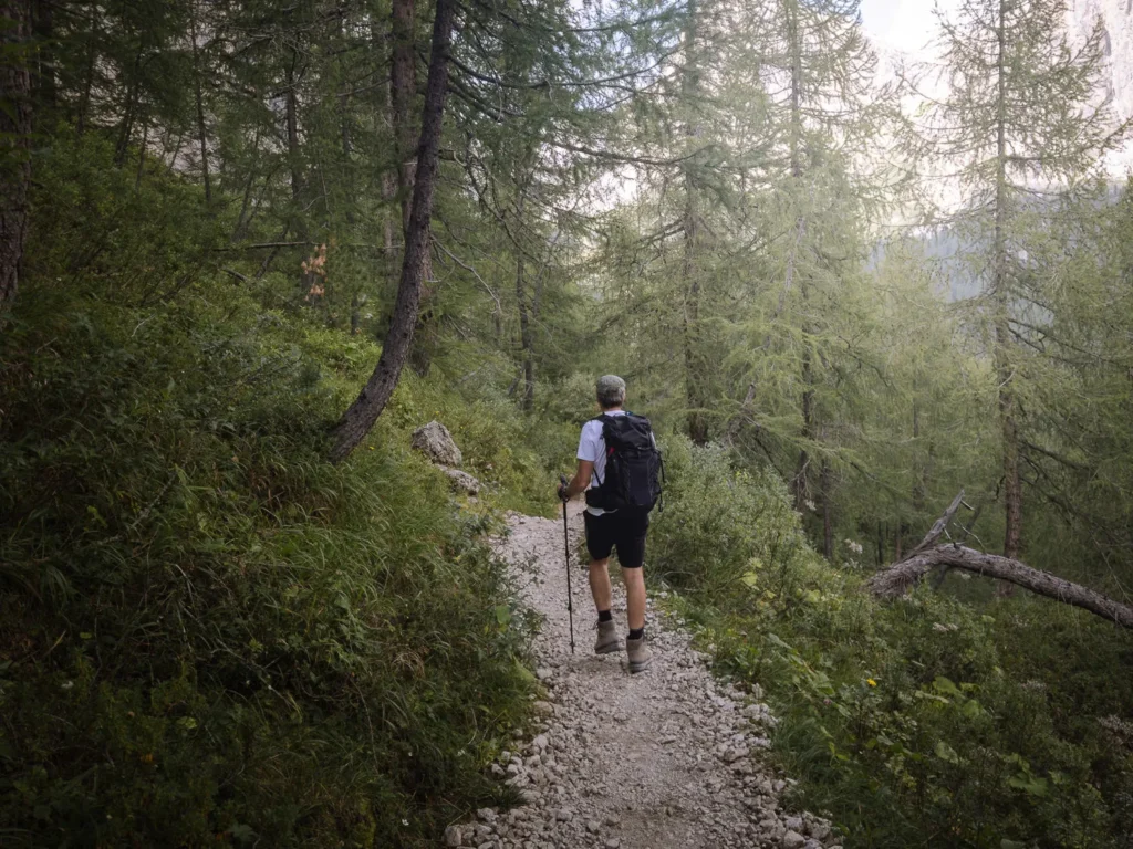
From Col Gallina (2,054m) follow Path 419 signed to Lago Limedes, Rifugio Averau and Rifugio Nuvolau.
The trail winds its way through the coniferous forest, splitting multiple times. Be sure to follow the red and white markings on the trees and rocks.
Rising above the tree line and over a low crest, it reaches Lago Limedes (2,171m). This attractive lake can dry up entirely in late summer, but if water remains, it often reflects the majestic tower of Monte Averau.
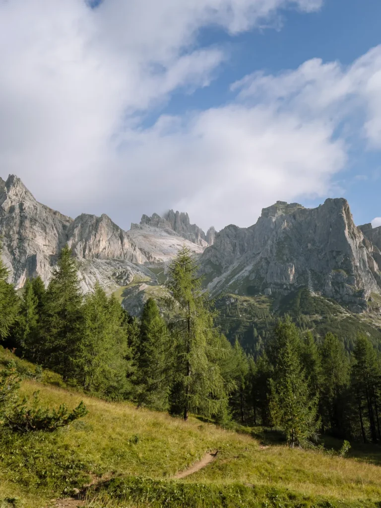
The views behind are equally spectacular, with the rocky massifs of Lagazuoi and Tofane dominating the skyline.
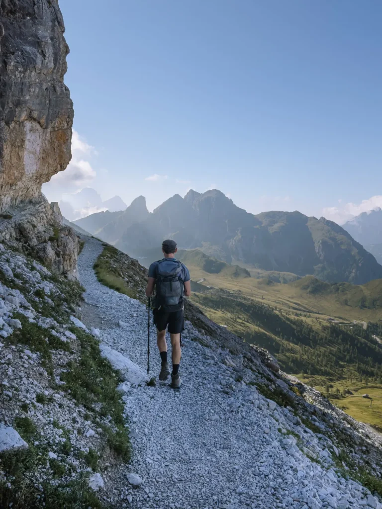
Keep to the left of the lake and continue to follow path 419. The trail becomes steeper, and the trees give way to grassy flanks and rocky gullies. It’s a relentless but steady ascent.
About 90 minutes after leaving Col Gallina, the path merges with Path 441 and reaches the top of Forcella Averau, where stunning views unfold to the south.
Forcella Averau to Rifugio Nuvolau (45 Minutes)
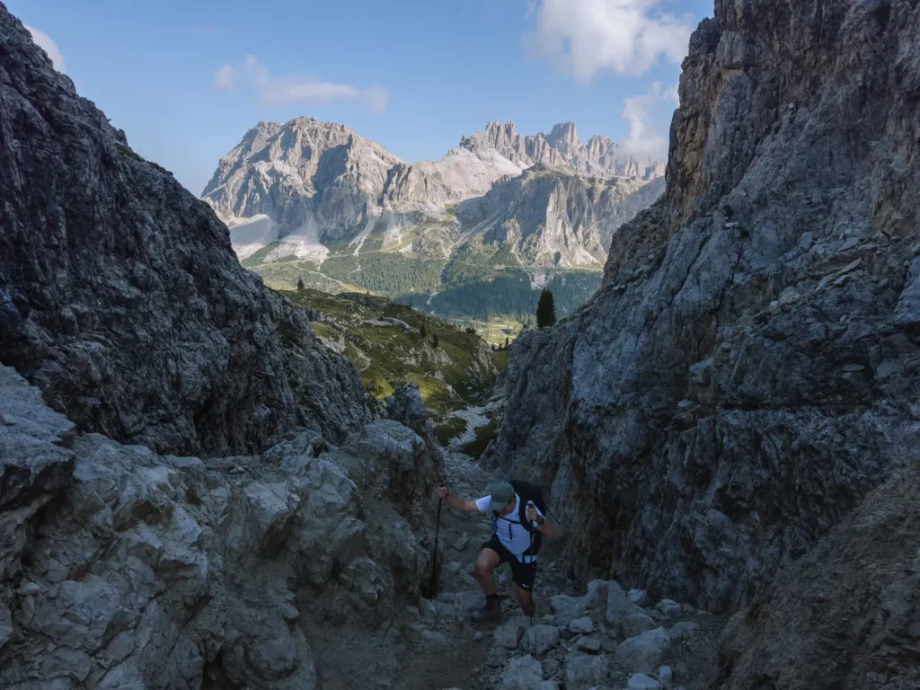
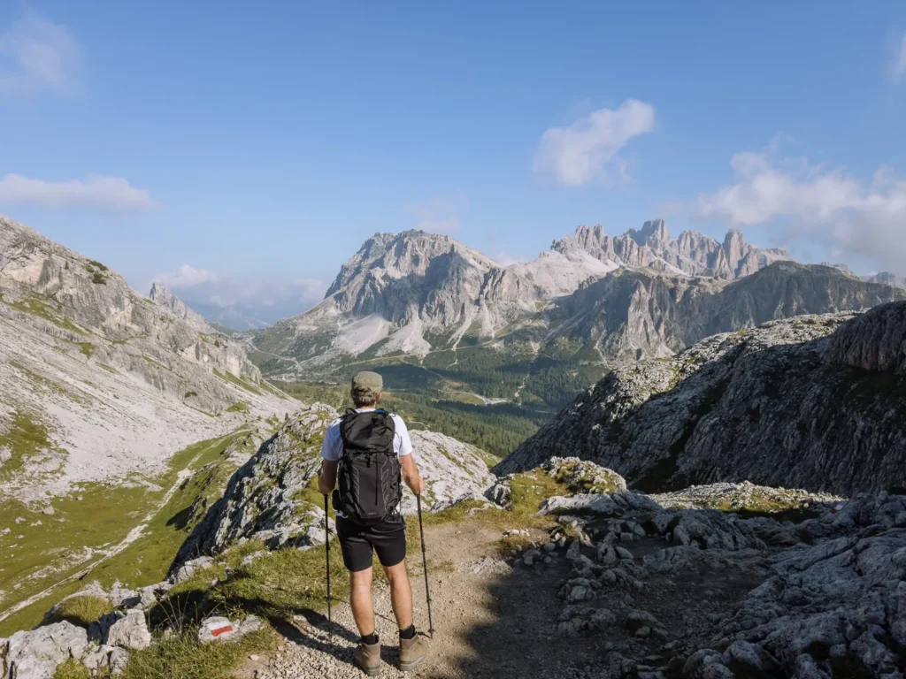
At Forcella Averau (2,435m), turn left and head southeast on the path that runs beneath the vertiginous face of Monte Averau. The trail is narrow, as it cuts along the top of a steep scree slope.
Neither Paul nor I like exposed paths, but we took our time and did not have a problem with the traverse.
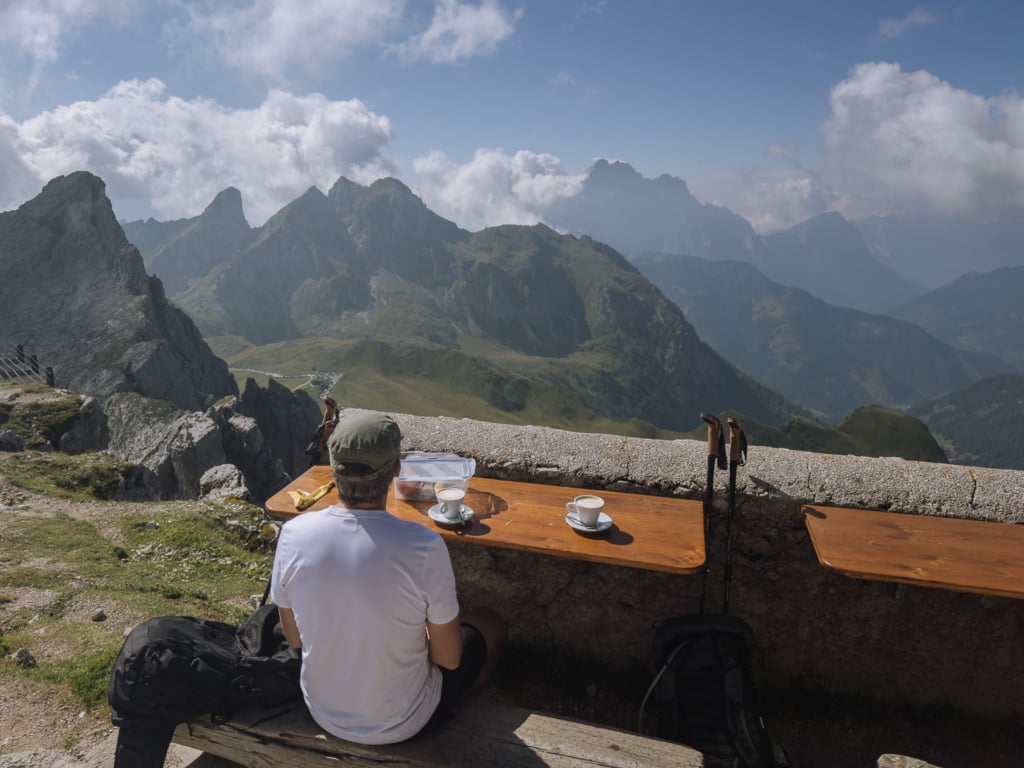
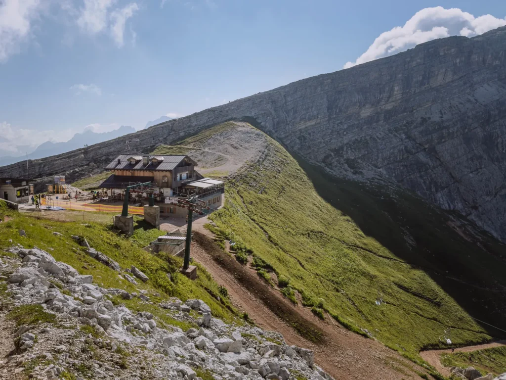
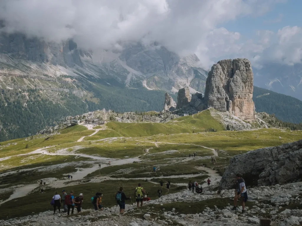
The scree trail ends at Rifugio Averau (2,413m). Here, you might encounter crowds of visitors who have come up from Passo Giau on the Fedare chairlift.
You may feel tempted to take a rest, but we strongly advise you to continue to Rifugio Nuvolau — it’s much better.
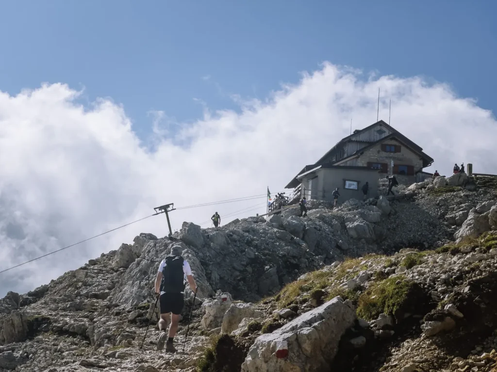
From Rifugio Averau, follow Path 439 as it heads up a broad shoulder of rock. The path can be indistinct, but there is only one direction to go, and there are usually many others on the trail.
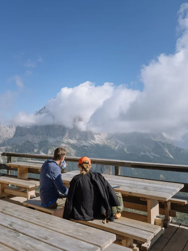
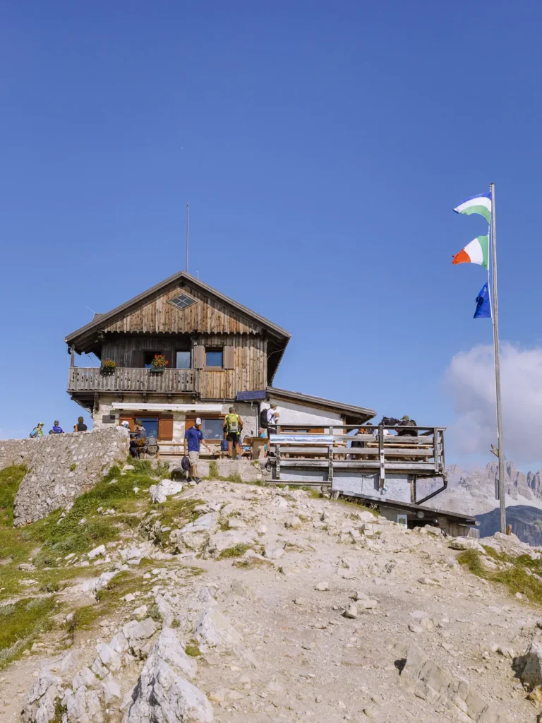
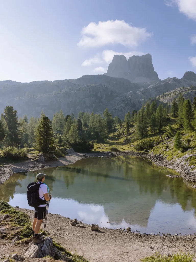
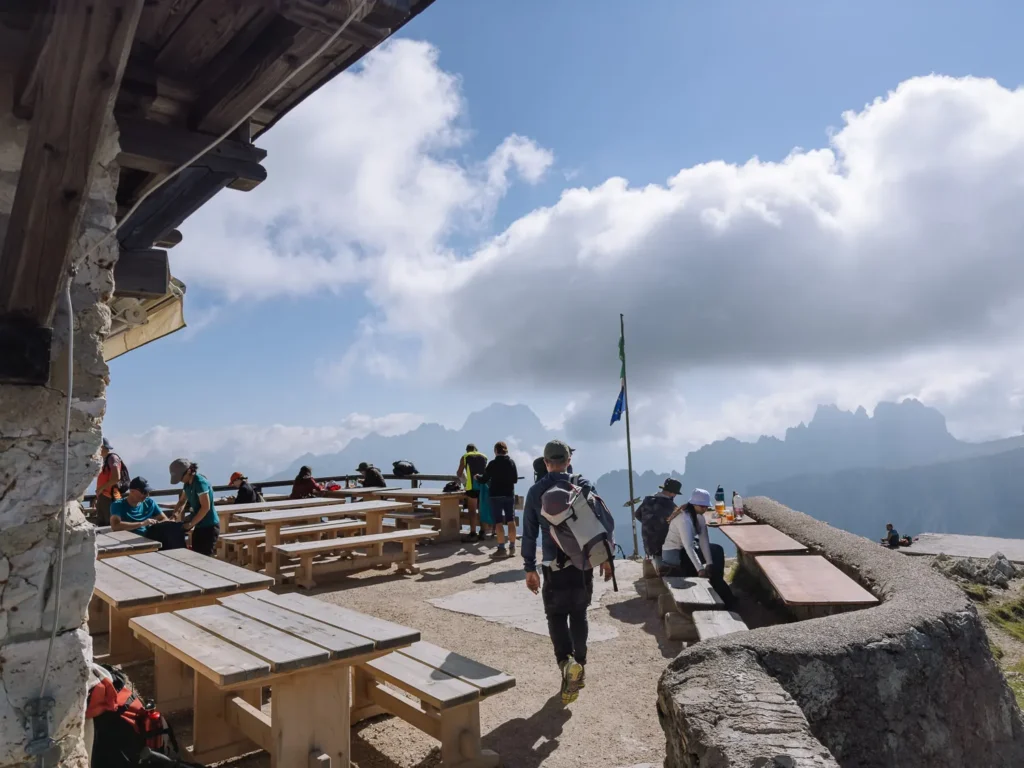
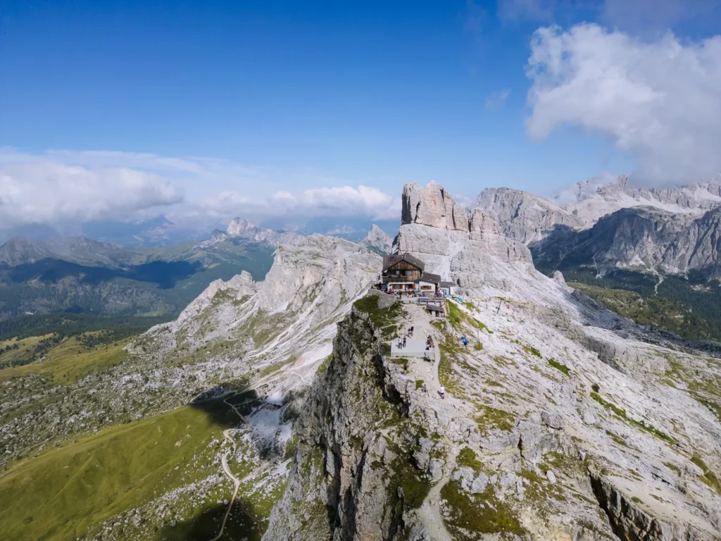
After about 30 minutes, you arrive at Rifugio Nuvolau (2,575m). It is aptly named, for Nuvolau means cloud and this place seems to float in the air.
We have never been to a more dramatically located rifugio. The views from the outside tables down to Passo Giau and across to Monte Civetta, Sella Group, and even Puez-Odle are excellent. It’s a great place for lunch or a coffee and a piece of apple strudel.
If you have a drone, this is a great place to use it. The rifugio provides an excellent focal point for the peaks and pinnacles that surround it.
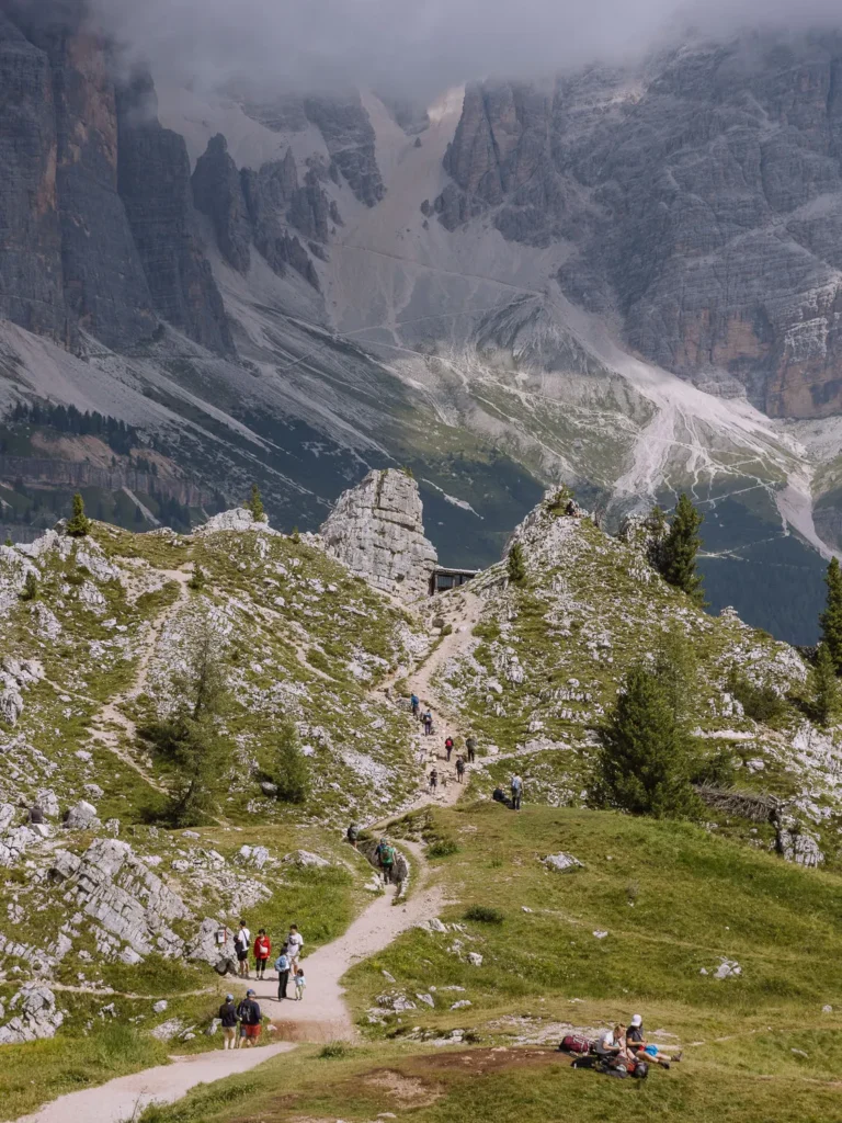
Rifugio Nuvolau to Cinque Torri (45 Minutes)
This section of the walk is often quite busy.
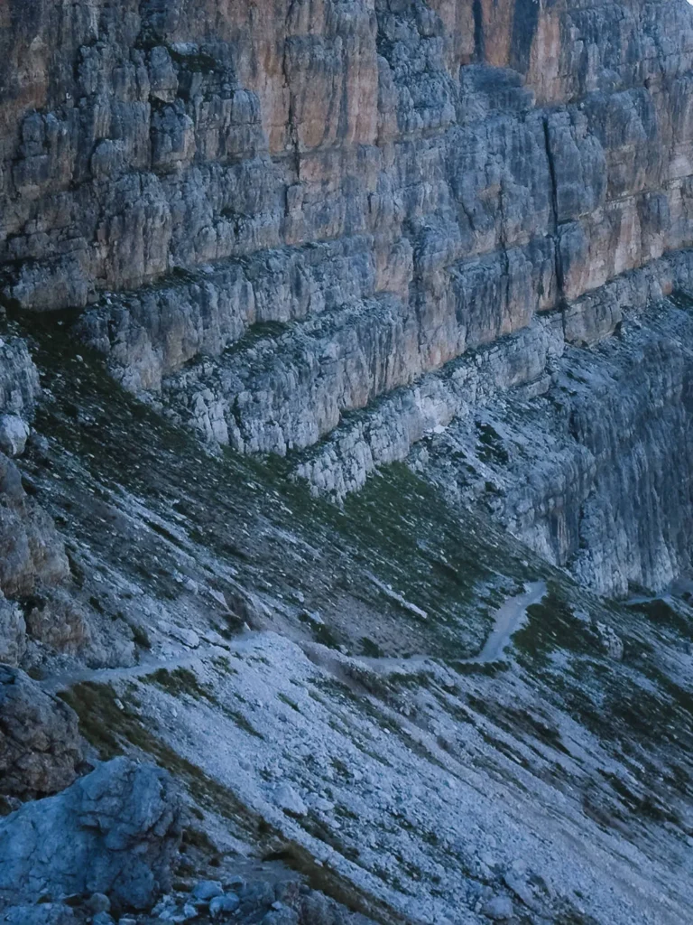
Follow Path 439 back down the broad shoulder, but instead of turning left towards Rifugio Averau, keep straight ahead and continue following Path 439 towards Cinque Torri.
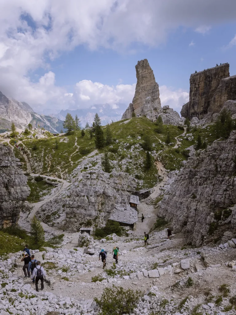
Before long, you are staring up at the largest of Cinque Torri’s five towers. Surrounding it is an open-air museum dedicated to WWI. There are trenches and ammunition dumps with some information boards to explain the location.
Set among weirdly shaped towers, it takes about 25 to 30 minutes to explore the area. When you have finished, head to Rifugio Scoiattoli (2,255m).
Cinque Torri to Col Gallina (1 Hour 15 Minutes)
From Rifugio Scoiattoli, head west picking up Path 1 (Alta Via Dolomiti). It shortly comes to a junction of paths.
Turn right on Path 440 signed to Pian dei Menis and begin the steady descent northwestward back towards Col Gallina (2,054m).
The trail is well signed, as it winds its way across a series of rocky ledges. Tree trunks have been laid to prevent the path from slipping away. Whenever you can take your eyes off your feet, there are wonderful views up to the Tofane massif towering above you.
After about 50 minutes, the trail drops out of the trees and comes to a large field. Cut diagonally across the field and pick up Path 424 on the other side. The trail re-enters the forest and steadily climbs, following the route of the road now on your right.
Soon, you arrive at the sign for Path 419, where your hike began many hours earlier. Turn right to reach the main road and Col Gallina.
Rifugios on the Route
One of the great things about the Dolomites, and particularly this hike, is having lunch and breaks at the rifugios.
There are three rifugios on the route. All of them are open from mid-June to the end of September.
Rifugio Averau — This excellent rifugio has a lovely outdoor terrace with terrific views. During peak season, it can get busy as it is directly accessible using the Fedare chairlift (mid-July to mid-September) from Passo Giau. You might be tempted to stop here, but with Rifugio Nuvolau only a 30-minute walk away, we recommend you carry on.
Rifugio Nuvolau — Open from mid-June to the end of September, this is one of the great huts of the Dolomites. You can have lunch if you are there between 11:30 AM and 2:30 PM; outside these hours you can have coffee, beer and cake.
Rifugio Scoiattoli — Rifugio Scoiattoli is situated at the top of the Cinque Torri chairlift (early June to end of September), which runs from Bai de Dones on the Falzarego Pass. There is a restaurant that takes reservations and a bar that serves snacks and sandwiches (with pagers to call you when the food is ready).
Scoiattoli can be extremely busy, so we suggest you eat at either Rifugio Nuvolau or at the end of the hike at Da Strobel.
Da Strobel — This is not a rifugio, but it feels like one. A charming and friendly restaurant set back from the road at Col Gallina, its outdoor seating has wonderful views up to Tofana and Lagazuoi. The food is very good, especially the carrot cake and chocolate cake, which we devoured after the walk.
Best Time to Hike to Rifugio Nuvolau
The best time to hike to Rifugio Nuvolau is from early July to late September. The rifugios are open, the snow should have melted from the high ground, and the weather is at its warmest.
We hiked in mid-August, and despite it being peak season, we only saw four other people during the ascent to Forcella Averau. It became considerably busier around the three rifugios (two of which can be reached directly by cable car), but the descent was again very peaceful.
Parking at Col Gallina is generally quieter than other places in the Dolomites. Nevertheless, it can fill up in peak season, so try to arrive early.
What to Take on the Hike
Hiking Boots – The full circuit is reasonably long so we suggest wearing proper hiking boots (we use something similar to these).
Hiking Poles – We’re recent converts to hiking poles as they make everything much easier. We use the trusty Leki Sticks.
Waterproofs – Weather conditions on the walk can change dramatically, and rain is common in the afternoon. Make sure you take a waterproof like this one.
Sunblock/Hat – If it’s not raining, you’ll need sunblock and a hat for when you’re out of the shade.
Water – Make sure you have plenty of water. We use one of these hydration packs, which makes it much easier to stay hydrated on the trail.
Maps – Make sure you have a map with you. The physical map for this hike is 617: Cortina d’Ampezzo, or you can use our Google Map which is at the top of this post.
Drones – Drones are permitted at Rifugio Nuvolau and it’s a great place for aerial photography.
More Dolomites Guides
- Here are all our favourite places to visit in the Dolomites.
- Put your trip together with our Dolomites road trip itinerary.
- Hike to the beautiful Lago di Sorapis.
- Try one of our favourite hikes in the Dolomites.
- The Sassolungo Circuit is one of our favourite walks in the world.
- Take on one of the most popular hikes in the Dolomites – Tre Cime di Lavaredo.
- Visit the beautiful Lago di Braies.

reader-supported
When you buy through links on our site, we may earn a small affiliate commission at no extra cost to you.
Thanks for your support // Paul & Mark