Deep in the Iceland Highlands, the colourful mountains of Landmannalaugar are a mystical-looking wonder, but getting there is not easy. Here’s our advice on how to get to Landmannalaugar by car, bus or jeep.
By: Paul Healy | Last Updated:
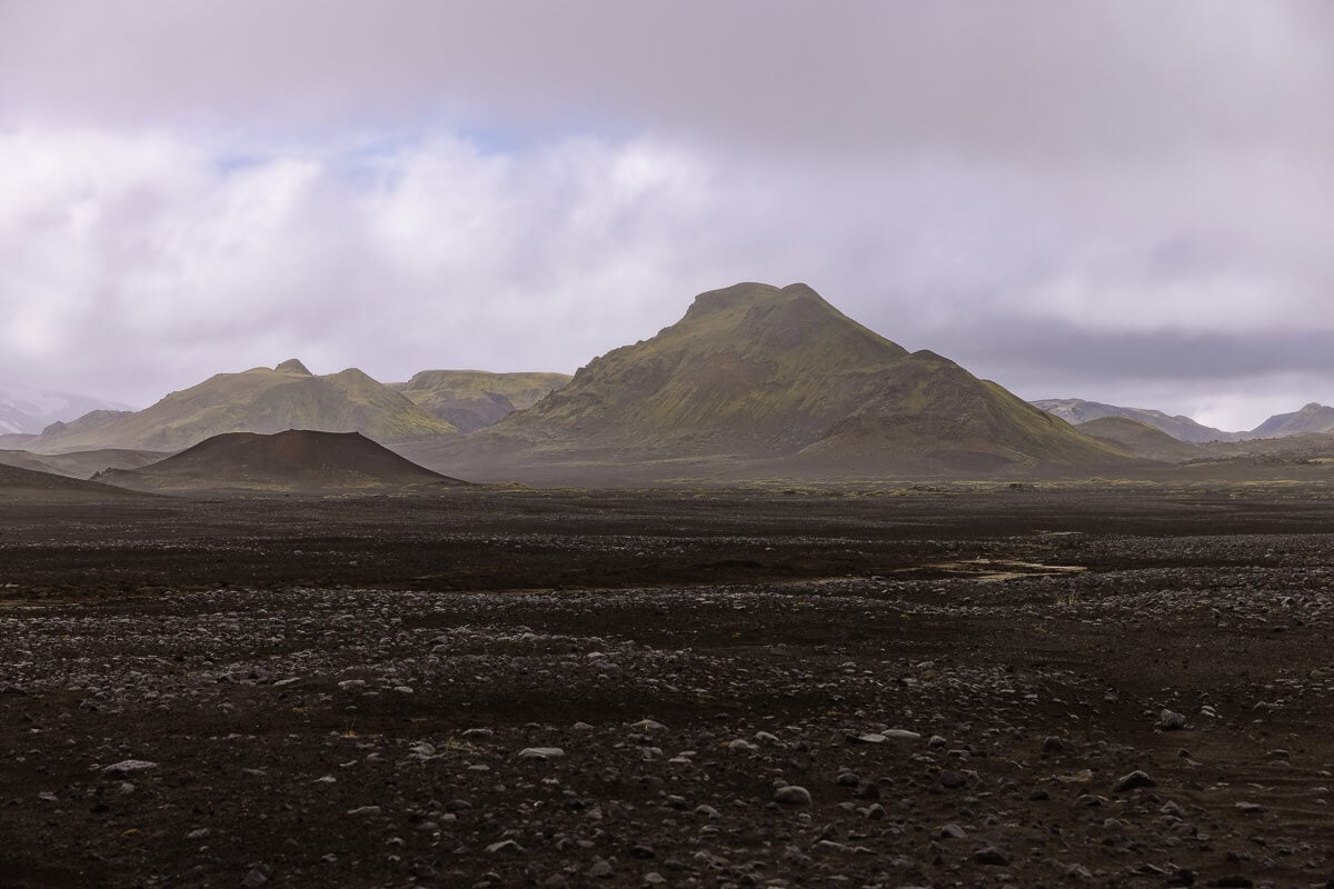
Landmannalaugar is an area of immense beauty in the Fjallabak National Reserve in southwest Iceland.
It’s famous for dramatically coloured mountains, steaming sulphur vents and thermal pools. Its proximity to Reykjavík has made it a very popular day trip, but getting there is not easy.
There are three ways to get to Landmannalaugar.
- Self-Drive on F-roads – mountain roads that require a 4×4.
- Get the Highland Bus – which runs from Reykjavík via Selfoss and Hella.
- Join an Organised Tour – most of which leave from Reykjavík.
Here’s a breakdown of each option for you to decide how to get to this beautiful part of Iceland.

Self-Driving to Landmannalaugar
Landmannalaugar can only be accessed via Iceland’s mountain roads (f-roads). These are unpaved gravel tracks that are not regularly maintained.
F-roads come in all shapes and sizes. Some are good-quality gravel tracks that allow speeds of up to 80 kilometres per hour (50 miles per hour); others will require fording rivers, traversing steep rocky inclines, and gliding through sand.
There are three different routes to choose from when driving to Landmannalaugar, some easier than others.
- Route 1 – F26 and F208 from the north. This is the easiest route, manageable with any 4×4 car. Marked in red below.
- Route 2 – F225 from the west. This route is not rough, but there are 4 (usually small) rivers to cross. Marked in blue below.
- Route 3 – F208 from the south. The most difficult route with 3 sizeable river crossings. Marked in purple below.
Click on the top right corner to open our map in your Google Maps app. Click the star next to the title to save it to your Google account.
For each of these routes, you will need a 4×4 vehicle that is authorised by your rental car company to be driven on F-roads.
There is no gas station at Landmannalaugar, so make sure you fill up with fuel before entering the highlands or at the Hrauneyjar Highland Centre on the northern section of the F208.
For detailed information about driving on mountain roads, including tips on what type of 4×4 to hire, you can read our F-Roads in Iceland post.
Here is a breakdown of each route.


Route 1: via the F26 / F208 from the North
This is the easiest route to drive to Landmannalaugar and one of the easiest F-roads in Iceland. If you are new to driving 4WD, then this is a great way to start.
The F26 is a gravel road that begins at the intersection of Routes 26 and 32. It is not too stony or rough, and there are no river crossings. Driving is easy, and you can make progress at a decent pace on these roads.
About 10 minutes after the Route 26/32 intersection, you’ll pass the Hrauneyjar Highland Centre, which has a gas station and a bar selling very basic snacks.
Ten minutes after the Hrauneyjar Highland Centre, turn right onto the F208 signed to Landmannalaugar.
The F208 is also a gravel track in pretty good condition. It is a little rougher than the F26, with a short stony section about 15 minutes after joining.
Here you can find a wonderful 5-minute detour (on your left) to Sigöldugljúfur Canyon. This sheer-sided gorge has a turquoise river running along its base with several waterfalls trickling over the moss-covered edges.


The F208 continues south across dusty roads and through lava fields. After another 45 minutes, it meets the F225 coming in from the west.
Ljötipollur Crater – another great detour – is opposite the F208/F225 junction. If you want to visit, it’s a 5-minute drive to the car park (free), then another 5-minute walk to the rim of the crater.
Back on the F208, it winds past a lake and over a hill, dropping down the other side. At the junction with the F224, turn right and head to Landmannalaugar.
Allow 1 hour and 30 minutes from the junction of Route 26 and Route 32 to reach Landmannalaugar (marked in red on the map below).
If you stop at both Sigöldugljúfur Canyon and Ljötipollur Crater, add at least 30 more minutes.


Route 2: via the F225 from the West
The F225 F-road is not very bumpy or rough, but there are 3 or four 4 river crossings to negotiate.
From Route 26, the F225 heads eastwards under the flanks of Hekla Volcano, which, on a clear day, you’ll see rising above a sea of black gravel and ash. This first section is desolate and wild.
The F225 continues through the gravel and around the edge of a lava field until it reaches the river crossings.
In normal conditions, they are all relatively easy (not very deep or wide) and could be done in any-sized 4×4.
The first cross Rauðfossakvisl, downstream from Rauðfoss waterfall. There is an optional 30-minute hike each way to the waterfall from the river crossing.


The next two river crossings are just a little further, and both cross the Kluukkugilskvisl River.
In normal conditions, they are not too difficult, but make sure you follow the guidelines for crossing rivers on the F-Roads.
The scenery changes, and the F225 now heads through green valleys and past colourful mountains.
After just over an hour, the F225 meets the F208. Turn right, then after another 20 minutes, turn right again on the F224 to Landmannalaugar.
Allow 1 hour and 20 minutes from the junction of Route 26 and F225 to Landmannalaugar (marked blue on the map below with the crosses to indicate the river crossings).
Add an extra 1 hour if you hike to Rauðfoss waterfall, and about 30 minutes more if you also visit Ljötipollur Crater.


Route 3: via the F208 from the South
This is the toughest route into Landmannalaugar.
The F208 from the south is long and involves three quite sizeable river crossings (and many smaller ones).
From the south, the F208 starts near the village of Grafarkirkja, and the first hour is straightforward.
But once you pass the Hólaskjól Highland Centre, things get more interesting.
The first big river crossing is the Kylslahólmar, and about 40 minutes later are the Halldórsdalur and the Kirkjufellfoss river crossings.
They can be 40 to 60 centimetres deep and present quite a challenge. In normal conditions, they can be completed with a large 4×4 vehicle, and sometimes with a medium 4×4. Rangers are often positioned along the road to offer advice.
On both our trips to Landmannalaugar, we hired a medium-sized 4×4 and assessed whether we could go back via the F208. One time, the ranger said we’d be fine; on another, they said we wouldn’t!
If you can make it, it’s a fantastic experience, especially the last section, which winds through glacial rivers and towering green mountains.
After the three river crossings, the F208 comes to a junction with F224. Turn left and head into Landmannalaugar.
Allow 2 hours and 30 minutes from the junction of Route 209 & 208 to Landmannalaugar (marked purple on the map below). However, keep in mind you may need to get out and assess the rivers, which takes extra time.

Driving to Landmannalaugar Tips
Our Recommended Route
If you are new to driving a 4×4, we recommend taking option 1, the F26 / F208 / F224. You can return the same way you came, but we suggest asking the ranger at the information hut in Landmannalugar about conditions on the F225. If they indicate conditions are good, then return using option 2 and complete a loop.
When Can You Drive to Landmanalaugar?
The f-roads are closed throughout winter to all vehicles except Super Jeeps (specially modified 4×4 vehicles), so you can only self-drive to Landmannalaugar over summer.
They are generally open by the end of June and remain open until early October; however, openings vary from year to year based on weather conditions.
River Crossing at the Campsite
Immediately before reaching Landmannalaugar Campsite, there is a medium-sized river crossing.
But don’t worry, you do not need to cross it. You can park before the river crossing (Parking lot – P1 Námskvísl), then cross the pedestrian walkway over the river and walk into camp (5 minutes).
You can find all the information for visiting in our Complete Guide to Landmannalaugar.
Reserving Parking at Landmannalaguar
The Environment Agency for Landmannalaugar has recently implemented a parking reservation system.
You will need to reserve parking in advance between 20 June and 15 September if you arrive between 9 AM and 4 PM.
You can book your parking in advance without adding your car registration. A few days before your arrival date, you’ll receive a reminder to add your car registration details to your booking.
There is also a service fee to enter the park during these times, which is paid when you reserve the parking.
For cost information and to book, visit: www.ust.is/reservations

Landmannalaugar by the Highland Bus
If you haven’t hired a 4×4 or don’t want to drive on the F-roads, a great option is to take the Highland Bus to Landmannalaugar.
There is a 7 AM bus from Reykjavík each day. It stops at Selfoss and Hella before arriving at Landmannalaugar at 11.30 AM. The return bus leaves Landmannalaugar around 3:45 PM, giving you 4 hours to explore the area.
This usually leaves plenty of time to try one or two of the amazing hikes in Landmannalaugar and have a soak in the hot springs.
Tickets are not cheap —around £160 return ($214 US) —but it’s an incredible experience without the hassle of driving yourself.
You should book tickets for the Highland Bus in advance.

Tours to Landmannalaugar
To make it even easier to reach Landmannalaugar, several great day tours depart from Reykjavík.
These still allow you to experience the geological wonder of the Landmannalaugar area, but only for a limited time.
Most tours drive past the base of Mt Hekla – Iceland’s most active volcano – offering excellent views of one of the country’s most impressive natural landmarks.
You’ll also be able to do most of what you can do on a self-drive excursion: explore the Laugarhraun lava field, admire the colourful rhyolite mountains and relax in the waters of a natural geothermal pool.
GetYourGuide – This well-rated tour includes pickup from Reykjavík and visits the Hekla Volcano area and Landmannalaugar.
Viator – This tour also includes pickup from Reykjavík, but spends more time hiking around the Landmannalaugar area.
Another great option is a Super Jeep tour to Landmannalaugar. This is a more expensive way to see the area, but you can go year-round and cross extremely rugged terrain. You’ll get to more dramatic locations than you would on a regular tour.
GetYourGuide – This Super Jeep tour includes Thjórsárdalur, Hjálparfoss Waterfall, Hnausapollur and Frostastadavatn, before reaching Landmannalaugar.
Viator – This Super Jeep tour includes a drive around the base of one of Europe’s most active volcanoes—Hekla, the Laugarhraun lava field and Landmannalaugar.


What to Do at Landmannalaugar
Landmannalaugar has a campsite, a food truck, and an excellent natural hot spring. For all the information read our complete Guide to Landmannalaugar.
Landmannalaugar has some truly amazing hikes, from easy 1-hour strolls to challenging mountain traverses. We cover our favourites in the best hikes in Landmannalaugar.
More Remote Iceland Guides
- All you need to know about driving the F-roads in Iceland.
- Explore the top places to visit in the Iceland Highlands.
- Read our tips to plan your Iceland Highland’s trip.
- Best day trips to the Iceland Highlands – with driving instructions.
- Test yourself on this challenging drive to Askja.
- Take an easy F-road to magical Kerlingarfjöll.
- Explore the Valley of the Gods with our complete guide to Thórsmörk.
- See the under-visited green volcano of Maelifell.
- Make sure you visit the best viewpoints at Stuðlagil Canyon.
- Looking for remote accommodation? Here’s where to stay in Iceland.

reader-supported
When you buy through links on our site, we may earn a small affiliate commission at no extra cost to you.
Thanks for your support // Paul & Mark
Hi Paul & Mark,
Hope you guys are good.
We’ve really enjoyed reading your posts on Landmannalaugar. It really is one of the most beautifully surreal landscapes! We visited last summer and settled on the bus to get us there. Like with Iceland in general, it wasn’t the cheapest, but our experience with TREX Travel Experiences was brilliant. They even happily swapped our return trip to Reykjavik around due to adverse weather. We’d very much love to go back, the hiking is excellent! Your blogs have been a nice trip down memory lane 🙂
Thanks and stay safe,
Beck & Dan
Hi Becky & Dan – Glad you enjoyed reading it, we had a great time putting it together. The hiking around Landmannalaugar was amazing, such a unique landscape. Thanks for stopping by, glad we could fire up some old memories from your trip.
Thanks for the great blog. Just wondering if the drive from kerlingafoll to landmannalaugur is fairly straightforward?
It would be via f 208 an F 26
Hi Arun,
Yes that should be fine. The F35 from Kerlingrfjoll and the F26/F208 from the north to Landmannalaugar are all pretty good F roads. Obviously it will depends on conditions on the day, but unless you have very bad weather it should be fine.
Paul.
Thank you for the informative post. We went via F26/F208 and came back via F225 after checking with the rangers as suggested. It was great driving there since it gave us a chance to visit some of other mentioned places along the way. We didn’t visit Ljötipollur Crater since there was a sign saying that it was closed (we did not go check to confirm). We did stop by Bláhylur since it was on the way, and it was also beautiful.
Hi Josephine,
Glad to hear you had a chance to visit some of the places around Landmannalagar. I’m not sure why Ljötipollur Crater was closed, but these things can happen from time to time in Iceland. Such a great part of the country to explore independently.
Paul.
Thanks for the great information. We followed Option 1 last week. The F26 section is paved now thankfully. Most of F208 is still gravel and bumpy but manageable.
Thanks for letting us know. We’ll get the guide updated.